
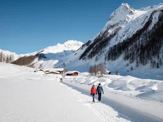
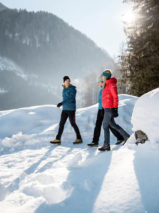
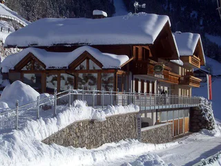
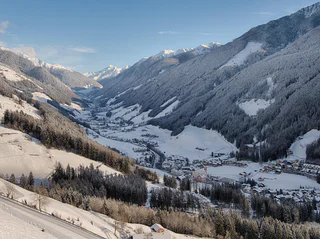
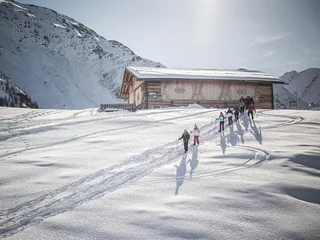
Winter walk - Rein in Taufers/Riva di Tures Inderederhof
S. Pietro/St. Peter - Valle Aurina/Ahrntal, Sand in Taufers/Campo Tures, Ahrntal/Valle Aurina
easy
Obtížnost
154 m
Převýšení
1h:30 min
doba trvání
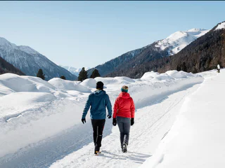
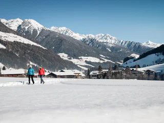
| Zimní turistika v Ahrntalu vám nabízí jedinečný zážitek z procházek zasněženou přírodou. Užijte si klid a krásu hor. |
S. Pietro/St. Peter - Valle Aurina/Ahrntal, Sand in Taufers/Campo Tures, Ahrntal/Valle Aurina
easy
Obtížnost
154 m
Převýšení
1h:30 min
doba trvání
1/2
Casere/Kasern, Prettau/Predoi, Ahrntal/Valle Aurina
easy
Obtížnost
98 m
Převýšení
1h:15 min
doba trvání
1/2
Steinhaus/Cadipietra, Ahrntal/Valle Aurina, Ahrntal/Valle Aurina
easy
Obtížnost
111 m
Převýšení
1h:40 min
doba trvání
1/2
Riva di Tures/Rein in Taufers, Ahrntal/Valle Aurina, Ahrntal/Valle Aurina
medium
Obtížnost
306 m
Převýšení
2h:12 min
doba trvání
Selva die Molini/Mühlwald, Mühlwald/Selva dei Molini, Ahrntal/Valle Aurina
easy
Obtížnost
66 m
Převýšení
1h:00 min
doba trvání
Caminata di Tures/Kematen, Sand in Taufers/Campo Tures, Ahrntal/Valle Aurina
medium
Obtížnost
694 m
Převýšení
2h:30 min
doba trvání
1/2
S. Pietro/St. Peter - Valle Aurina/Ahrntal, Ahrntal/Valle Aurina, Ahrntal/Valle Aurina
medium
Obtížnost
253 m
Převýšení
2h:00 min
doba trvání
1/2
Caminata di Tures/Kematen, Sand in Taufers/Campo Tures, Ahrntal/Valle Aurina
medium
Obtížnost
461 m
Převýšení
2h:00 min
doba trvání
S. Giovanni/St. Johann, Ahrntal/Valle Aurina, Ahrntal/Valle Aurina
medium
Obtížnost
241 m
Převýšení
2h:07 min
doba trvání
1/2
S. Pietro/St. Peter - Valle Aurina/Ahrntal, Ahrntal/Valle Aurina, Ahrntal/Valle Aurina
easy
Obtížnost
213 m
Převýšení
2h:00 min
doba trvání
Riva di Tures/Rein in Taufers, Sand in Taufers/Campo Tures, Ahrntal/Valle Aurina
easy
Obtížnost
231 m
Převýšení
2h:00 min
doba trvání
1/2
S. Pietro/St. Peter - Valle Aurina/Ahrntal, Ahrntal/Valle Aurina, Ahrntal/Valle Aurina
easy
Obtížnost
380 m
Převýšení
1h:33 min
doba trvání
S. Pietro/St. Peter - Valle Aurina/Ahrntal, Sand in Taufers/Campo Tures, Ahrntal/Valle Aurina
easy
Obtížnost
109 m
Převýšení
1h:30 min
doba trvání
1/2
St. Jakob/S. Giacomo - Ahrntal/Valle Aurina, Ahrntal/Valle Aurina, Ahrntal/Valle Aurina
easy
Obtížnost
121 m
Převýšení
0h:37 min
doba trvání
1/2
Casere/Kasern, Prettau/Predoi, Ahrntal/Valle Aurina
medium
Obtížnost
408 m
Převýšení
2h:27 min
doba trvání
Selva die Molini/Mühlwald, Mühlwald/Selva dei Molini, Ahrntal/Valle Aurina
medium
Obtížnost
337 m
Převýšení
2h:30 min
doba trvání
1/2
Caminata di Tures/Kematen, Sand in Taufers/Campo Tures, Ahrntal/Valle Aurina
easy
Obtížnost
231 m
Převýšení
2h:00 min
doba trvání
1/2
Selva die Molini/Mühlwald, Mühlwald/Selva dei Molini, Ahrntal/Valle Aurina
easy
Obtížnost
265 m
Převýšení
1h:30 min
doba trvání
1/2
Riva di Tures/Rein in Taufers, Ahrntal/Valle Aurina, Ahrntal/Valle Aurina
easy
Obtížnost
88 m
Převýšení
2h:00 min
doba trvání
Selva die Molini/Mühlwald, Mühlwald/Selva dei Molini, Ahrntal/Valle Aurina
easy
Obtížnost
105 m
Převýšení
2h:30 min
doba trvání
Steinhaus/Cadipietra, Ahrntal/Valle Aurina, Ahrntal/Valle Aurina
easy
Obtížnost
82 m
Převýšení
1h:01 min
doba trvání
Caminata di Tures/Kematen, Sand in Taufers/Campo Tures, Ahrntal/Valle Aurina
medium
Obtížnost
274 m
Převýšení
1h:49 min
doba trvání
1/2
S. Pietro/St. Peter - Valle Aurina/Ahrntal, Ahrntal/Valle Aurina, Ahrntal/Valle Aurina
easy
Obtížnost
98 m
Převýšení
2h:01 min
doba trvání
1/3
Riva di Tures/Rein in Taufers, Sand in Taufers/Campo Tures, Ahrntal/Valle Aurina
easy
Obtížnost
50 m
Převýšení
1h:30 min
doba trvání
1/2
Riobianco/Weissenbach - Valle Aurina/Ahrntal, Ahrntal/Valle Aurina, Ahrntal/Valle Aurina
medium
Obtížnost
263 m
Převýšení
1h:42 min
doba trvání
Caminata di Tures/Kematen, Sand in Taufers/Campo Tures, Ahrntal/Valle Aurina
easy
Obtížnost
166 m
Převýšení
0h:34 min
doba trvání
Montassilone/Tesselberg, Sand in Taufers/Campo Tures, Ahrntal/Valle Aurina
easy
Obtížnost
0 m
Převýšení
1h:13 min
doba trvání
1/2
Caminata di Tures/Kematen, Sand in Taufers/Campo Tures, Ahrntal/Valle Aurina
easy
Obtížnost
269 m
Převýšení
1h:30 min
doba trvání
1/3
Casere/Kasern, Prettau/Predoi, Ahrntal/Valle Aurina
medium
Obtížnost
536 m
Převýšení
2h:30 min
doba trvání
1/2
Riva di Tures/Rein in Taufers, Ahrntal/Valle Aurina, Ahrntal/Valle Aurina
medium
Obtížnost
110 m
Převýšení
1h:45 min
doba trvání


