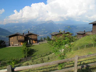
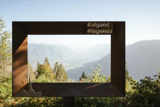
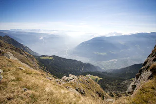
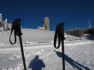
Skip to content

added to favourites

removed from favourites

Oops! Something went wrong. Try again

Your account is being created

Your account has been successfully created and you are now logged in

You’ve been logged in successfully!

Your account was created successfully, but we couldn't log you in automatically

You are logged out.

Filter
Selected filters
    Level of difficulty
    Duration
    Distance in KM

    All hikes in Algund/Lagundo

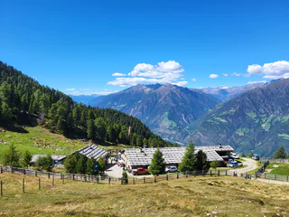
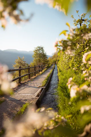
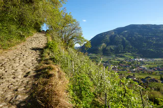
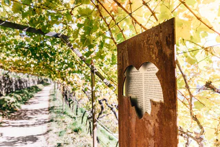
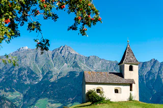
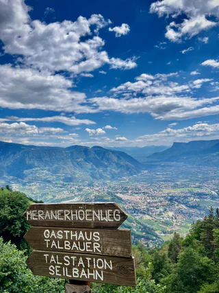
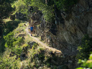
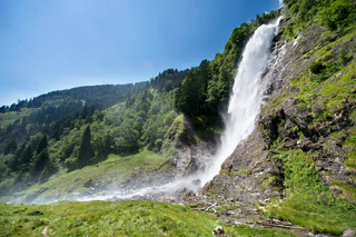
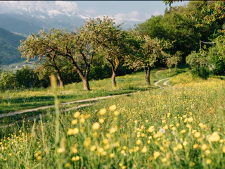
    Nestled in the stunning nature of South Tyrol, the region around Algund offers numerous hiking trails that lead through dense forests, blooming meadows, and picturesque vineyards. Whether you prefer a leisurely stroll or a challenging hike, you'll find the perfect route for your hiking adventure.

    Results
    Summer
    Aschbach - Naturnser Alm
    St.Pankraz/San Pancrazio, Meran/Merano and environs

    Aschbach, a fraction of Algund, is a small mountain village at 1,360 meters. It is located southwest of Algund and can be reached by cable car in only 7 minutes. In a circular hike you will discover the Naturnser Alm (mountain hut) and its surroundings at 2.000 m, located below the Mount Guardia Alta at the eastern foothills of the Ortles-Cevedale Group.

    Difficulty: medium
    658 m elevation gain
    2h:30 min duration
    Summer
    Wine educational trail Algund/Lagundo
    Algund/Lagundo, Meran/Merano and environs


    The vineyards along the Algunder Waal and the Schlundensteinweg are a special example of a cultural landscape shaped by the diligence of farmers. On the Algund Wine Trail, the history of the cultural vineyard landscape comes to life and is tangible for hikers. The simple panels describe the Algunder Waal, the old grape varieties and the work of the vineyard watchman known as the Saltner. His job was to watch over the ripe harvest.

    Difficulty: easy
    244 m elevation gain
    1h:34 min duration
    Summer
    Oberplars - Saxner path - Vellau - Kienegger path - Oberplars
    Algund/Lagundo, Meran/Merano and environs
    The moderately difficult Saxnerweg leads from Partschins to Vellau. The small fraction on the sunny slope of Algund is looking forward to welcoming you!
    Enjoy the magnificent view over Merano up to Bolzano, from the Ortler massif to the Dolomites.
    Difficulty: medium
    612 m elevation gain
    3h:07 min duration
    Summer
    Lagundo - Leiter Alm mountain hut
    Algund/Lagundo, Meran/Merano and environs

    The Leiter Alm is located directly at the well-known Meraner Höhenweg at 1550 m.
    It is located in the heart of the Nature Park Texelgruppe and is an ideal starting point for hikes and summit tours.
    The Leiteralm offers their guests delicious traditional and international dishes.
    Difficulty: difficult
    1216 m elevation gain
    4h:01 min duration
    Long-Distance Hiking Paths
    Burgweg trail from Algund/Lagundo to Schloss Tirol castle
    Algund/Lagundo, Meran/Merano and environs
    A wonderful hike that leads via the Burg and Ochsentodweg to Thurnstein Castle and further to Tirol Castle.
    You can already feel the Mediterranean climate here.
    This hike is also suitable for families.
    Difficulty: easy
    423 m elevation gain
    3h:00 min duration
    Snowshoe Hikes
    From Aschbach to the circular hiking trail Martinsweg
    Algund/Lagundo, Meran/Merano and environs

    The circular hike Martinsweg is an easily walkable circular trail named after the little church of St. Martin, near the Eggerhöfe farm houses. The Martinsweg is signposted as saasy family hiking tour with spectacular mountain views!

    Difficulty: easy
    361 m elevation gain
    3h:01 min duration
    Summer
    Huts tour to Naturns
    Naturns/Naturno, Meran/Merano and environs
    It is a little challenging hikeing tour. You pass three popular alpine huts. A wonderfull alpine panorama view is always with you.
    Difficulty: medium
    776 m elevation gain
    4h:49 min duration
    Summer
    From Algund/Lagundo to Vellau/Velloi along the Grabbachweg and the Saxnerweg trails
    Algund/Lagundo, Meran/Merano and environs
    As the name suggests: Ebeneich, an old farmstead, is located on a somewhat flatter, flat shoulder of land on the steep mountain slope that rises in the back of Algund towards the Mutspitze and the almost three-thousand-meter peak Tschigot (2998 m). Back in the 14th century a farm was already mentioned here. By dividing the farm in more recent times, an excursion inn with a large panoramic terrace was created. This place now has one of the most beautiful views in Burggrafenamt! The view over the Merano basin, the Adige valley and the distant mountains almost literally takes your breath away!
    Difficulty: medium
    696 m elevation gain
    4h:00 min duration
    Summer
    Panoramic Kneipp Tour Lagundo
    Algund/Lagundo, Meran/Merano and environs
    22 Chestnut trees Vellau Recharge your batteries
    23 Herb slope Vellau Herbal scents and colours
    24 Church of the Holy Trinity Vellau Order of life Living naturally
    26 Organic Hoferhof Vellau Nutrition Versatility
    25 Adventure playground Vellau Movement Stability
    21 Pirbamegger seating area Order of life Vastness
    32 Blumenthalerhof Water Water and herbs
    38 Grabbach Water Treading water
    4 Balthasar-Leiter-Straße Exercise Workout
    5 Klosterbauerhof Exercise Natural circulation
    6 Pirhofer vegetable garden Nutrition Natural nutrition
    1 Town hall Water Kneipp espresso
    2 Tauber bakery Nutrition Mood enhancer
    3 Tourism Association Water Water as an incentive
    Difficulty: easy
    122 m elevation gain
    1h:48 min duration
    Summer
    Meran High Mountain Road from Leiter Alm hut
    Algund/Lagundo, Meran/Merano and environs

    The Meran High Mountain Road is one of the most beautiful high-Alpine circular trails in Europe. At a length of 100 kilometres, it surrounds South Tyrol’s largest nature park, the Texel Group Nature Park, at an altitude of approx. 1,400 metres. There are altitude differences at around 100 metres along the way. The Texel Group is situated between the Italian-Austrian border, the Meran basin, the Passeier Valley and the Schnals Valley.

    The Meran High Mountain Road is divided into a Northern and a Southern route. The northern part of the mountain road has its peak at the Eisjöchl, which is at an altitude of 2,895 metres. In the southern realm, you can reach an altitude of 1,839 metres at the Hochganghaus Hut.

    Depending on your condition and the length of the stages you choose, it will take you between 3 and 8 days to cover the entire circular route. No fear! Along the way, there are numerous Alpine huts, offering South Tyrolean delicacies and protection from the rain and storms. Please check out the opening times of the individual huts.

    Lagundo is situated at the southern side – also called the sunny side. The route leads you along the southern slopes of the Texel Group. Enjoy breath-taking panoramic views of an impressive cultural landscape, particularly the Vinschgau region, as well as the Burgrave’s office and the Passeier Valley. In general, the southern part is recommended for trips from May to November. Some parts of the route are walkable all year round – depending on the weather conditions.

    There are many places of natural beauty along the High Mountain Road waiting to be discovered and definitely worth seeing. Enjoy the breath-taking views of the impressive Tschigat peak (2,998 metres), the Mutspitze (2,294 metres), as well as the Matatzspitze (2,179 metres). Another highlight is the Partschins waterfalls, which roars down from a height of 97 metres and is therefore one of the highest South Tyrolean waterfalls. In addition, there are the Spronser Lakes, the highest located Alpine lake area in South Tyrol with 10 lakes at an altitude of 2,117 metres to 2,589 metres.

    While walking, you will keep coming across mountain farmhouses, which are several hundred years old and have marked the Alpine landscape enormously. In the old days, farmhouses were built on higher ground due to insufficient space in the valley regions. You can imagine that cultivation at such an altitude was quite difficult – and still is today.

    The Northern part of the High Mountain Road has a high-Alpine characteristic. It leads through the Pfossen and Pfelder Valleys. The Eisjöchl at an altitude of 2,895 metres is the highest point and divides the valleys from each other. Due to its high-Alpine character, the Northern part can only be accessed through the summer months, from June to September.

    Difficulty: difficult
    5697 m elevation gain
    6h:07 min duration
    Summer
    Vellauer Felsenweg trail and Hans-Frieden-Weg trail
    Algund/Lagundo, Meran/Merano and environs

    The Felsenweg (Rock Trail) is a well-maintained hiking trail close to the edge of the mountain, a rather easy and flat path but you need to be sure-footed and free from giddiness. Take special care if the ground is slippery - you should avoid the hike in case of snow and ice as well as on hot summer days. After heavy rain there’s also a risk of rockfall!

    Difficulty: difficult
    774 m elevation gain
    2h:37 min duration
    Long-Distance Hiking Paths
    Circular hike along the Merano High Mountain Trail
    Algund/Lagundo, Meran/Merano and environs

    The Merano High Mountain Trail, considered one of the most beautiful hikes in the entire Alpine region, is an approx. 100-km circular hike. It can be circumnavigated in both directions in five to eight daily stages.

    The Merano High Mountain Trail is divided into a northern and a southern part. Extending along route 24 at a relatively constant altitude, the trail surrounds the Texelgruppe Nature Park. The northern part features the high mountain climate typical of the Texelgruppe range while the southern part boasts a sub-Mediterranean climate with characteristically lush flora. In particular, the southern part features fantastic views of the city of Meran and the Etschtal and Vinschgau valleys.

    The lowest point of the trail is 839 m elevation while the highest section extends to nearly 3,000 m. Hikers along this route can ascend and descend to and from the Etschtal, Passeiertal and Schnalstal valleys. Additionally, there are numerous overnight accommodation options along the trail that make it possible to hike only individual stages or to tailor the route to personal preferences. The trail demands both sure-footedness and alpine experience and the exposed areas are always secured with chains or ropes.

    Possible start and finish points: Katharinaberg, Unterstell, Hochmuth, Ulfas, Vellau, Giggelberg, Pfossental, Christl, Matatz

    Duration: 5-8 days

    Length: approx. 100 km

    Total difference in altitude: 5,100 m

    Lowest point: 839 m

    Highest point: 2,895 m

    Level of difficulty: for experienced mountain hikers

    Best period: from July to September

    Information about possible closed trails on maps.merano-suedtirol.it

    General information: www.meranerhoehenweg.com


    Difficulty: medium
    0 m elevation gain
    37h:00 min duration
    Summer
    Hiking tour along the Kneipp trail of Lagundo
    Algund/Lagundo, Meran/Merano and environs
    The natural healing method according to Kneipp is based on five pillars: order of life, exercise, nutrition, herbs and water. The order of life can be seen as the foundation on which the other methods are based. Basically, human beings have sufficient bodily defences, but our civilised way of life lacks the natural stimuli and stimulation that challenge and train the immune system. And this is exactly where Kneipp comes in: especially with his water treatments, he forces our body to react and thus regulate itself. However, Kneipp advises moderation - "order lies in moderation" is one of his principles - and careful handling of the water applications, which must be adapted to each individual. This also applies to the "Healthy in Algund" stations: let's listen to our body and feel what is good for us.
    Difficulty: medium
    745 m elevation gain
    3h:45 min duration
    Summer
    From Algund/Tell along the Marling Waalweg canal trail
    Algund/Lagundo, Meran/Merano and environs

    Twelve kilometers long, the Marlinger Waalweg trail is a popular hiking trail which runs along the former irrigation channels, the longest of its kind in South Tyrol. Starting at the Töllbrücke bridge, the 250 year-old path gently ascends through apple orchards and woods to firmer and more level ground. After pausing to admire the medieval Lebenberg Castle, hikers continue slightly downhill along the slope of Marling mountain to the village of Lana.

    Spectacular views of the surrounding mountains can be seen along the entire length of the Marlinger Waalweg trail. The agricultural landscape lining the irrigation channels is also impressive, with meadows and forests alternating with vineyards and orchards. Along the Marlinger Waalweg trail there are also impressive views of the Merano basin, the Val Passiria/Passeier Valley, and the imposing Texelgruppe mountain range.

    Difficulty: easy
    252 m elevation gain
    2h:58 min duration
    Summer
    Algund Waalweg canal trail
    Algund/Lagundo, Meran/Merano and environs

    Waalwege are paths along the ancient irrigation channels. The Algunder Waalweg Trail is split into two parts with a lenght of 5 to 6 km. The hike leads along an historical irrigation canal. The canal trail is almost flat. It is therefore ideal for older people or families with children. Hikers, young and old, will be rewarded with fantastic views of Lagundo/Algund as well as the entirety of Merano/Meran and the surrounding area.

    Difficulty: easy
    29 m elevation gain
    1h:08 min duration
    Snowshoe Hikes
    Terrain Cure Trail 1 - Circular trail: Aschbach - Vigiljoch - Aschbach
    Algund/Lagundo, Meran/Merano and environs

    The climatic terrain cure is a special form of exercise therapy characterised by activity adapted to one’s fitness level, endurance training, and time spent in the outdoors experiencing the landscape, which is carried out through a personalised walking programme.

    So-called terrain hiking improves endurance and agility, increases speed and flexibility, reinforces the cardiovascular system, stimulates breathing activity and strengthens muscles, ligaments and joints. It has a positive impact on the metabolism, activates the digestive system and noticeably increases the expenditure of calories.
    The climatic terrain cure is recommended for functional cardiovascular disorders, respiratory and metabolic disorders, and above all is a tried and tested method of primary prevention and general health promotion.
    The "Terrainkur" trails in Partschins/Parcines have been certified  by the Ludwig-Maximilians-University of Munich.

    Difficulty: difficult
    435 m elevation gain
    2h:08 min duration
    Summer
    Lagundo- Aschbach/Rio Lagundo
    Partschins/Parcines, Meran/Merano and environs
    Challenging mountain run from the cable car valley station to the mountain station of Aschbach - Rio Lagundo.
    Difficulty: difficult
    834 m elevation gain
    2h:43 min duration
    Long-Distance Hiking Paths
    Leiter Alm - Hochganghaus - Oberhaus - Niederhaus
    Algund/Lagundo, Meran/Merano and environs

    Beautiful mountain hike with a wonderful view of the Merano region and the surrounding mountain scenery. There are some alpine pastures along the way that invite you to stop and relax.

    Difficulty: medium
    451 m elevation gain
    3h:19 min duration
    Summer
    Algund - Mahlbach - Seespitz - Vigiljoch - Aschbach
    Algund/Lagundo, Meran/Merano and environs
    The Vigiljoch really is a natural treausure and especially in spring and summer a small paradise for hikers, families and nature lovers. Wonderful hiking trails lead you through coniferous forests and flower meadows to alpine pastures and healing springs such as the forest lake Schwarze Lacke.
    With a wide network of trails and an excellent panoramic view over the Adige Valley to the Dolomites, the Vigiljoch hiking area is very popular with families, hikers and mountain bikers.
    Difficulty: difficult
    1433 m elevation gain
    5h:19 min duration
    1