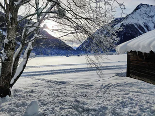
Start by the Fußendras hamlet along trail 17 through the Droßberg valley on the steady ascending trail to the Drosberg mountain hut (1933m, no service).
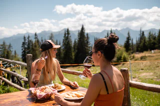
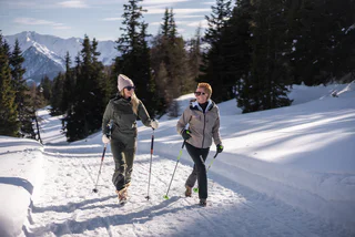
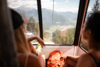
Walking is the best way to enjoy wonderful stretches of greenery. During your spring in South Tyrol, you can witness the awakening of nature in the valley and on the alpine meadows in bloom. Midsummer days are equally surprising: people are lured to mountain peaks, marvel at sweeping views and indulge in the traditional dishes served in quaint mountain huts. Go on a hike to watch the spectacle of autumn’s glorious colours and relax in nature.
Start by the Fußendras hamlet along trail 17 through the Droßberg valley on the steady ascending trail to the Drosberg mountain hut (1933m, no service).
From Stein on trail 3 upwards through the wood and then on the steep serpentines passing the forrestal pass road and some old military constructions to the Pfitscherjochhaus mountain hut (2288m). Furtheron on trail 3 to the Pfitsch joke (2248m), there at left for a short part on the Landshuter Höhenweg to the Pfitscherjoch lakes (2237m). Lunch possibilities: Pfitscherjoch-Haus, Gasthof Stein
Easy family hiking tour from Stilves to the Rofis Boden wood play ground. Start in Stilves and along the road in direction Niederried/Novale Bassa. Soon after leaving the village along the trail 17 on the right side upwards to the Rofis Boden. Along the forestal road you will arrive to the Rofis Boden also with a stroller. Lunch possibility: Restaurant Hotel Wieser
Starting point is the Hotel Larchhof in the valley Innerratschings. From there, you hike along flowery meadows towards Flading, a small hamlet at the end of the valley Ratschings. On the right side you can hear the sound of the creek Ratschinger Bach, then you cross a small forest and the destination of the walk is quickly reached.
“Feel nature” – is literally the aim of the ca. 400m long barefoot path at Ratschings/Racines. Barefoot through nature, feeling fully aware different materials, like grass, sand, pebbles, marble of Ratschings, wood in all types and the natural forest soil and its quality. Try out the difference between rough and pleasant materials, the equilibration by balancing and enjoy a natural foot reflexology at the Kneipp-route at the river Ratschingerbach with hot stones and cold water. Walk barefoot is a sensual pleasure for old and young and provides significant health benefits, stimulates the organism and our immune system.
Ridnaun High Trail - a panoramic hike in the mining valley By the Rosskopf mountain station in Sterzing / Vipiteno in direction west to the mountain huts Kuhalm and Ochsenalm (mark 23). After the hut Ochesenalm on hike no. 23b, passing downside the summits Telfer Weissen, Wetterspitz and Seeberspitz. After 4 hours you will arrive to the mountain hut Prischeralm. Descend on trail no. 27 to Maiern/Ridnaun and return to Sterzing with the public bus (312).
The new Mushroom Trail starts at the kids playground "Aue"in St. Jakob in the Pfitsch Valley near Sterzing and extends one kilometer through the forest. Information panels along the themed trail inform hikers about the world of mushrooms, their reproduction, and their uses.
The life-sized mushrooms were mainly crafted from wooden elements with a uniform design to ensure recognizability along the entire themed trail. The Mushroom Trail is easy for everyone to walk and offers children and school groups the unique opportunity to learn about the life of mushrooms. Additionally, the themed trail provides visitors with an interesting recreational activity in the forests of the Pfitsch Valley.
This project was realized by the Tourism Cooperative of Sterzing – Pfitsch – Freienfeld.
The trails starts by the Ladurns mountain station and goes to the Edelweisshütte alpine hut. Right on to the "Teisljöchl" and here turn right on mark 35. After a few minutes you will arrive to the Dolomieu trail. Follow the trail passing the Toffring Meadows until the Allriss mountain hut. Further on descend on trail 27 to the valley bottom to S. Antonio/St .Anton. Return to the valley station with pubblic bus (313).
The hike starts at the fire station in Obertelfes/Telves di Sopra. Follow the comfortable path no. 5 for about one hour, evenly rising to the first mountain pasture, the Freundalm. Further on uphill on path no. 5 and no. 6, which lead to the mountain pasture Ochsenalm.
Alternative: reachable also by using the cable car Rosskopf Monte Cavallo
Cutting through pure white marble, which used to be coveted by stonemasons from all over the world and which shimmers here in every conceivable shade of green, the otherwise peaceful Ratschinger Bach stream becomes a raging torrent. By going down steep steps and over narrow bridges, you can get right down to the heart of the gorge, where a breathtaking natural scene awaits. The lower entrance to the Gilfenklamm gorge is in Stange/Stanghe, from where you walk along a level hiking trail to the entrance to the gorge, where the trail begins to climb gradually over bridges and along well-secured trails. Storming and raging, the wild waters of the Ratschinger stream tumble over numerous waterfalls, forcing themselves through narrow chasms between the steep cliff walls, which ensure that at the lowest, most impressive point - the so-called "church" - even the most dazzling sunshine is dimmed. Going from one bridge to another and up and down steps, you finally reach the end of the gorge. If you take your time, have good shoes and a camera, this hike is a memorable experience for all the family.
Open daily from 09.00 -17.00 (July and August 09.00-18.00)
Open from May 17, 2024 to November 03, 2024
By the Nordpark Sterzing parking lot along the Via Pineta and furtheron on trail 19 over Raminges or trail 23 along the water experience path to the sunny Rosskopf hiking area.
This hike starts at the fire station in Obertelfes/Telves di Sopra. Follow the path no. 5 for about 1,5 hours upwards to the first mountain pasture, the Freundalm. Continue on path no. 5 until you reach a fork, from where you turn right to path no. 5A and shortly thereafter reach the mountain pasture Kuhalm.
Alternative: reachable also over the mountain railway station Rosskopf Monte Cavallo in about 45 minutes across the panoramic trail.
From Pfulters following the forestal road through the Egg valley. By the third bridge crossing the river and ascent to the Egg hamlet (1500m). Lunch possibility: Gasthaus Egg, Gasthaus Schönblick.
We start in the village of Gasteig/Casateia, cross the main road and go along the Mühlbachlweg trail as far as the signposts. We then follow the trail up the valley towards Stange/Stanghe. At first, a well-marked but narrow trail takes us through an interesting forest with a number of inviting benches to rest on. Soon the trail becomes wider and the scenery more varied: a river biotope, a newly-planted forest, low-growing mixed woodland and meadows. At Stange we go over a bridge and walk along the tarmac cycle path to Mareit/Mareta. If you wish, you can walk to the square by the church where an interesting nature trail begins. Exploring the themes of woodland and water, it takes you past the castle (open for visitors). The return is along the same route. You can also start the hike in Stanghe, which shortens it by about an hour. Quality of the trail: for a short distance, narrow, then wider and tarmac to Stanghe. All types of buggy. Things to see on the way: South Tyrol’s rock garden, museum at Wolfsthurn Castle (Schloss Wolfsthurn), Woodland & Water hiking/nature trail.
The Three-Passture-Trail is a fantastic day trip for the whole family, which starts at the mountain station of the Ladurns cable car and leads through the idyllic alpine village. Firstly, you hike uphill to the right in the direction of Wastenegg, past small, glistening mountain lakes to the idyllic Toffringalm. There, a breathtaking panorama opens up before you: on one side, the imposing Telfer Weissen (2588 m) and the Wetterspitze (2709 m) tower up, while on the other side, the Tribulaun massif (3096 m), the Weisswandspitze (3016 m) and the Schneespitze (3128 m) impress, while the Feuersteine (3246 m) adorn the horizon.
From the Toffringalm, the trail continues slightly uphill to the Pfaffenberg before finally descending to the Allrissalm. On the way back, you can either take the forest road and the so-called ‘Sogeweg’ to the Ladurns valley station or a cosy forest road to St. Anton in Innerpflersch. From there, the 313 bus takes you back to the valley station every hour.
A perfect hike for nature lovers who want to enjoy the magnificent views and experience the calming tranquillity of the mountains.
From Rosskopf / Monte Cavallo at Sterzing / Vipiteno to the Telfes mountain huts. Starting by the Rosskopf mountain station in direction Ochsenalm mountain hut, following the Ridnauner Höhenweg trail. By the mountain hut Ochsenalm turn left and descend to the next mountain hut Freundalm. Afterwards following the trail to Obertelfes, passing by the Witwenbrünnl spring (from here bus connection to Sterzing on weekdays.
Starting point: mountain station Rosskopf Monte Cavallo (1.860m)
The cable car (valley station near the north park in Vipiteno) takes you to the mountain of Vipiteno. Leave the mountain station and follow on your right the marked trails: “Kastellacke”, “Flaner Jöchl” or “Vallminger Almen”. After approx. 15 minutes of walking time you finally reach the mountain hut Sternhütte above the mountain station.
Alternative: by foot to the Rosskopf Monte Cavallo: starting point is the valley station of the Rosskopf Monte Cavallo cable car. Follow path no. 19 or no. 23 through a shady forest and over serpentines to a forest path. Continue to the mountain station. From there follow the trails “Kastellacke”, “Flaner Jöchl” or “Vallminger Almen” until you reach the mountain hut Sternhütte.
Tip: children’s playground and sunbathing area, on Sundays spear ribs
The hike to the Enzianhütte starts about 1.5 km south of Brennerbad (1310 m) on the Brennerstreet, where a signposted access road (sign "Enzianhütte") branches off. After passing under the highway, the path first goes left and then through the forest, leading you up to the meadows of Kreithof (1391 m). From there, continue on foot in gentle switchbacks through the forest to the hut "Ziroger Alm" (1762 m). The path continues through open slopes and finally reaches the hut Enzianhütte (1894 m), a private and managed mountain hut. The descent can be done either on foot (approx. 1.5 hours) or by sleigh.
During the winter season 2024/25, the hut Enzianhütte will be closed, and there will be no opportunity for refreshments.
From Gasse in Ridnaun/Ridanna turn left in direction “Entholz”. At the sign to the upper Gewingesalm drive on about 2 kilometers to a wooden bridge and further on to the Steinhöfen, where you can park your car. From here further on, first along a forest path until you reach a forest clearing, from where you hike left on a forest path a bit steeper uphill to mountain meadows. From there follow a forest path to the mountain hut Zunderspitzhütte and after about 20 minutes you reach the upper Gewingesalm.
Alternative 1: starting from Maiern/Masseria behind the Hotel Schneeberg – walking time 2h. Alternative 2: starting from Ried at the fire station – park area Gewingeshof – walking time 2,5h.
Starting from Flading at the end of the Ratschingstal , walk first through a forest ascending on path no. 12. Then steep over meadows to the pasture Klammalm (1925m). From there forward on path no. 12B over meadows until the climb beneath the summit gets steep. On it up to the summit of the Kleine Kreuzspitze with summit cross. The return follows the same route as the ascent. Exposed and brittle rocky ridge! Surefootedness necessary!
The circular hike starts at Ibsenplatz in Gossensass. Begin by walking along the Silbergasse, then continue through the Mooshöfe and follow the valleyline to Ladurns. Once in Ladurns, follow the groomed winter hiking trail behind the Hotel Alpin towards St. Anton.
In St. Anton, enjoy the winter landscape and continue back towards Außerpflersch. Once in Außerpflersch, turn right at the railway underpass and follow the lakeside promenade back to your starting point at Ibsenplatz.
The total walking time for the entire loop is about 4 hours. The Hotels Alpin and Bergkristall in Ladurns offer a great place to rest along the way.
Alternatively, you can take the bus line 313 back to Gossensass.
This hike is perfect for families and anyone who wants to enjoy the winter scenery on a relaxed walk.
By the Rosskpof mountain station following on the right trail no. 19 until the weather cross. Following the signs to the road and along the road to the little chapel. Take here the trail on the right and follow the serpentines to Vipiteno.
Starting point: Ridnaun/Ridanna - Maiern/Masseria (1.370m). Take the same route to the mountain pasture Martalm and then follow the marking no. 30 to the mountain pasture Staudenbergalm.
Alternative: starting point Bergl (1.560m) to the Martalm and further on follow path no. 30.
The pasture trail Ratschings/Racines starts at the road "Jaufenpassstraße" and leads through fantastic landscape past seven mountain pastures. First you reach the mountain pasture Kalcheralm, from there it goes further to the Rinneralm and to the Wasserfalleralm. Along the already existing walking trail it proceeds towards the Saxnerhütte. The next mountain pastures are the Äussere and the Innere Wumblsalm. The trail ends finally at the Klammalm on 1925 meters of altitude, from which you can reach Flading on the marked path no. 12. The pasture trail can be easily manageable in a one-day excursion and is ideal for families. It is also possible to take the cable car Ratschings-Jaufen to the mountain station, from where you can start the pasture trail.
Above the Braunhof farm near Schmuders on the trail 3 in direction to the Weisse Spitze summit. Furtheron on the forestal road for a little while and descent on the left to the Prantneralm mountain inn (1780m). Alternativ: ascent on the forestal road, suitable for strollers. Lunch possibility: Prantneralm, Braunhof
Easy, comfortable hike at Rosskopf / Monte Cavallo near Sterzing / Vipiteno to the spring "Ferchwasser" which cures the body and the spirit.
The tour “Mountain Adventure World” starts directly at the mountain station of the cable car Ratschings-Jaufen on a good, suitable for buggies, path. This tour can easily be covered at an altitude difference of 50 meters in about 45 minutes and is therefore ideal especially for families with children. The adventurous hiking trail surprises with numerous attractions, like the ant words, the marmot world, the petting zoo, funny water games, the penguin giant, surprising climbing scaffolds, viewing bridges and rest points in the mountain pastures. At many locations there are educational signposts, that inform about the local flora and fauna and satisfy the thirst of knowledge of nature lovers.
The trail leads from the Val di Vizze high valley through the Droßberg-mountain valley along the old military road upwards in the Fundres mountains. By the Sandjoch jag is waiting a panoramic view on the surrounding summits like Wilde Kreuzspitze summit and Grabspitze summit. Route: Start by the Fußendraß hamlet in direction Droßbergalm on the trail 17, passing throug the Droßberg valley and after the mountain hut on trail 17 up to the Sandjoch joke (2651m) and through the pastures to the Brixnerhütte mountain hut (2282m). Lunch possibilities: Brixner Hütte.
The Rosskopf cable car (valley station near the north park in Vipiteno) takes you to the mountain Rosskopf Monte Cavallo. Leave the mountain station on your right and follow the marked trail “Vallminger Almen”. Alternative: by foot to the Rosskopf Monte Cavallo: starting from the valley station of the Rosskopf Monte Cavallo cable car and follow the paths no. 19 or no. 23 through a shady forest over serpentines. Then continue to the mountain station and finally follow the marked trail “Vallminger Almen”.
Tip: alpine butter and cheese
Start by the Rosskopf / Monte Cavallo mountain station in direction biotope Kastellacke, on the hike number 19. By the biotope on the right side on the circular trail to the antenna station. Return on the forest road, passing the mountain hut Furlhütte, to the mountain station.