Přeskočit na obsah

přidáno k oblíbeným

odebráno z oblíbených

Jejda! Došlo k problému, zkuste to prosím znovu

Vytváří se váš účet

Váš účet byl úspěšně vytvořen a nyní jste přihlášeni

Jste úspěšně přihlášeni!

Váš účet byl úspěšně vytvořen, ale nepodařilo se nám vás automaticky přihlásit

Jste odhlášeni

Filtr
Vybrané filtry
    Úroveň obtížnosti
    Doba trvání
    Vzdálenost v km
    Zajímavá místa
    Shops
    Golf

    Památky v Jižním Tyrolsku

    Jižní Tyrolsko je obzvláště bohaté na příběhy, které se vinou kolem tajných míst a neobvyklých přírodních útvarů. Památky, jako jsou čarodějnické lavice na Alpe di Siusi/Seiser Alm, vyprávějí příběhy o čarodějnicích a králích, zatímco místa síly, jako je "Stoanerne Mandln" s více než stovkou cairnů nebo starobylé zříceniny na kopci Castelfeder, vybízejí návštěvníky k odpočinku a hlubokému nádechu. Jedinečné přírodní útvary, jako jsou zemní pyramidy, jsou místa, která stojí za procházku a prozkoumání.

    Výsledky
    Culture & Attractions
    E-Lok Lana Burgstall/Postal
    Burgstall/Postal, Meran/Merano and environs

    Historical restoration of the electric locomotive in Burgstall
    A restoration of the historic electric locomotive in Burgstall has been done. The locomotive, once located in the ruined carriage house at the old bus station in Lana, has been placed near the train station Lana-Burgstall and the Adige bridge.

    The restored iron truss bridge of the Water Protection Office together with the wicker dome and the locomotive give a round picture of South Tyrol's technical culture.

    Culture & Attractions
    Gustav Mahler statue
    Toblach/Dobbiaco, Dolomites Region 3 Zinnen

    The Gustav Mahler statue is located directly in the village center of Dobbiaco and was made in the years 1976 - 1982 by the Slovenian Bojan Kunaver.

    The famous composer Gustav Mahler delighted in his summer holidays in Dobbiaco: “It is wonderful to be here, it sets your soul and body at ease...”. From 1908 to 1910 Gustav Mahler spent the summer months at the Trenkerhof farm in Carbonin Vecchia. In the composing house there he created his Ninth Symphony, the unfinished Tenth Symphony and “Das Lied von der Erde.”

    Culture & Attractions
    The Trauttmansdorff Throne
    Algund/Lagundo, Meran/Merano and environs

    There is a very special vantage point in "Hochkreuz" in Lagundo, located on the popular Via Claudia Augusta bicycle path: the Trauttmansdorffer Throne. The view of Merano and the surrounding area, including Forst Castle (and the brewery with the same name) and one of the most modern churches in the entire Alpine region, the San Giuseppe Parish Church, is breathtaking in its splendour. Ideal for photographs and an absolute must-see for every tourist in Merano. Especially cyclists often stop here for a break to enjoy the view with a picnic before continuing their journey towards Val Venosta (Vinschgau) valley or Merano. Visitors can see the famous Botanical Gardens at the Trauttmansdorff Castle with binoculars. This observation deck is the ideal starting point for a visit to the Botanical Gardens of the Trauttmansdorff Castle.

    Culture & Attractions
    Geocaching
    Lana, Meran/Merano and environs

    Geocaching - The GPS Treasure Hunt

    Geocaching (from "geo", the Greek for earth, and "cache" or "secret store") is a kind of electronic treasure hunt practiced the world over, which first came into being in 2004.

    The basic idea is to communicate the location of new and interesting places, to foster group dynamics and the ability to get one's bearings, all whilst having fun.

    Geocaches are also hidden in Merano and Environs and published on the internet using geographical data on the official geocaching database. With the help of a GPS receiver, anyone can go treasure hunting. Together with the MGM (Merano Marketing association), the Lana & Environs Tourist Information Association has also hidden geocaches under the  reference "eye-catcher".

    But what is a geocache? A geocache is a water-tight container containing a logbook that is well hidden in an interesting place. Whoever finds it can enter their name in the logbook and so document their successful search.

    Afterwards the container has to be put back in its hiding place! The successful hunt is entered on the internet and, perhaps, complemented with photos and comments. In this way other interested parties and above all the person who hid it can find out about what goes on with the geocache.

    Culture & Attractions
    Pine hill
    Martell/Martello, Vinschgau/Val Venosta
    An expressive hillock rises by the timberline above wonderfully fragrant stands of swiss stone pine, accompanied by the "rasping" sound of the spotted nutcracker, the calls of an eagle and the whistling of marmots. Even the stone pines seem to try to get higher up. An enchanted fountain invites you to linger, contemplate and ponder.
    Culture & Attractions
    Speikboden: Viewing tower at 2400m
    Sand in Taufers/Campo Tures, Ahrntal/Valle Aurina

    Viewing tower at 2,400 m Pure fascination: 360° panorama with 150 peaks and more than 80 three-thousanders. Enjoy the wonderful view on the Dolomites with the Tre Cime di Lavaredo/Drei Zinnen, on the Zillertaler Alps, on the Durreck-group – and all this from the top station of the chairlift Sonnklar. Thanks to the clear labeling you will find it easy to locate and marvel at our beautiful mountains. With photo point. Just flying can beat this experience!

    Culture & Attractions
    mystic place Zirmtaler See
    Kastelbell-Tschars/Castelbello-Ciardes, Vinschgau/Val Venosta

    The mystical place: "ZirmtalerSee"aboveKastelbell
    Itinerary:ParkingSchartegg(1490m) - path number4- path number18A-Altalm- path number18-path number 18A-ZirmtalAlm/ZirmtalLake(2119m), 2hours 15 minutes-moderate hikeor parking Alte Säge (1498m) - path number7-MarzonerAlm-MarzonerAlm- path number18-ZirmtalAlm/Zirmtallake(2119m), 2hours -moderate hike

    Culture & Attractions
    Bunker Resia Reschen
    Graun im Vinschgau/Curon Venosta, Vinschgau/Val Venosta

    The bunker 20 is located near Reschen to about 1550m above sea level. Here is also the source of the Adige, with its 415 km of Italy's second longest river. The bunker is dug partly into the rock and partly executed in concrete. It has a length of approximately 20 m and a walk-in area of ​​about 450 m²

    Admission by guided tour only.


    Culture & Attractions
    Kompfoss lake in terenten
    Terenten/Terento, Brixen/Bressanone and environs
    Campofosso Lake is also a deep blue alpine lake (2.439m) with a legendary story: once upon a time there was a beautiful, green meadow in the Campofosso area. This was the property of the richest farmer in the village of Terento. A young shepherd, with eyes as blue as gentian, used to live here. One day, the only daughter of the farmer brought his lunch up to him. When she looked into his eyes she fell in love. He fell in love too. Some time went by, but the farmer's daughter did not visit the shepherd again. One day, the farm labourer brought lunch up to the alpine pasture and informed the shepherd about the upcoming farmers' daughter's wedding. The shepherd was petrified and the mountain trolls provoked a storm. Instead of the alpine hut, the farmers' daughter found a lake, as blue as the eyes of the shepherd.
    Culture & Attractions
    Lake of Dobbiaco/Toblach
    Toblach/Dobbiaco, Dolomites Region 3 Zinnen
    Lake Lago di Dobbiaco is situated at 1259 m in the Val di Landro which links Dobbiaco with Cortina. It is located in the Fanes-Senes-Braies Nature Park. The lake with its varied lakeside vegetation is the ideal resting and breeding place for many kinds of water birds, including those which breed in South Tyrol only rarely and infrequently. During the bird migration periods in the spring and the autumn several rare migratory birds can be spotted here.
    Lake Dobbiaco is a safe and relatively undisturbed habitat and one of the few remaining wetlands in South Tyrol.

    A nature discovery trail with 11 stations around the lake provides important informations on the vegetation, wildlife and geomorphology of the area. The viewing platform on the western shore offers a place to rest and views of the lake’s plants and wildlife and of the silted areas. Walking time approx. 2 hours from Dobbiaco.

    In the summer the lake is refreshingly cool for tired feet. Boat trips (contact boat hire: +39 0474 973 267) and fishing are also recommended: fishing licenses for foreigners can be obtained from the Tourism Association Dobbiaco, day tickets in the restaurant by the lake.

    In winter you can enjoy ice stick shooting, curling and ice skating.
    Forts & Castles
    Roman milestone
    St.Lorenzen/San Lorenzo di Sebato, Dolomites Region Kronplatz/Plan de Corones

    Roman Milestone of the Emperor M. Opellius Severus Macrinus and his son Diaduminanus (located on the main road, branching off towards Sonnenburg). The Roman milestone was found in Sonnenburg in 1857. Today the milestone is located at the entrance of the Museum Mansio Sebatum.

    Culture & Attractions
    Power plant "Schmelze"
    Toblach/Dobbiaco, Dolomites Region 3 Zinnen

    Modern water use, using the example of the power plant "Schmelze", is clearly visible before the eyes and ears.

    Further information to the water treasures of Dobbiaco: http://www.drei-zinnen.info/en/dobbiaco/dobbiaco/experiencing-dobbiaco/lago-di-dobbiaco-lago-di-landro-and-dobbiaco-water-treasures.html?_ga=1.243384837.1489106145.1483110301

    Culture & Attractions
    yew tree forest at Andrian
    Andrian/Andriano, Alto Adige Wine Road
    In Andriano there is a beautiful wooded area characterized by a strong presence of yew trees, which has been designated as a landscape protection zone.
    Yew trees are found in communities with pines, hornbeams and black hornbeams, but also in pure, dark and dense stands, and offer an optimal habitat for many species of animals.
    The yew forest with its numerous paths invites you to walk and relax.

    Translated with www.DeepL.com/Translator (free version)
    Culture & Attractions
    Boat trip with the MS Hubertus Interregio
    Graun im Vinschgau/Curon Venosta, Vinschgau/Val Venosta

    From July to October there is on the biggest lake in South Tyrol, the lago Resia, "Ship Ahoy" with the "MS Hubertus"
    While the ship that passeth away, idyllically situated on the turquoise blue lago Resia, passengers have views of the impressive mountain panorama.
    Captain Winkler informed about the natural beauty around the 6 km long reservoir and are legends and stories about the sunken villages for the best.

    Culture & Attractions
    Dolomites without borders
    Sexten/Sesto, Dolomites Region 3 Zinnen
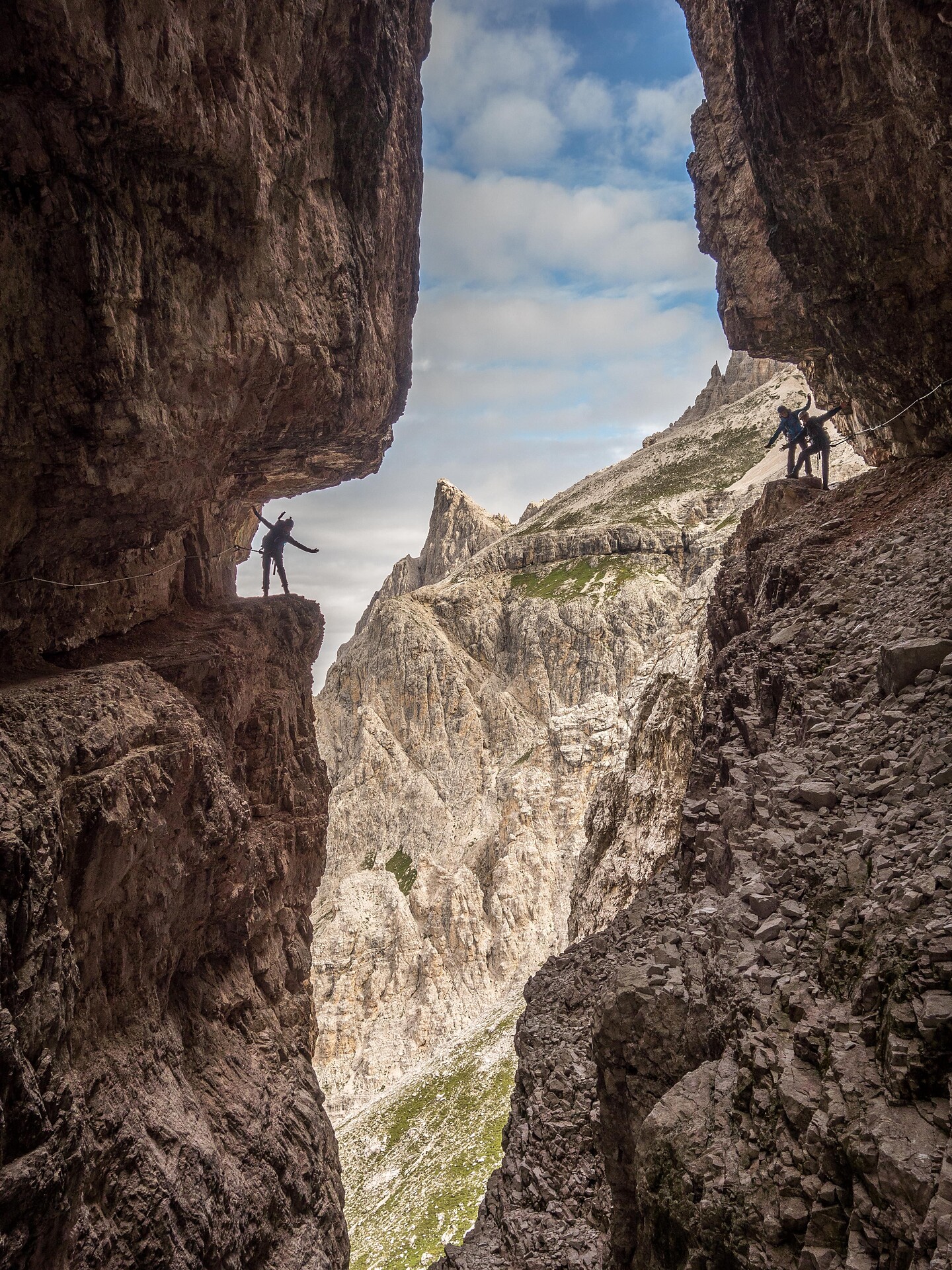
    “DOLOMITES WITHOUT BORDERS” is a unique mountain trail with demanding via ferrata sections that runs, in nine stages covering a total of 108 kilometres, through two countries, along 12 via ferrata and past 17 mountain refuges. It is deeply symbolic, not just from a mountaineering but also from a historical point of view. The route runs partly along old military trails by trenches and galleries from the war, and passes through the areas of Cadore and the Sesto Dolomites in the region of the Three Peaks (Tre Cime di Lavaredo) and as far as the Gail Valley in the Austrian Tyrol. There are also several places where the trail can be accessed: in East Tyrol from the mountaineering villages of Kartitsch and Obertilliach, in Sesto from the Passo Monte Croce Pass, the Prati di Croda Rossa or the Fondovalle Refuge Hut, and in Belluno from the Auronzo Hut, Misurina or the Valgrande near Padola. An adventure for present-day summiteers
    Culture & Attractions
    Natural heritage Partschinser Wasserfall/Cascata di Parcines
    Partschins/Parcines, Meran/Merano and environs

    Water is, without doubt, one of the most important natural elements in the Texel Group Nature Park. It runs off nearby glaciers and bubbles up from deep underground springs to fill many crystal-clear streams and lakes. The Partschins waterfall is one of the most impressive falls in the Alpine region.

    The thundering water shoots out over a towering rock wall and thunders, rages and roars downwards like a "liquid curtain”. The sun’s rays shine on the drops of water making a fascinating myriad of rainbow colours. The 97 mt. high falls are at their best from May to July, when they swell with melted snow water, or after heavy rain storms (water capacity 4,000 – 10,000 per second). Water in all its mighty, majestic forms – the Partschins waterfall is an absolute must, especially around the end of March to the beginning of April when the snow starts to melt and the falls reach a 50 to 60 lt. per second capacity, at the end of April with an average 100 to 200 lt. per second or the end of May with records of between 350 to 500 lt. per second.

    The falls reach their full weight with melted snow from mid-May to the end of June or beginning of July with 5,000 to 6,000 lt. of water crashing over them. The most impressive sight of all was seen in July 1989 when an estimated 10,000 lt. per second went hurtling its way towards the valley.

    Alpine Health: The high level of humidity found at the waterfall has an extremely beneficial, refreshing and re-vitalising effect on our body, helps improve the circulation of air in our lungs and boosts our immune system. The “WATERFALL CURE” is recommended as a means of combatting the effects of air pollution as well as for itscleansing action on the breathing mucous membranes. The Partschins waterfall is known to have an exceptionally high concentration of so-called oxygen-ions, estimated at an incredible figure of 50,000 per sq: cm. These particular oxygen-ions are present in our homes as 100 ions pro cm³, 200 ions in town and city air, and 5,000 in mountain and seaside regions. You can either walk up to the bottom of the Partschins waterfall from the village centre in about 1,5 hoursor take the bus line 265. A well-marked, safe path then leads up to a viewing platform with a fantastic panorama out over the nearby valley and imposing mountain peaks.

    The Partschins waterfall is fed by various side streams and other smaller falls all along its 8km. journey on through a steep gorge. The watershed of the Texel Nature Park, which is completely encircled by the Merano High Path, totals some 25 sq. km. and includes the highest peak of the Partschins/Parcines area, the Roteck peak at 3,337 mt.

    The falls are most swollen at about 20.00 by which time the run-off water from various mountain streams and little lakes, which takes five hours to reach the main stream, has found its way to the waterfall. The water volume decreases during the night.

    Culture & Attractions
    Ice caves
    Kaltern an der Weinstraße/Caldaro sulla Strada del Vino, Alto Adige Wine Road

    The unusual phenomenon of the ice caves between the two villages of Kaltern (Oberplanitzing/Pianizza di Sopra) and Eppan/Appiano can be explained with a simple physical principle: air streams down through cracks in the porphyry stone, creating a system of windpipes that becomes cooler as it descends. This heavier, cold air mass collects in a 5 meter high pool in the depression. This climate is ideal for plants that would normally thrive in higher alpine regions. We do recommend to make this excursion during warm summer months.

    Culture & Attractions
    Montelbon Roman Votive Stone
    Partschins/Parcines, Meran/Merano and environs

    The Montelbon manor house with its façade fresco (Maria Hilf) and round-arched passage is situated in the centre of the village of Partschins.
    Uphill from it a medieval curtain wall still exists today with an arched gateway. The building is a protected monument.

    Some time ago, during work to repair windows on the first floor of the manor, the top part of an inscription stone made of white marble was found. For a long time nobody could explain its meaning, and therefore the stone was left lying in the house unnoticed. In 1954 a second stone was found in the dairy opposite. This proved to be the second part of the inscription stone, which fitted exactly below the top section. 

    The inscription on the Roman era votive stone is difficult to read and incompletely preserved. For this reason, its exact meaning is a matter of interpretation. For example, it might be that the words on the so-called “beneficarius stone” refer to a private working for a financial or customs procurator. Equally, it might be about an assistant beneficarius. In the Roman Empire, beneficarii exercised a role resembling that of a police officer. The beneficarius, who was answerable to the governor of the Province of Raetia, could have been stationed in Partschins and responsible for checking the traffic, as well as for maintaining the Via Claudia Augusta. This might be proof of the possibility that the Rhaetian-Italic border ran to the south/east of Partschins. However these interpretations remain open to question. (Cf. Kaufmann, 2018, p. 50).

    The Montelbon Votive Stone is on display in Merano Municipal Museum. The building is privately owned and the inside is not open to visitors.

    Culture & Attractions
    Coppelle/ "Schalensteine"
    Latsch/Laces, Vinschgau/Val Venosta

    No-one has yet been able to explain exactly the function or the reason why ancient man hollowed out identations in the rock face know as "Schalensteine", although thousand of pages have been written on this subject. In the Vinschgau and neighbouring valleys hundreds of "Schalensteine" can be seen. They vary in size from minute hollows to hollows the size of a human cranium. Some possibile theories of their use are that they were places of workship, guiding points for travellers or possibly that the hollowing out of the stone face was for ritualistic or medical purposes.
    Route description
    Start at the village square in Castelbello, pass by Castelbello Castle, go to the Latschander irrigation channel path and follow it until the junction for Laces. There is the access to the nature's myths path. The first section of the myths path takes you on path no. 8 towards Montetrumes. The path leads through Douglas firs, Austrian pines and locust trees before you reach the so-called "Luamer Tschött" pond and the cupstone after some 30 minutes. Soon afterwards, the path branches off to the right. It is first even before you descend to reach the Via Montetrumes street that you follow for about 300 m towards Castelbello. Turn right at the sign (path no. 8) and continue to the "Klumper" slab and the irrigation channel path above Castelbello form where you can return to Castelbello's village square.

    Culture & Attractions
    Waterfall in Schrambach
    Feldthurns/Velturno, Brixen/Bressanone and environs

    Length: 3,8 km Difficulty: Medium Duration: 1.10 hours ascent. 180 m in altitude Itinerary: From the scrap mill in Schrambach slightly uphill through mixed forest to the Mediterranean Schrambacher Wallserfall back to the starting point. Special round trip for spring and autumn. You can also continue to Loatererhof -Buschenschank - Refreshments (autumn to march).

    Culture & Attractions
    History stones
    Sexten/Sesto, Dolomites Region 3 Zinnen

    You can find the history stones at the road of meditation. The "Schalensteine" - history stones discovered the priest Küer. They are one of the most ancient sings of habitation at Sesto / Sexten.

    Culture & Attractions
    War cemetery "Burg"
    Innichen/San Candido, Dolomites Region 3 Zinnen

    Because of the proximity to the Dolomites front several military hospitals were opened in San Candido in 1914-1989 during the First World War. So many wounded and sick soldiers died there that they could no longer be buried in the cemetery of the collegiate church. Mayor Josef Baumgartner therefore asked the Imperial and Royal Borders Commando No. 10 to create an own inter-faith military cemetery. In the summer of 1915 the work was started and at the end of July the first soldiers were laid to rest in the cemetery. On 12 March 1916 the cemetery and the chapel were consecrated by divisional priest Anton Pircher and formally opened by Major General Karl Englert. By November 1918 over 700 known soldiers were buried there in individual graves, among them members of the Imperial and Royal Army, Italian, Russian, Romanian and Serbian prisoners of war and Bosniacs, as well as many unknown soldiers interred in a mass grave. When in 1916 San Candido was bombarded with grenades and Services in the collegiate church and in the Franciscan monastery church became too risky, Holy Mass and other Worship was moved to the chapel of the military cemetery. Between the wars the parish and the Italian War Graves Commission (C.O.S.C.G.) looked after the cemetery, and in 1927 a special Cemetery Commission was set up for this purpose. In October 1934 the State ordered for the Italian prisoners of war to be exhumed and to be interred in the ossuary Pocol near Cortina. Following the options agreement between Germany and Italy and after the cemetery was already officially decommissioned by the Italian War Graves Commission in 1941, 181 victims of war were exhumed and re-interred in the war cemeteries in Varna/Bressanone (92), Croda Bagnata (68), San Giacomo/Bolzano (11), Merano (8), Passo Pordoi (2). The remaining crosses and the chapel disappeared over a period of time and vegetation covered the levelled field of graves. Thanks to the efforts of the Franciscan Father Brother Siegfried Volgger, and with the help of the renowned Regiment "Schützen Hofmark Innichen”, the war cemetery Burg was restored during 2002/04 and the chapel rebuilt. On 28 August 2004 the restored cemetery was formally consecrated by Suffragan Bishop Dr. Franz Lackner OFM of Graz. The hallmarks of the war cemetery “Burg” in San Candido and its charm are its simplicity and cared for appearance.

    Bathing Lakes
    Big Montiggl Lake
    Eppan an der Weinstaße/Appiano sulla Strada del Vino, Alto Adige Wine Road

    Position:
    The big Montiggl Lake is located in the middle of the nature reserve Montiggl with its stunning mixed forest in the community of Eppan on 492 meters above sea level. It can be reached by car or by the numerous walking paths nearby.

    Topography:
    The big Montiggl Lake has a shoreline of 2 kilometres and its surface is around 18 hectares wide. At its deepest spot it has a depth of 11.5 meters. In the north-east it is surrounded by rock, whereat the opposite site it changes to a swamp.

    Utilization:
    According to analyses the lake has very good data regarding the water quality and is therefore one of South Tyroles most popular swimming lake. In the west of the lake there are hotels, restaurants and a swimming pool with a pier located.

    Culture & Attractions
    Technology Monument Monte San Vigilio
    Lana, Meran/Merano and environs

    31 August 2012 marked exactly one hundred years since the Mount Vigiljoch cable car made its maiden voyage, the world's third suspended cable car approved for passengers. To mark this anniversary and beyond the cable car monument remembers this technological breakthrough.

    In Lana, at the roundabout of Meranerstrasse / Ultnerstrasse streets, looking down to the station towards the valley, one of the decommissioned cabins of the Monte S. Vigilio cable car, still functioning today according to the latest safety standards, serves as an all-around visible eye-catcher.

    The Lana Monte S. Vigilio Cable Car

    As the world's third suspended cable car approved for passengers, in 1912 the cable car on Monte S. Vigilio made history. Today, rebuilt according to modern safety standards, the cable car is a technical monument of national importance.

    Since the company of the Monte S. Vigilio cable car tried already in 1912 to attain a refined artistic impression, it proclaimed Gustav Birkenstaedt as the artistic consultant to the company, which included, beyond the cable car, also the planned “high colony” (Höhenkolonie). As a result, Birkenstaedt developed the plans for the mountain hotel located near the mountain station and for a holiday house model that proved influential for the emerging residential area.

    In 2008 the cable car once again underwent a general refurbishment. New cabins allow passenger transportation today without accompaniment in the cabin, and a video surveillance system ensures maximum safety. The journey from Lana to Monte S. Vigilio (1,486 m above sea level) takes 8 minutes.

    Culture & Attractions
    The king of the larch - a nature monument
    Olang/Valdaora, Dolomites Region Kronplatz/Plan de Corones

    One of the biggest larches in the area is located in Valdaora di Sotto, near by the “Lexen” farm At the site there is a rest area and a wall chart with all the dates about the tree.
    These are: age: 170 years, height: 37 m, diameter: 1,06 m

    Culture & Attractions
    Chestnut grove at Schlosspichl
    Andrian/Andriano, Alto Adige Wine Road
    North of Wolfsthurn Castle, on the hiking trail from Andriano to the Bittner farm, on a flat slope called Schlosspichl you will find a magnificent chestnut grove.
    Chestnut trees of different ages stand on the green meadow and have a special aura due to their fresh, light green foliage. One large oak tree dominates the chestnut grove majestically, which thanks to its position is much warmer than the surrounding forest and radiates vitality through its radiant colours.

    A place to fall in love! A place that allows hikers to rest and that is a natural playground for children.   From the chestnut grove a short path leads to a small hill with a cross and several benches, from where you can enjoy a magnificent view of Andriano and the Adige valley.
    Culture & Attractions
    Fortification Alps Wall in Plamort
    Graun im Vinschgau/Curon Venosta, Vinschgau/Val Venosta

    The defense Plamort (plan mort = dead ground) covers an area of ​​about 1 square kilometer at an altitude of about 2050 m. A special feature is the tank barrier with a length of about 250 m and their so-called dragon teeth. Categories: culture,

    Culture & Attractions
    The plague wayside shrine
    Olang/Valdaora, Dolomites Region Kronplatz/Plan de Corones

    The plague wayside shrine is a well known landmark of Valdaora and is reminiscent of the plague epidemic from the year 1448.

    Culture & Attractions
    Monument Peter Sigmayr
    Olang/Valdaora, Dolomites Region Kronplatz/Plan de Corones

    In the center of Valdaora di Mezzo, not far from the St. Ägidius church, Valdaora remembers one of his famous sons. The hero of the french wars from 1809/10 is devoted a huge monument from Hans Piffrader.

    Culture & Attractions
    the Carnic mountain ridge
    Sexten/Sesto, Dolomites Region 3 Zinnen

    The Carnic mountain ridge appears almost insignificant compared to the stately Dolomite rock towers on the opposite side of the Sesto valley. But this impression is deceiving! From Sesto, you can not only reach the Tre Cime Dolomiti, a popular and panoramic hiking and skiing area, but also the western foothills of a mountain range that stretches for over 100 km, almost to Villach in Carinthia. Interesting detail: The Carnic Alps were formed long before the Dolomites. Numerous fossil finds indicate a turbulent, geological past. However, the mountain range also has great historical importance, as it forms part of the Italian-Austrian border. Those who want to experience a border passing on high tracks can walk from the Monte Elmo peak (2,434 m) past the Helmhaus and along the ridge - with their left foot in Austria and the right one in Italy. This is also the starting point of the popular Carnic high route, also called the "peace route", which leads in eight to eleven days of walking to Arnoldstein in Carinthia.

    Do not miss out! The 3 Zinnen Dolomites mountain cable cars organise spectacular sunrise walks to the Elmo peak during the summer months. Celebrate the dawn of the day with a mountain experience to satisfy all your senses!

    1 2 3 4 5 6 7 8 9 10 11 12 13 14 15