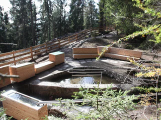
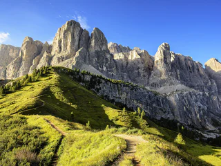
Přeskočit na obsah

přidáno k oblíbeným

odebráno z oblíbených

Jejda! Došlo k problému, zkuste to prosím znovu

Vytváří se váš účet

Váš účet byl úspěšně vytvořen a nyní jste přihlášeni

Jste úspěšně přihlášeni!

Váš účet byl úspěšně vytvořen, ale nepodařilo se nám vás automaticky přihlásit

Jste odhlášeni

Filtr
Vybrané filtry
    Úroveň obtížnosti
    Doba trvání
    Vzdálenost v km

    Speciální túry v Jižním Tyrolsku

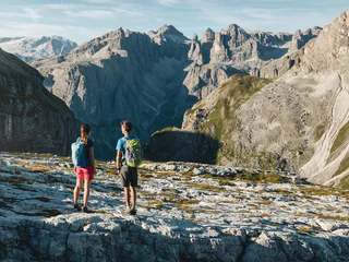
    Zde najdete přehled všech speciálních túr v Jižním Tyrolsku, jako jsou třeba tematická putování, hřebenové trasy, dálkové trasy atd.

    Výsledky
    Long-Distance Hiking Paths
    San Genesio - Salto - Lavena
    Jenesien/San Genesio Atesino, Bolzano/Bozen and environs

    Trail no.1- Suitable for pushchairs. Jenesien, departure from the sportsground on trail no. 33 or trail no.1. Walk along trail no. 1 or the E5 European long-distance walking trail trough the hilly landscape offered by the Salten, to then reach the little church of St. Jacob and Langfenn. Our Hikers' bus can drive xou back to Jenesien. Duration of the excursion: 2 hours and 30 minutes - Drop/rise: 440 m

    Obtížnost: nízká
    421 m nadmořská výška
    2h:16 min doba trvání
    Long-Distance Hiking Paths
    Dolomites World Heritage Geotrail II - Stage 4: from the Tierser Alpl Hut to Ortisei/St. Ulrich
    Kastelruth/Castelrotto, Dolomites Region Seiser Alm

    The fourth stage of the Dolomites World Heritage Geotrail II descends from Tierser Alpl Mountain Refuge to Seiser Alm (Europes largest Alpine pasture), past volcanic rocks, verdant meadows, and inviting mountain huts, until it reaches Ortisei/St. Ulrich in Val Gardena.

    Obtížnost: střední
    426 m nadmořská výška
    5h:30 min doba trvání
    Long-Distance Hiking Paths
    Dolomites World Heritage Geotrail II – Stage 6: from the Puez Hut to Armentarola
    Badia, Dolomites Region Alta Badia

    The impressively steep and rocky tooth of the Sassongher rises directly before us, while far to the south we see the imposing and majestic northwest wall of the Civetta. Merely crossing the plateau on which the Puez Hut is located represents a unique experience for mountaineers without vast geological knowledge, with bizarre rock formations that only a whim of nature could create. The Pralongiá plateau offers a breathtaking view of the largest glacier in the Dolomites, the north face of the Marmolada.

    Discover more: https://www.dolomitiunesco.info/attivita/dolomites-world-heritage-geotrail/?lang=en 

    Obtížnost: vysoká
    788 m nadmořská výška
    6h:16 min doba trvání
    Hiking
    Dolomite Alpine Ridgeway No.1
    Dolomites Region 3 Zinnen
    This alpine path leads along the north - south route through the eastern Dolomites. During the course of the hike you will get to know interesting areas of the eastern Dolomites. The main route leads along an average height of 2.000m - so you have to expect high - alpine conditions. With the exception of the last sections, which can be bypassed on an easier path, experienced hikers will have no difficulties.

    Stages: 8 -12 days
    Obtížnost: vysoká
    6820 m nadmořská výška
    41h:00 min doba trvání
    Long-Distance Hiking Paths
    Tru di pra certified path
    La Val, Dolomites Region Alta Badia

    This trail has been certified by 'Europäisches Wandergütesiegel' (European Certification for hiking trails).

    Once you have left the village centre, you will understand why La Val is called the village of Alpine meadows: green, well-kept meadows will constantly surround you during this hike. The man-made landscape between 1300 and 2000 metres above sea level developed through the hard work of our farming ancestors, which today is facilitated by the use of agricultural machinery. 

    As the altitude increases, so does the consistency of the meadows: from meagre meadows to the larch meadows of Armentara. Along the route you will find wonderful viewpoints, a sulphurous water spring at Al Bagn and several refreshment points where you can refresh yourself with some of the delicious Ladin specialities that can satisfy every palate: try the typical bales (dumplings) or snack on a well-earned slice of strudel.

    Every year, the non-competitive half-marathon 'Tru di pra' takes place on this route.

    Obtížnost: vysoká
    1713 m nadmořská výška
    8h:37 min doba trvání
    Long-Distance Hiking Paths
    Dolomites World Heritage Geotrail II - stage 2: from the Lavazèjoch Pass to the Karer Pass
    Welschnofen/Nova Levante, Dolomites Region Eggental

    In this second stage of the Dolomites World Heritage Geotrail II you reach the mountain massif, that is left as a remnant of a former Triassic atoll: the Latemar. This second stage leads to the western flank of the former atoll and gives the impression of walking on the seabed of the underwater slope that once rose upwards to the surface of the water.

    Find out more: https://www.dolomitiunesco.info/attivita/dolomites-world-heritage-geotrail/?lang=en

    Obtížnost: střední
    842 m nadmořská výška
    6h:24 min doba trvání
    Long-Distance Hiking Paths
    Trail d | Gfrill - Altrei
    Neumarkt/Egna, Alto Adige Wine Road

    On this segment, you will proceed first from Gfrill to the bogland lakes of the "Weiss" and the "Schwarz." From there, the route continues to the Horn-Alm, the highest point of the segment. Hikers can stop here for refreshments and then continue downhill via the Ziss Saddle – not far from there, you can admire the stunning "huckete Stoan," a free-standing erratic boulder made of porphyry the size of a house – until you come to Altrei.

    Obtížnost: střední
    467 m nadmořská výška
    3h:42 min doba trvání
    Long-Distance Hiking Paths
    The path across the cols: The smugglers’ path
    Gsies/Valle di Casies

    The history: The mountains of Defreggen Tal Valley form a big border between Val Casies Valley (I) and Villgratental Valley (A). It has always been crossed by the residents of the two valleys to trade. During the years from 1810–1814 and after the 2nd world war different goods have been smuggled across the border. Because of this the three “The path across the cols” developed. Some informative signs were arranged along the paths to tell about the history and life in earlier times.

    Obtížnost: střední
    870 m nadmořská výška
    4h:30 min doba trvání
    Long-Distance Hiking Paths
    Dolomites World Heritage Geotrail II - Stage 9: from the Plätzwiese High Plateau to the Dreizinnenhütte Hut
    Prags/Braies, Dolomites Region 3 Zinnen
    The ninth stage of the Dolomites World Heritage Geotrail II leads up the Rienztal valley to the Dreizinnenhütte hut in the shadow of the Three Peaks. This stage takes in a precise moment in the geological history of the Dolomites, namely when, 235 million years ago, after a period of intense volcanic activity, new reefs of algae, sponges and corals took root on the cores of the previous tropical atolls.

    More information: https://www.dolomitiunesco.info/attivita/dolomites-world-heritage-geotrail/?lang=en
    Obtížnost: střední
    1387 m nadmořská výška
    6h:04 min doba trvání
    Long-Distance Hiking Paths
    360° Alta Venosta: San Valentino alla Muta - Planol
    Mals/Malles, Vinschgau/Val Venosta

    Idyllic mountain villages with a unique charm is what the second stage of the circular hiking trail 360° Upper Vinschgau Valley has to offer.

    Obtížnost: nízká
    512 m nadmořská výška
    4h:00 min doba trvání
    Long-Distance Hiking Paths
    360° Alta Venosta: Prämajur - San Valentino alla Muta
    Mals/Malles, Vinschgau/Val Venosta

    The first stage of the circular hiking trail 360° Upper Vinschgau Valley leads to the marvelous scenery of the Upper Vinschgau Valley with refreshments at Brugger Alm alpine pasture.

    Obtížnost: nízká
    380 m nadmořská výška
    4h:30 min doba trvání
    Long-Distance Hiking Paths
    Excursion Selva - Passo Gardena
    Corvara, Dolomites Region Val Gardena
    From Selva / Plan path no. 654 starts in the direction of Passo Gardena via the beautiful Plans de Frea.
    Obtížnost: střední
    611 m nadmořská výška
    3h:28 min doba trvání
    Long-Distance Hiking Paths
    San Jacob´s path in South Tyrol
    Bolzano/Bozen, Bolzano/Bozen and environs
    The Way of St. James leads along the slope over the Ritten. On the Keschtnweg from Klausen to Barbian and further to Lengstein to Siffian and Unterinn. There up to Wolfsgruben via Oberbozen down to Bozen. Romanesque, Gothic and Baroque churches and chapels, hospices, castles and countless works of art created by important painters and sculptors await pilgrims right along the way.
    Obtížnost: střední
    820 m nadmořská výška
    6h:37 min doba trvání
    Long-Distance Hiking Paths
    360° Alta Val Venosta: Sluderno/Schluderns - Prato allo Stelvio/Prad am Stilfserjoch
    Prad am Stilfser Joch/Prato allo Stelvio, Vinschgau/Val Venosta

    Passing the impressive Churburg Castle is where the fifth stage of the circular hiking trail 360° Upper Vinschgau Valley starts. Probably the most beautiful view to the Ortler mountain group with the highest glacier in South Tyrol is what the stretch along the Monte Sole mountain in Vinschgau, which is rich in vegetation, has to offer.

    Obtížnost: střední
    361 m nadmořská výška
    3h:30 min doba trvání
    Long-Distance Hiking Paths
    Trail of the legends
    Jenesien/San Genesio Atesino, Bolzano/Bozen and environs

    Along the way there are 12 stations, which were designed by the pupils of the local primary school. There are lots of small master pieces which were smoothly integrated into the landscape of the Salten high plateau. Each station tells you about a local fairy tale from the area of San Genesio. The stories and fairy tales about witches and similar legendary creatures have always excited the fantasy of children and adults alike. Examples of the many exciting stories are the explanation why the Castle Greifenstein is always called ”Sauerschloss“, the fairy tale of the sunken city, the endless ball of threads, the butter witch of Afing, how the Castle of Greifenstein got its name, the captured mermaid, and many more. Duration: approx. 2 hours Length: 7 km Starting point: Parking space Schermoos Destination: bus stop Straße Jenesien - Mölten

    Obtížnost: nízká
    0 m nadmořská výška
    2h:30 min doba trvání
    Long-Distance Hiking Paths
    Hiking on the "Keschtnweg
    Ritten/Renon, Bolzano/Bozen and environs

    Hiking & "törggelen": This ancient South Tyrolean custom alone is worth a trip. From October to the beginning of the Advent season, you meet the "törggelen" in the Renon inns and taverns with young wine, sweet cider and hearty delicacies. When the chestnuts are roasted over the "Keschtnfeuer", you feel as if you have travelled back in time. One-time quaint!

    Obtížnost: střední
    707 m nadmořská výška
    4h:46 min doba trvání
    Long-Distance Hiking Paths
    The path across the cols: The cultivating path
    Gsies/Valle di Casies

    The history: The mountains of Defreggen Tal Valley form a big border between Val Casies Valley (I) and Villgratental Valley (A). It has always been crossed by the residents of the two valleys to trade. During the years from 1810–1814 and after the 2nd world war different goods have been smuggled across the border. Because of this the three “The path across the cols” developed. Some informative signs were arranged along the paths to tell about the history and life in earlier times.

    Obtížnost: vysoká
    870 m nadmořská výška
    6h:00 min doba trvání
    Long-Distance Hiking Paths
    360° Alta Val Venosta: Tubre i.V.M./Taufers i.M. (farm Egghof) - Slingia/Schlinig
    Taufers im Münstertal/Tubre, Vinschgau/Val Venosta

    The shortened variant of the eighth stage of the circular hiking trail 360° Upper Vinschgau Valley leads to the Tellajoch with a typical 360° panoramic view to the mountain peaks of the Ortler group and the Sesvenna group. The 360° viewing platform titles the mountainous panorama.
    From there it continues with insights into the Upper Vinschgau Valleys alpine pasture to Schlinig/Slingia.

    Obtížnost: vysoká
    918 m nadmořská výška
    6h:00 min doba trvání
    Long-Distance Hiking Paths
    360° Alta Val Venosta: Mazia/Matsch - Sluderno/Schluderns
    Mals/Malles, Vinschgau/Val Venosta

    The start of the fourth stage of the circular hiking trail 360° Upper Vinschgau Valley is the mountaineering village Matsch/ Mazia. Along this stretch, you will experience the numerous cultural highlights of the Upper Vinschgau Valley.

    Obtížnost: střední
    104 m nadmořská výška
    3h:00 min doba trvání
    Long-Distance Hiking Paths
    The path across the cols
    Gsies/Valle di Casies
    The history: The mountains of Defreggen Tal Valley form a big border between Val Casies Valley (I) and Villgratental Valley (A). It has always been crossed by the residents of the two valleys to trade. During the years from 1810–1814 and after the 2nd world war different goods have been smuggled across the border. Because of this the three “The path across the cols” developed. Some informative signs were arranged along the paths to tell about the history and life in earlier times.
    Obtížnost: střední
    870 m nadmořská výška
    4h:30 min doba trvání
    Long-Distance Hiking Paths
    Marble Circuit Trail
    Martell/Martello, Vinschgau/Val Venosta

    This multi-day hike at high altitude is through the tree linein the Stelvio National Park.Twisting its way around the imposing Laas/Lasa mountains,the breath-takingMarble Circuit Trailhas a total length of 80 km. Part of the formidable Ortler Alps, this spectacular mountain range is internationally renowned for its unusual pure-white Laas/Lasa marble. With stops along the way the circuit trail can be hiked in one go or split into six single-day stages.

    Lining the Marble Circuit Trailare several panels delineating the rich natural diversity found along the trail. Each of these 30 info panels is centred on a specific theme. A further 10 orientation placards offering descriptions of the start and end of the trail are positioned at strategic points along the trail.

    Obtížnost: vysoká
    4164 m nadmořská výška
    36h:00 min doba trvání
    Long-Distance Hiking Paths
    360° Alta Val Venosta: Slingia/Schlinig - Prämajur (Valley station Watles)
    Mals/Malles, Vinschgau/Val Venosta

    Along alpine meadows to the waterfall below the alpine hut Sesvenna leads the first part of the ninth stage of the circular hiking trail 360° Upper Vinschgau Valley. It continues on the high mountain trail to the mountain restaurant Plantapatsch and along the “Almenweg” path to Prämajur.

    Obtížnost: střední
    627 m nadmořská výška
    5h:30 min doba trvání
    Long-Distance Hiking Paths
    Romedius Pilgrim’s Trail in the Passeiertal Valley
    Moos in Passeier/Moso in Passiria, Meran/Merano and environs

    >> It's great to be walking, especially when swapping the daily grind for a holy place. <<

    From Thaur to San Romedio, on the Pilgrims' trail, one cannot but marvel at the spectacle of sanctuaries, wayside shrines, breath-taking landscapes, pastures and mountain crossings. Along its 180 km length with a difference in altitude of 9,800 m, the trail leads to the sanctuary of San Romedio in Trentino, with two stages passing through the Passeiertal Valley.

    Obtížnost: vysoká
    1900 m nadmořská výška
    14h:30 min doba trvání
    Long-Distance Hiking Paths
    The path across the cols: The traditions and customs path
    Gsies/Valle di Casies

    The history: The mountains of Defreggen Tal Valley form a big border between Val Casies Valley (I) and Villgratental Valley (A). It has always been crossed by the residents of the two valleys to trade. During the years from 1810–1814 and after the 2nd world war different goods have been smuggled across the border. Because of this the three “The path across the cols” developed. Some informative signs were arranged along the paths to tell about the history and life in earlier times.

    Obtížnost: vysoká
    1200 m nadmořská výška
    6h:00 min doba trvání
    Long-Distance Hiking Paths
    Legend trail
    Jenesien/San Genesio Atesino, Bolzano/Bozen and environs

    Trail of Legends: San Genesio Atesino/Jenesien Remarkably, it was 132 students from the municipality of San Genesio Atesino who are responsible for the creation of this fabulous Trail of Legends, which they based on 14 myths from their community. Trail of Legends: San Genesio Atesino/Jenesien Starting point: Salto Parking Area (sports fields in San Genesio Atesino) Highest point: 1.500

    Obtížnost: nízká
    466 m nadmořská výška
    4h:10 min doba trvání
    Long-Distance Hiking Paths
    360° Alta Val Venosta: Tubre i.V.M./Taufers i.M. - Slingia/Schlinig
    Taufers im Münstertal/Tubre, Vinschgau/Val Venosta

    The eighth stage is the most demanding tour of the circular hiking trail 360° Upper Vinschgau Valley. The Tellajoch surprises with a typical 360° panoramic view to the mountain peaks of the Ortler group and the Sesvenna group. The 360° viewing platform titles the mountainous panorama.
    From there it continues with insights into the Upper Vinschgau Valleys alpine pasture to Schlinig/ Slingia.

    Obtížnost: vysoká
    1417 m nadmořská výška
    7h:30 min doba trvání
    Long-Distance Hiking Paths
    360° Alta Val Venosta - The varied circular adventure trail in the Upper Venosta Valley
    Mals/Malles, Vinschgau/Val Venosta

    The newly created 360° Upper Vinschgau Valley is an adventure-packed circular hiking trail through the villages of the Upper Vinschgau Valley. For families and pleasure hikers the nine stages can be seen as individual hiking tips for day tours. Experienced hikers looking for a challenge can plan a hiking tour consisting of several stages.
    At each stage interactive nature installations from local larch await young and grown-up hikers.

    Obtížnost: střední
    5777 m nadmořská výška
    35h:34 min doba trvání
    1 2 3 4 5 6 7 8 9 10 11 12 13 14 15 16 17 18 19 20 21