
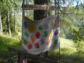
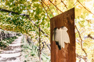
The path across the cols: The Traditions and Customs Path
S. Maddalena/St. Magdalena - Casies/Gsies, Gsies/Valle di Casies
difficult
Moeilijkheidsgraad
1200 m
Hoogteverschil
6h:00 min
Duur
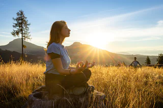
Vind alle speciale wandelingen, zoals themawandelingen, bergwandelroutes, langeafstandswandelroutes etc. van Zuid-Tirol in één oogopslag.
S. Maddalena/St. Magdalena - Casies/Gsies, Gsies/Valle di Casies
difficult
Moeilijkheidsgraad
1200 m
Hoogteverschil
6h:00 min
Duur
1/2
Cengles/Tschengls, Laas/Lasa, Vinschgau/Val Venosta
difficult
Moeilijkheidsgraad
914 m
Hoogteverschil
6h:30 min
Duur
1/5
Valgiovo/Jaufental, Ratschings/Racines, Sterzing/Vipiteno and environs
easy
Moeilijkheidsgraad
48 m
Hoogteverschil
0h:45 min
Duur
1/7
Alpe di Rodengo/Rodenecker Alm, Rodeneck/Rodengo, Brixen/Bressanone and environs
easy
Moeilijkheidsgraad
188 m
Hoogteverschil
1h:30 min
Duur
1/3
Bressanone città/Brixen Stadt, Brixen/Bressanone, Brixen/Bressanone and environs
easy
Moeilijkheidsgraad
0 m
Hoogteverschil
2h:15 min
Duur
Aldino/Aldein, Aldein/Aldino
easy
Moeilijkheidsgraad
391 m
Hoogteverschil
3h:23 min
Duur
1/3
Glorenza/Glurns, Glurns/Glorenza, Vinschgau/Val Venosta
medium
Moeilijkheidsgraad
409 m
Hoogteverschil
4h:00 min
Duur
1/4
Falzeben/Falzeben, Hafling/Avelengo, Meran/Merano and environs
difficult
Moeilijkheidsgraad
1300 m
Hoogteverschil
5h:30 min
Duur
Slingia/Schlinig, Mals/Malles, Vinschgau/Val Venosta
difficult
Moeilijkheidsgraad
1213 m
Hoogteverschil
5h:45 min
Duur
1/3
La Villa/La Villa, Badia, Dolomites Region Alta Badia
easy
Moeilijkheidsgraad
282 m
Hoogteverschil
2h:40 min
Duur
Prissiano/Prissian, Tisens/Tesimo, Meran/Merano and environs
easy
Moeilijkheidsgraad
162 m
Hoogteverschil
1h:13 min
Duur
1/2
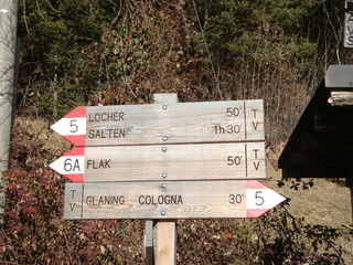
Cologna/Glaning, Jenesien/San Genesio Atesino, Bolzano/Bozen and environs
medium
Moeilijkheidsgraad
338 m
Hoogteverschil
3h:28 min
Duur
1/3
Obereggen/Obereggen, Deutschnofen/Nova Ponente, Dolomites Region Eggental
easy
Moeilijkheidsgraad
41 m
Hoogteverschil
2h:00 min
Duur
San Nicolò/St. Nikolaus, Ulten/Ultimo, Meran/Merano and environs
easy
Moeilijkheidsgraad
0 m
Hoogteverschil
0h:49 min
Duur
1/4
San Lugano/San Lugano, Truden/Trodena
medium
Moeilijkheidsgraad
440 m
Hoogteverschil
3h:10 min
Duur
1/8
Longiarù/Campill, San Martin /San Martino, Dolomites Region Kronplatz/Plan de Corones
easy
Moeilijkheidsgraad
36 m
Hoogteverschil
0h:25 min
Duur
Redagno/Radein, Aldein/Aldino
medium
Moeilijkheidsgraad
431 m
Hoogteverschil
2h:22 min
Duur
1/3
Tramin an der Weinstraße/Termeno sulla Strada del Vino, Alto Adige Wine Road
easy
Moeilijkheidsgraad
294 m
Hoogteverschil
1h:55 min
Duur
1/5
Anterivo/Altrei, Altrei/Anterivo
easy
Moeilijkheidsgraad
0 m
Hoogteverschil
1h:30 min
Duur
1/2
La Val/La Val, La Val, Dolomites Region Alta Badia
easy
Moeilijkheidsgraad
129 m
Hoogteverschil
0h:45 min
Duur
Pinzano/Pinzon, Montan/Montagna, Alto Adige Wine Road
medium
Moeilijkheidsgraad
980 m
Hoogteverschil
3h:51 min
Duur
Alpe di Rodengo/Rodenecker Alm, Lajen/Laion
medium
Moeilijkheidsgraad
2419 m
Hoogteverschil
11h:54 min
Duur
Novale/Ried - San Martino i.P./St. Martin i.P., St.Martin in Passeier/San Martino in Passiria, Meran/Merano and environs
easy
Moeilijkheidsgraad
262 m
Hoogteverschil
1h:38 min
Duur
1/4
Monte Scena/Schennaberg, Schenna/Scena, Meran/Merano and environs
medium
Moeilijkheidsgraad
400 m
Hoogteverschil
2h:30 min
Duur
1/4
Ortisei/Urtijëi/St. Ulrich/Urtijëi, Urtijëi/Ortisei, Dolomites Region Val Gardena
medium
Moeilijkheidsgraad
0 m
Hoogteverschil
0h:49 min
Duur
1/5
Velloi/Vellau, Algund/Lagundo, Meran/Merano and environs
easy
Moeilijkheidsgraad
244 m
Hoogteverschil
1h:34 min
Duur
1/3
Obereggen/Obereggen, Deutschnofen/Nova Ponente, Dolomites Region Eggental
easy
Moeilijkheidsgraad
141 m
Hoogteverschil
1h:04 min
Duur
1/3
Corvara/Corvara, Corvara, Dolomites Region Alta Badia
medium
Moeilijkheidsgraad
581 m
Hoogteverschil
4h:32 min
Duur
Moos/S.Giuseppe
medium
Moeilijkheidsgraad
1754 m
Hoogteverschil
7h:28 min
Duur
Plata/Platten - Falzes/Pfalzen, Pfalzen/Falzes, Dolomites Region Kronplatz/Plan de Corones
medium
Moeilijkheidsgraad
422 m
Hoogteverschil
4h:00 min
Duur
Bedankt voor je inschrijving!
Inschrijving al actief
Bevestig je inschrijving
Om je inschrijving te voltooien, open de e-mail die we je net hebben gestuurd en klik op de bevestigingslink.
Niet gevonden? Kijk ook even in je spammap.
Je ontvangt al onze exclusieve aanbiedingen, handige tips en speciale suggesties om volop van je vakantie te genieten.
Je hebt je al geprobeerd in te schrijven voor onze nieuwsbrief maar deze nog niet bevestigd. We hebben je de e‑mail zojuist opnieuw gestuurd. Controleer je inbox en je spammap en bevestig nu.


