
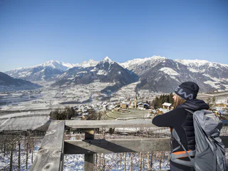
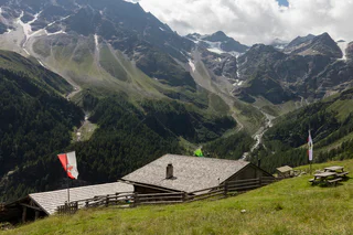
La Ferata – The old railway line featuring Bronze Sculptures and Snow Depths - Winter
Selva/Sëlva/Wolkenstein/Sëlva, Urtijëi/Ortisei, Dolomites Region Val Gardena
easy
Poziom trudności
61 m
Wzlot
2h:31 min
czas trwania
Selva/Sëlva/Wolkenstein/Sëlva, Urtijëi/Ortisei, Dolomites Region Val Gardena
easy
Poziom trudności
61 m
Wzlot
2h:31 min
czas trwania
1/4
Scena/Schenna, Schenna/Scena, Meran/Merano and environs
easy
Poziom trudności
320 m
Wzlot
2h:00 min
czas trwania
Monteponente/Pfeffersberg, Brixen/Bressanone, Brixen/Bressanone and environs
easy
Poziom trudności
280 m
Wzlot
2h:00 min
czas trwania
1/5
Niederrasen/Rasun di Sotto, Rasen-Antholz/Rasun Anterselva, Dolomites Region Kronplatz/Plan de Corones
easy
Poziom trudności
108 m
Wzlot
0h:25 min
czas trwania

1/13
S.Cristina Gherdëina/S.Cristina Val Gardena/S.Cristina Gherdëina/St.Christina in Gröden, S.Crestina Gherdëina/Santa Cristina Val Gardana, Dolomites Region Val Gardena
difficult
Poziom trudności
303 m
Wzlot
2h:00 min
czas trwania
1/2
Novacella/Neustift, Vahrn/Varna, Brixen/Bressanone and environs
easy
Poziom trudności
215 m
Wzlot
1h:46 min
czas trwania
S. Martino al Monte/St. Martin - Laces/Latsch, Latsch/Laces, Vinschgau/Val Venosta
medium
Poziom trudności
708 m
Wzlot
3h:32 min
czas trwania
San Cassiano/San Cassiano, Niederdorf/Villabassa, Dolomites Region 3 Zinnen
medium
Poziom trudności
500 m
Wzlot
36.1 Km
odległość
Piavenna/Plawenn, Graun im Vinschgau/Curon Venosta, Vinschgau/Val Venosta
medium
Poziom trudności
1010 m
Wzlot
5h:42 min
czas trwania
Braies di Fuori/Ausserprags, Prags/Braies, Dolomites Region 3 Zinnen
medium
Poziom trudności
309 m
Wzlot
1h:04 min
czas trwania
1/3
Lazfons/Latzfons, Klausen/Chiusa, Brixen/Bressanone and environs
medium
Poziom trudności
539 m
Wzlot
3h:15 min
czas trwania
Alpe di Villandro/Villanderer Alm, Villanders/Villandro, Brixen/Bressanone and environs
medium
Poziom trudności
638 m
Wzlot
3h:00 min
czas trwania
Pineta di Laives/Steinmannwald, Laives/Leifers, Bolzano/Bozen and environs
medium
Poziom trudności
497 m
Wzlot
2h:30 min
czas trwania
1/5
Siusi/Seis, Kastelruth/Castelrotto, Dolomites Region Seiser Alm
medium
Poziom trudności
939 m
Wzlot
6h:00 min
czas trwania
Piavenna/Plawenn, Graun im Vinschgau/Curon Venosta, Vinschgau/Val Venosta
medium
Poziom trudności
404 m
Wzlot
2.2 Km
odległość
Vallesina/Versein, Mölten/Meltina, Bolzano/Bozen and environs
easy
Poziom trudności
405 m
Wzlot
1h:42 min
czas trwania
San Vigilio, Badia, Dolomites Region Alta Badia
difficult
Poziom trudności
3174 m
Wzlot
17h:28 min
czas trwania
Bressanone città/Brixen Stadt, Brixen/Bressanone, Brixen/Bressanone and environs
easy
Poziom trudności
286 m
Wzlot
1h:37 min
czas trwania
Prissiano/Prissian, Tisens/Tesimo, Meran/Merano and environs
easy
Poziom trudności
38 m
Wzlot
0h:25 min
czas trwania
Burgeis/Burgusio, Mals/Malles, Vinschgau/Val Venosta
easy
Poziom trudności
146 m
Wzlot
0h:45 min
czas trwania
1/3
Colfosco/Colfosco, Badia, Dolomites Region Alta Badia
easy
Poziom trudności
49 m
Wzlot
368.0 m
odległość
1/5
Vallesina/Versein, Mölten/Meltina, Bolzano/Bozen and environs
medium
Poziom trudności
356 m
Wzlot
1h:13 min
czas trwania
Villabassa/Niederdorf, Niederdorf/Villabassa, Dolomites Region 3 Zinnen
easy
Poziom trudności
36 m
Wzlot
2h:08 min
czas trwania
1/2
Colfosco/Colfosco, Badia, Dolomites Region Alta Badia
easy
Poziom trudności
0 m
Wzlot
157.0 m
odległość
medium
Poziom trudności
339 m
Wzlot
6h:30 min
czas trwania
Ausserprags/Braies di Fuori, Prags/Braies, Dolomites Region 3 Zinnen
easy
Poziom trudności
47 m
Wzlot
0h:40 min
czas trwania
San Leonardo i.P./St. Leonhard i.P., St.Leonhard in Passeier/San Leonardo in Passiria, Meran/Merano and environs
medium
Poziom trudności
183 m
Wzlot
1h:31 min
czas trwania
Valgiovo/Jaufental, Ratschings/Racines, Sterzing/Vipiteno and environs
medium
Poziom trudności
569 m
Wzlot
2h:31 min
czas trwania
1/9
Oris/Eyrs, Laas/Lasa, Vinschgau/Val Venosta
medium
Poziom trudności
880 m
Wzlot
4h:01 min
czas trwania
1/2
Seis/Siusi, Kastelruth/Castelrotto, Dolomites Region Seiser Alm
difficult
Poziom trudności
3913 m
Wzlot
96.4 Km
odległość
Dziękujemy za zapisanie się!
Subskrypcja jest już aktywna
Potwierdź rejestrację
Aby zakończyć rejestrację, otwórz e-mail, który właśnie wysłaliśmy, i kliknij link potwierdzający.
Nie widzisz wiadomości? Sprawdź folder spam.
Zauważyliśmy, że próbowałeś(-aś) zapisać się do newslettera, ale Twój adres e-mail jest już zarejestrowany. Nadal będziesz otrzymywać nasze oferty, wskazówki i inspiracje na Twój urlop.
Już próbowałeś zapisać się do naszego newslettera, ale nie potwierdziłeś rejestracji. Właśnie wysłaliśmy ci ponownie e‑mail. Sprawdź swoją skrzynkę odbiorczą i folder ze spamem i potwierdź teraz.


