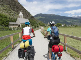
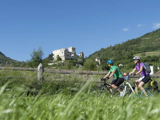
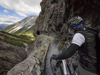
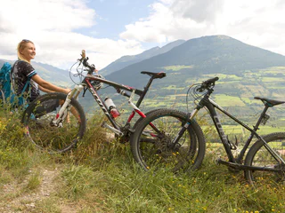
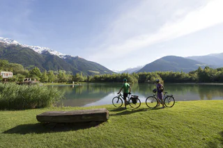
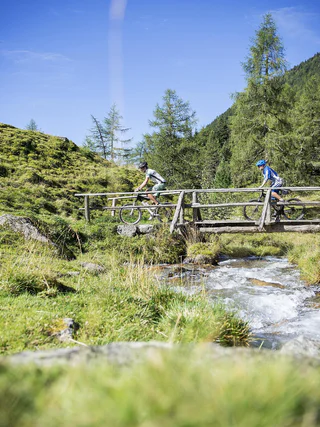
You can travel long distances on a bike, feel a sense of freedom and warm up for the best adventures. Experience the thrill of discovering new places on two wheels in South Tyrol, where the cycling season starts as early as March. If you are a hardened cyclist, you’ll have your best time cycling on pass roads and on the valley cycle route. You’ll surely find a wealth of family-friendly excursions through South Tyrol’s unique cultural landscape and if you hop on the e-bike, you’ll probably travel even further.
A trail classic with fantastic trail descents.
Start in Tarres and first take the partially demanding asphalt road for a little while and then go along the forest road to Malga di Montefranco. This mostly shady tour with some steeper passages takes you up to 1.674m and offers wonderful views of Naturno and Merano and environs. Refresh yourself at the mountain hut before you continue uphill or take one of the downhill trails.
Tips: The Lupo and Fontana trails start just below Malga di Marzon. You can reach further trails via Bike Highline Meran(o).
Bicycle route from Mals via Taufers to Müstair in Switzerland
Flowing, partially rough trail with wonderful views. You will definitely win on this legendary Laces trail.
The famous trail no. 4 in combination with the panoramic and partially exposed trail no. 13 is a true enrichment. Start at the Malga di Laces mountain hut and go through the green forest landscape until the wayside cross where you turn right into trail no. 4. Continue on sometimes flowing and sometimes rough meadow and forest floor trails that wind through the forest until Plumargun and get you into the right trail mood. Don’t follow the steep and heavily washed out trail no. 4, which has been removed from the trail concept, but take the forest road and turn right into trail no. 13 below the distinctive tree. The slightly exposed flowing and narrow S2 trail turns into a heavy passage with some roots and debris towards the end. The view of the valley offers a wonderful panorama at sunset. Please note: “Share the Trail” sections on the hiking paths! The lower part of trail no. 4 from the forest road at Partschogg onwards as well as paths 4a and 4b are for hikers only!
Road bike tour with view to the marble quarry, the Ortler group and the orchards of the Lasa and Sluderno Monte Sole mountain
Before setting off on this tour, it is legitimate to think about the delicious Kaiserschmarren at the Rescher Alm. Follow the cycle path along the lakeshore from Reschen towards the Schöneben valley station. From the valley station, cycle uphill on the main road, in the direction of Rojen and then in the direction of St. Valentin to the hamlet of Spin. Shortly after the Spin´s farm, take a sharp right onto the forest and meadow path. In the forest, bend the way north above lake Resia and the Rojen road past a small forest lake (1,850 m). Follow the forest road, meet the Rojen road a little later and follow it to the trendy Rescher Alm hut. Here, at an altitude of 2,000 m, with a splendid view from the terrace, enjoy one of the best lunches. From the Rescher Alm alpine hut, continue north along the forest road, down to Tenders, where the Tendershof farmhouse invites for refreshment. From here, it is not far to the final destination: Reschen. Tip: For enduro enthusiasts: there is the option of rocking down via the 3-Länder Trail in the direction of Nauders to the Mutzkopf. From Mutzkopf, take one of the trails to Nauders.
Cross Country Tour around the landmark of Schluderns: the Churburg, one of the best preserved castles in South Tyrol
Do not fall in love with the high valley of Schlinig - former stopping place of smugglers on the way to Switzerland.
The Upper Belpiano Trail is a special trail, it is perfectly adapted in the landscape and has challenging parts for all single trail-lovers. The trail starts at the mountainstation Belpiano and goes trough forests down to the brach-off in direction to the 3-Country-Trail. The character changes only insignificantly in the lower part. Wonderful cross-country skiing and deep views of Lake Resia make the Schöneben Trail an unforgettable experience - an experience that can be repeated over and over again thanks to the Schönebenbahn.
Leisurely tour through the enchanted Prato forest to the castle ruin above Cengles/Tschengls. A stop at a special cultural guest house.
To reach the ruin of the Cengles Castle above the Venosta Valley, the trail leads from Prato/Prad in the Stelvio National Park in a south-easterly direction to the St. Johann church and further past the “Dürre Ast“ up to the Prato mountain farms. At the branch to Wittenberger Hof farm, the ground changes to gravel and a little later, the highest point has been reached (1,430m) at the streambed. During the descent on gravel and tarmac, the forest curtain opens up and with it, the view to the Tschengslburg castle ruin and the cultural landscape of the Venosta Valley covered with small squares. The view across green meadows on the other side of the valley with the sparse slopes and beautiful summits of the Monte Sole Mountain is, in any event, worthy of a stop to take a photo. You could stop in the Tschengelsburg, at Karl Perfler’s castle restaurant which has been developed to a cultural guest house. Then you leisurely pass the apple orchards and return to Prato at the foot of the imposing Tschenglser Hochwand mountain (3,376 m).
Tip: The field name Gungadria originates from the “Tschrinwiesen” fields at the Nittbach stream. The Romanic term “concha” (muscle) signifies the round or oval area indentations or hollow forms.
As racing cyclist one should meanwhile not miss this classic
On the 27th of May, 2014 won Nairo Quintana (MOV) this stage.
An enjoyable tour to Malettes a great viewpoint above Mals
Pleasant route across Montechiaro/Lichtenberg and the Platzhof farm into the 12er Trail.
From Prato/Prad, the gateway to the Stelvio National Park and to Solda/Sulden, you proceed across the Suldenbach streem to Agumes/Agums and from there via a beautiful meadow path with view to the fields, castles and summits of the Upper Venosta Valley in northerly direction to Montechiaro/Lichtenberg. Here starts the ascent on asphalt up to the Lichtenberg Fortress and then on gravel further up to Adelheid Schöpf Lechner from the Platzhof farm (1,354 m). After a nice snack (Brotzeit) with a view towards the direction of Sluderno/Schluderns and on the 3,202 m high Allitzer Spitz peak, you reach the highest point after a few metres further uphill. A flowy descent on narrow and wide trails (S1 and S2), with a few technical tight turns – no risk of boredom. From the Agumsbergerhöfe farms we carry on rolling, soon on tarmac back into the direction of the starting point to the interesting aquaprad National Park visitor center and look forward to a leisurely drink containing electrolytes.
Tip: The unusual name of the tour relates to a field name at the Agumser Berg mountain at the former climb from the Platzhof farm to Gawierg.
Anche questo single trail ha tanto da offrire. Parte sopra Spin e rappresenta un interessante raccordo per San Valentino e per la funivia della malga San Valentino; vi accompagnerà lungo il crinale sempre in direzione sud. L'imbocco si raggiunge alla fine della parte inferiore dello Spin Trail.
From the village center in Schlanders on the cycle path to Holzbrugg, through fruit gardens following the river to the lake Goldrain.
Nestled between the Endkopf "Jaggl" (2,627 m) and Pleisköpfl (2,425 m) lies the destination, the Grauner Alm alpine pasture, at 2,173 m. Start the tour in Graun at 1,500 m. For a quick warm up, follow the road into the Langtauferer valley. After 250 m, turn right over the bridge and pedal up through the shady Arluiwald forest on a mainly pleasant incline on the alpine path to the Grauner Alm alpine pasture. There is a possibility to park your mountain bike at the mountain pasture and continue on foot via hiking trail no. 10 to the summit of the Endkopf (2,652 m). Duration of hike: approx. 2.5 hours (ascent and descent). On the hiking path to the peak, it's possible to spot some rare edelweiss flowers and marmots. Lying in the grass on the slope, enjoy the sensational panorama and head back down to the valley via the alpine path to stop by the village for a good meal.
The Adige Trail can be reached just above the Resia and is named after the river in Italy, which springs right next start. He is also the continuation of the bunker trails and leads down to the village Resia and the lake lago di Resia. It is a lightweight, highly flow trail which makes you want more.
Sulla parte inferiore del trail Belpiano, all'ultimo incrocio con la pista da sci, il facile Giern Trail porta in direzione di San Valentino e Giern. Il Giern Trail è il collegamento con il lago di Resia e termina al maso Giernhof. Da lì si può pedalare sulla pista ciclabile per San Valentino.
The 3-country Enduro Trails combine a globally unique scenic experience with imposing views, cosy alpine pastures, beautiful lakes, history and culture - interwoven through mountain bike trails. Since mountain biking was discovered and promoted by locals more than 25 years ago, there is a lively mountain bike culture in the villages around the Reschen Pass and you can literally feel you are welcome as a mountain biker.
Moreover, even in midsummer, temperatures in the Reschen Pass are usually pleasant. In addition to jumping into the Reschen lake, further natural lakes in the forests around the Reschen Pass also provide cooling.
Trail descents of the finest quality from almost 2,500 metres above sea level make "runs" with more than 1,000 metres in decent at a time is possible! From flowing to technically demanding, but mostly natural, the trails offer everything an enduro heart desires. On a trail day in the border triangle, you will also pass by important landmarks, such as the 3-country border stone, Nauders mountain castle or the Reschen lake with its striking sunken church tower. Due to the vast size of the area, all types of mountain bikers are spread out inconspicuously throughout the terrain. By the end of the trail, all trails are guaranteed to lead you directly back to your starting point.
Up and down below Piz Salve, Munwartl and Glurnser Köpfl mountains.
From Trafoi, a lift takes you up to the Furkelhütte hut (2,153 m), where you can have a coffee before starting the tour. Then up and down on gravel paths, meadow paths towards the Stilfser Alm Alpine pasture (2,077 m). Here, another opportunity presents itself to enjoy the panoramic view. Now downhill around 500 metres of height, below the Stilfser Alm to the 6er trail (S1) and forest as well as gravel path downhill to the Faslarhöfe farms (1,550 m), to then carry on uphill again, towards Schartalm Alpine pasture (1,825 m). At the junction Schartalm, take the gravel path towards the Lichtenberger Almen Alpine pastures (2,066 m) to the beautiful Gutfalltal Valley. From the pastures, a lovely trail, with occasional roots and a brilliant panoramic view leads to the Glurnser Alm Alpine pasture (1,978 m). This part is challenging and occasionally requires some skill and fitness. At the pasture, it is worth taking a break and a snack you brought along (Marend).
From the Glurnser Alm Alpine pasture, follow the forest trail downhill up to the town walls of the beautiful little town of Glorenza/Glurns, with its cobbled old town and nice cafés. From Glorenza, briefly follow the road from the south gate of the town wall, then turn right into the meadow path to Prato.
Matscher Raubritter Mountain Bike Tour
The Holy Hansen trail was applied by bikers for bikers. The farm tavern Haslhof (1,550 m), after so many curves to satisfy the hunger of trail, awaits the deserved break with wonderful views.
From Haslhof westwards pass two fences and get off right after the flowy S1 trail section in sector 1 and 2. In sector 3 and 4 wait a few S2 and S3 somewhat more difficult to thereafter return to the easier element of fun for everyone. The Holy Hansen crosses repeatedly forest and asphalt paths.
At Wiebenhof follow on asphalt two bends downhill to then turn right into the trail section. Flow pure, spiced with abutting sections, small kickers and faster passages provides this trail section to the crossing of the asphalt road. Take the road uphill for a short stretch and then turn left to continue to enjoy the rest of the trail up to Göflan.
Time regulation for Shuttle transport at Holy Hansen
Monday + Wednesday + Friday: Shuttle from 1 pm
Tuesday + Thursday: Shuttle all day
Saturday: Shuttle until 11.30 am (start last ride)
Sunday: no Shuttle
Official MTB-Shuttles to Trails in Schlanders
Mobil Car Tel. +39 338 5 07 54 62 - Freeride Vinschgau Tel. +39 348 0 42 72 29
Stegges Taxi Tel. +39 335 5 44 06 20 - Vinschgau Shuttle Tel. +39 335 6 82 85 14
From the village center in Laas on the cycle path westwards through the orchards to Oris, through the Tschengls biotope further to Prad and over the "Prader Sand" to the fishing ponds.
One of the classic tours on the Laces "Nörderberg" - real alpine pasture food included.
From the car park of the Laces sports stadium (SportForum) we start in a southerly direction to the AquaForum adventure pool, then turn right to the ice stadium (IceForum) and straight to the Latscherhof and then to the forest path in the direction to Magrinböden. The forest path is now moderately steep but constant in the direction of Töbrunn. From there we crank the final stretch slightly up and down to the refreshment stop at the Latscher Alm. Homemade products and good dumplings as well as drinks containing electrolytes delight our bikers hearts. We return to the valley either via the same forest trail, the Tarscher Alm forest trail, the "Roatbrunn trail" (S3) or the "4-wins-13 trail" (S2).