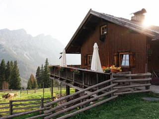
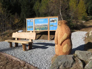
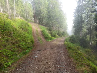
Skip to content

added to favourites

removed from favourites

Oops! Something went wrong. Try again

Your account is being created

Your account has been successfully created and you are now logged in

You’ve been logged in successfully!

Your account was created successfully, but we couldn't log you in automatically

You are logged out.

Filter
Selected filters
    Level of difficulty
    Duration
    Distance in KM

    Hiking trails in the Dolomites Region Kronplatz

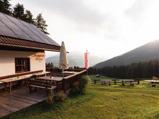
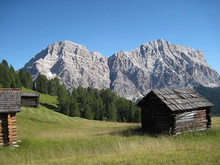
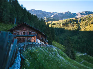
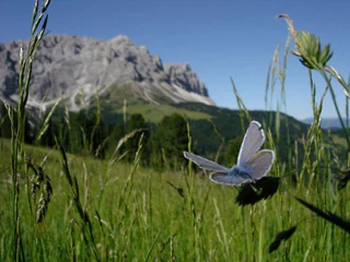
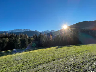
    Walking is the best way to enjoy wonderful stretches of greenery. During your spring in South Tyrol, you can witness the awakening of nature in the valley and on the alpine meadows in bloom. Midsummer days are equally surprising:  people are lured to mountain peaks, marvel at sweeping views and indulge in the traditional dishes served in quaint mountain huts. Go on a hike to watch the spectacle of autumn’s glorious colours and relax in nature.

    Results
    Summer
    Bergeralm
    Rasen-Antholz/Rasun Anterselva, Dolomites Region Kronplatz/Plan de Corones

    From Antholz Mittertal (sports area) > Eggerhöfe > turn right > follow the foresty street > n. 3/12 > Klammbach Waterfalls > Bergeralm.

    Difficulty: easy
    368 m elevation gain
    1h:15 min duration
    Summer
    Themed & didactic hiking path stone mile
    Olang/Valdaora, Dolomites Region Kronplatz/Plan de Corones

    Along the hiking path from Niederolang to Mühlbach were positioned different blocks of stone from all the different regions of Alto Adige. On the information boards next to the blocks you can get all the information about them. The hiking path now is a place of experience, a place of communication, a place for learn & linger.

    Difficulty: easy
    42 m elevation gain
    0h:12 min duration
    Summer
    Kumpflalm Hut (path)
    Rasen-Antholz/Rasun Anterselva, Dolomites Region Kronplatz/Plan de Corones

    From the village center Antholz Mittertal (passing the police station) > going up at the Amus Chalets > farm Außerkumpflhof > follow the path to the Kumpflalm hut.

    Difficulty: easy
    366 m elevation gain
    1h:04 min duration
    Summer
    Art along the way - Moarberger pond
    Bruneck/Brunico, Dolomites Region Kronplatz/Plan de Corones

    Extraordinary art objects have been incorporated into the picturesque backdrop of the hiking trails of Reischach/Riscone, which sometimes only the attentive hiker can see.

    Difficulty: easy
    9 m elevation gain
    0h:12 min duration
    Summer
    Plan de Corones > Passo Furcia
    Al Plan/San Vigilio, Dolomites Region Kronplatz/Plan de Corones

    Medium-difficult hike with marvellous views from the peak out onto the surrounding mountains.

    Difficulty: easy
    5 m elevation gain
    1h:30 min duration
    Summer
    Hut-tour Antermoia
    San Martin /San Martino, Dolomites Region Kronplatz/Plan de Corones

    It consists on a hut to hut hike, starting from Antermoia both in clockwise and in counter clockwise direction possible. From the typical mountain village of Antermoia you proceed to Alfarei and follow the indications for Montemuro, from where you descend on a path to the Pecol hut. Proceeding on the forestal road you reach the parking place Pé de Börz. You follow the path number 8, which leads you after ca. 45 pleasant walking minutes to the Passo delle Erbe where the next two alpine huts are waiting for you: Ütia de Börz and the Cir hut. After another 20 minutes through the marvellous flowering pastures which decorate the Sas Pütia you reach the Munt de Fornella. On your left you continue through the “Stone Village” and in ca. 35 minutes you reach the last of the planned alpine huts, that of Göma. From here you return to Antermoia on an easy path. Walking time: 6 h

    Difficulty: medium
    996 m elevation gain
    5h:25 min duration
    Summer
    Plan de Corones > Malga Oberegger > Casola
    Olang/Valdaora, Dolomites Region Kronplatz/Plan de Corones

    This very rewarding hike dotted with breath-taking views from the peak of Mount Kronplatzrequires a certain amount of stamina: Although the trail is not a particularly difficult one, it runs along a relatively long route.

    Difficulty: medium
    0 m elevation gain
    2h:30 min duration
    Summer
    Ausserweger Hütte - Staller Alm
    Rasen-Antholz/Rasun Anterselva, Dolomites Region Kronplatz/Plan de Corones

    Park your car on the top of the Staller Saddle (2.050 m) > path n. 113 > Lake Obersee > Ausserweger Hütte.

    Alternatively from Lake Antholz > trail no. 11 > Staller Saddle > Obersee > Außerweger Hütte.

    Difficulty: easy
    22 m elevation gain
    0h:45 min duration
    Summer
    Following in the tracks of the ancient romans
    Kiens/Chienes, Dolomites Region Kronplatz/Plan de Corones

    A walk through history


    More than 2000 years ago, the Puster Valley was under the administrative control of the Roman Empire. Today you can still discover evidence of the early history of the Noricum province, which was once part of the Great Celtic kingdom, in parts of Ehrenburg/Casteldare and the nearby settlement area of St. Lorenzen/San Lorenzo.

    An attractive and leisurely circular walk between the southern center of Kiens/Chienes and the western landscape area of Ehrenburg/Casteldarne offers insights into the history of the Romans. The importance of travelling and the role of the rest stops around Kiens/Chienes are presented in an exciting way at various rest points, with information’s about the Romans, to bring the past to life.

    One of the best-preserved milestones from Roman times is a two-meter-high column sculpted from quartz phyllite. The Roman stone was erected during the reign of the Roman Emperor Lucius Septinus Severus and shows the distance to the Roman town of Aguntum near Lienz in East Tyrol further to the east.

    Also worth seeing (only from the outside) is the historic Ehrenburg castle, which was built in 1250, and the nearby baroque parish church of the Assumption of the Virgin Mary. The beautiful wooden fences and the old dry-stone walls in Ehrenburg/Casteldarne are also particularly attractive. Refreshment stops to take a well-deserved break at: Bar Restaurant Obermair in Ehrenburg/Casteldarne and Riverhotel Post in Kiens/Chienes.

    Difficulty: easy
    50 m elevation gain
    1h:30 min duration
    Summer
    Collina del Miele/Honigbergweg
    Pfalzen/Falzes, Dolomites Region Kronplatz/Plan de Corones

    This adventure trail showcases the extraordinary interaction between nature and wildlife and invites you to relax and unwind.

    Difficulty: medium
    422 m elevation gain
    4h:00 min duration
    Long-Distance Hiking Paths
    Alpine Path of the Dolomites no. 1 - stage 2 & 3
    Al Plan/San Vigilio, Dolomites Region Kronplatz/Plan de Corones

    The High Route no. 1 winds along a route of approximately 125 km and 7,300 m of ascent, divided into 12 stages, connecting Lake Braies with Belluno. Here, ere two stages pass through the municipality of Marebbe

    Stage no. 2 goes from the Biella hut to the one in Fanes. Exploring the pastures of Senes, Fodara and Fanes, it is often possible to see animals grazing. The stage can be walked in 3 hours.

    Stage no. 3 goes from Fanes hut to Rifugio Lagazuoi.

    Especially inviting for a break are the various mountain lakes that are encountered along the route. Crossing the plateau of Fanes is a unique experience that, during the hikes, brings to life the legend of the Kingdom of the Fanes. The third stage can be walked in 5 hours.

    Difficulty: medium
    2098 m elevation gain
    10h:19 min duration
    Summer
    Adventure hike Piz de Plaies
    Al Plan/San Vigilio, Dolomites Region Kronplatz/Plan de Corones

    PIZ DE PLAIES ADVENTURE TRAIL (H 45 min.)
    The Piz-de-Plaies adventure trail is very easy and adorned with various play areas. The route is especially suitable for families with small children, even with prams.
    The trail starts at the mountain station of the Piz de Plaies lift on the Col dl'Ancona and passes by Alpinus Agriturism and ends at the summit of Piz de Plaies. Along the trail you will find various stations with games and seating as well as pic nic spots. On Piz de Plaies you will find the Labyrinth as well as the Panoramic Point by Swarovski Optik. You can return along the same path or via the Piz de Plaies circular route.

    Difficulty: easy
    112 m elevation gain
    0h:45 min duration
    Summer
    Archaeological Panoramic Trail
    St.Lorenzen/San Lorenzo di Sebato, Dolomites Region Kronplatz/Plan de Corones

    Archaeological thematic hike in St. Lorenzen/San Lorenzo, around the hill "Sonnenburger Kopf". 

    Difficulty: easy
    65 m elevation gain
    1h:45 min duration
    Summer
    Plan de Corones > S. Stefano > Riscone
    Bruneck/Brunico, Dolomites Region Kronplatz/Plan de Corones

    Although easy in terms of required hiking skills, its long duration makes this hike a medium-difficult one.Trail numbers: 8 + 4 + 7

    Difficulty: difficult
    57 m elevation gain
    4h:00 min duration
    Summer
    Culture Path (Element paths)
    Gais, Dolomites Region Kronplatz/Plan de Corones
    The Gais Culture Path leads over the stream divide to Neuhaus Castle and is the perfect invitation to meditating or just lounging around. Along the path, artists have installed works with which prominent personalities are acknowledged who formerly lived and worked in Gais. They are the troubadour Oswald von Wolkenstein, American poet Ezra Pound, his daughter Mary de Rachewiltz, and the sculptors Heinrich and Franz Bacher. At the same time, for attentive observers, the path presents itself as an enrichment for the soul, a silent bit of happiness in an increasingly loud world. Even though its total length is two kilometers (a mile and a quarter), at many places there is a clear view on the former Gais scree cone, on the village itself with its Romanesque church, and on the facing hill on which the majestic remnants of the Chela-Kehlburg fortress stands.
    Difficulty: easy
    94 m elevation gain
    0h:36 min duration
    Long-Distance Hiking Paths
    Alpine Path of the Dolomites no. 2 - stage 2 & 3
    Al Plan/San Vigilio, Dolomites Region Kronplatz/Plan de Corones

    The High Route no. 2 consists of a distance of 180 km, divided into 13 stages, which connects Bressanone to Feltre. The itinerary touches the three provinces of Bolzano, Trento and Belluno.

    Stage 2 goes from the Plose hut to Rifugio Genova, allowing trekkers to discover the wonders of the Puez-Odle Natural Park, often referred to as "Earth’s history book" due to its geological significance. Along the walk, the majestic Sasso Putia remains always in sight and offers many chances for a souvenir photo.

    Stage 3 connects the Rifugio Genova  to the Rifugio Puez. With an additional half an hour walk it is possible to climb to the top of Piz Duleda (2.909m), which offers a stunning view. Due to the multitude of rocks and interesting geological creations, the plateau of Puez is often compared to a moonscape. 

    Difficulty: medium
    1316 m elevation gain
    8h:19 min duration
    Summer
    Hiking Biotope Rasner Möser
    Rasen-Antholz/Rasun Anterselva, Dolomites Region Kronplatz/Plan de Corones

    From Niederrasen to Oberrasen (culture house) > along the river > after approx. 1 km turn right on a country lane > further on northwards to the biotope (the moor area - an integral natural reserve with nature trail). This hike can also be started from Antholz Niedertal or Antholz Mittertal!

    Difficulty: easy
    42 m elevation gain
    2h:19 min duration
    Summer
    2 lakes view hike
    Rasen-Antholz/Rasun Anterselva, Dolomites Region Kronplatz/Plan de Corones

    Lake Antholz (1,650 m) > Almensteig (cabin trail) > Steinzger cabin (1,894 m) > trail no. 7 B > Obere Steinzger Alm (2,076 m; not managed) > trail no. 7a > at the highest point (2,260 m) amazing view of both lakes and the surrounding mountain scenery > Staller Saddle / Obersee (2,050 m) > trail no. 11 back to Lake Antholz.

    Difficulty: medium
    678 m elevation gain
    3h:37 min duration
    Summer
    Spitzhorn
    Bruneck/Brunico, Dolomites Region Kronplatz/Plan de Corones

    The hike to Spitzhorn starts at the parking area near the Alpen Lift. From there, follow the paved road marked with trail no. 5 to the Olangerhof Hotel. Just behind the hotel, continue along trail no. 5B. Shortly before the reservoir, turn left onto trail no. 2, which leads directly to the summit of Spitzhorn.
    Pro tip: You can enjoy lunch at the Olangerhof Hotel, but only with a reservation – a perfect spot for a relaxing break before the climb.

    Difficulty: medium
    589 m elevation gain
    2h:53 min duration
    Summer
    Bad Bergfall - Kronplatz
    Olang/Valdaora, Dolomites Region Kronplatz/Plan de Corones

    This more challenging hike begins in Bad Bergfall and follows trail no. 4 all the way up to the summit of Kronplatz. The steady ascent takes you through quiet forest sections, gradually revealing stunning views over the Puster Valley and the Dolomites. At the top, a breathtaking 360° panorama awaits. Several mountain huts and restaurants on the summit offer the perfect opportunity for a well-deserved break – from traditional South Tyrolean dishes to modern alpine cuisine. A rewarding tour for experienced and fit hikers.

    Difficulty: difficult
    957 m elevation gain
    3h:00 min duration
    Long-Distance Hiking Paths
    Dolomites UNESCO Geotrail - Stage 8: from Pederü to Plätzwiese
    Al Plan/San Vigilio, Dolomites Region Kronplatz/Plan de Corones

    The eighth stage of the Dolomites World Heritage Geotrail II crosses the Senes plateau and reaches Prato Piazza along the northern side of the Croda Rossa d'Ampezzo. This stage invites you to observe the different forms that the relief takes around us: the peaks, the ridges, the valleys, the plateaus, the gorges, are all traces of the balance between erosion and tectonic uplift, which has been shaping the Dolomites for 30 million years.
    Discover more: https://www.dolomitiunesco.info/attivita/dolomites-world-heritage-geotrail/

    The Dolomites UNESCO Geotrail consists of 10 daily stages, focussing particularly on the Dolomites’ geological history.

    Difficulty: medium
    1305 m elevation gain
    6h:22 min duration
    Summer
    Kumpflalm Hut
    Rasen-Antholz/Rasun Anterselva, Dolomites Region Kronplatz/Plan de Corones

    From Antholz Mittertal (sports area) > to the Eggerhöfe > turn left > follow the foresty road (path n. 6a) > Kumpflalm.

    Difficulty: easy
    396 m elevation gain
    1h:16 min duration
    Summer
    From Antholz Mittertal to the Lake Antholz
    Rasen-Antholz/Rasun Anterselva, Dolomites Region Kronplatz/Plan de Corones

    From Antholz Mittertal (sports area) > in direction Eggerhöfe > before the farm turn right > path 11 > Lake Antholz > circular path around the Lake Antholz > back on path n. 1 on the left of the main road to Antholz Mittertal.

    From Antholz Niedertal> mark 6/11 to the Pfaffingerhof and Wiesemannhof > continue on path n. 11 (Franzosensteig) > continue as described above.

    Difficulty: medium
    727 m elevation gain
    5h:00 min duration
    Summer
    Bad Bergfall - Maurerkopf
    Olang/Valdaora, Dolomites Region Kronplatz/Plan de Corones
    This scenic mountain hike begins at the sulfur spring. Follow trail no. 6B at first, then continue on trail no. 6. Finally, trail no. 61 leads up to the summit of the Maurerkopf.
    A peaceful route with stunning views – ideal for those who enjoy the raw beauty of the mountains.  
    Difficulty: difficult
    1459 m elevation gain
    4h:49 min duration
    Summer
    Bad Bergfall - Dreifinger peak
    Olang/Valdaora, Dolomites Region Kronplatz/Plan de Corones

    This scenic hike starts at Bad Bergfall. Follow trail no. 3A, which connects to trail no. 3 leading directly to the summit – a rewarding destination with great views. For the return, take trail no. 32 down into the valley.
    A well-rounded loop for nature lovers!

    Difficulty: difficult
    1106 m elevation gain
    3h:22 min duration
    Long-Distance Hiking Paths
    3 day hike in the nature park Fanes-Senes-Braies
    Al Plan/San Vigilio, Dolomites Region Kronplatz/Plan de Corones

    This three-day excursion takes you to the most fascinating places in the nature park Fanes-Senes-Braies. During this tour we also pass close to some mountain lakes such as the Fojedöra, Limo and Parom.

    Difficulty: difficult
    3174 m elevation gain
    17h:28 min duration
    Summer
    Marmot walk
    Mühlwald/Selva dei Molini, Dolomites Region Kronplatz/Plan de Corones

    Hiking with marmots

    Meet Merlin the Marmot and find out what life in the mountains is like for our furry friend and his family.
    The adventure trail takes you past the farmed Moarhofalm until shortly before the upper Grünbachalm uphill on the forest road and the last section on the well-marked hiking trail to Grünbachsee.
    Except for a few possible shortcuts, the same way back.

    A fun hike for the whole family

    Difficulty: easy
    699 m elevation gain
    3h:40 min duration
    1 2 3 4 5 6 7 8 9 10