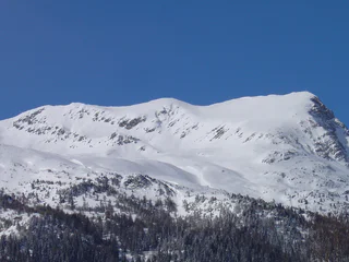
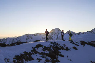
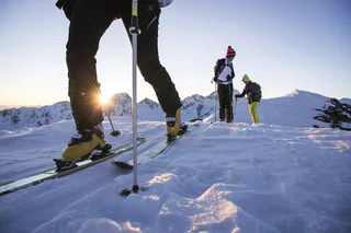
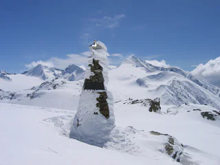
1/3
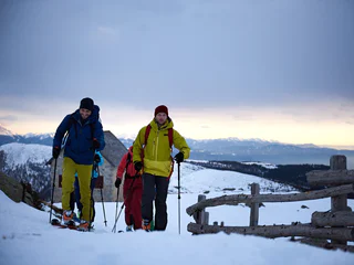
Ski tour to Kuhleiten mountain hut on Meran 2000
Falzeben/Falzeben, Hafling/Avelengo, Meran/Merano and environs
difficult
Obtížnost
752 m
Převýšení
2h:34 min
doba trvání
Stoupejte zasněženými sjezdovkami nebo po sjezdovkách, pak vás láká sjezd prašanem a firnem: Na lyžařské túře v Ortler Skiaren si můžete vychutnat jedinečné zážitky z přírody se sportovními zážitky.
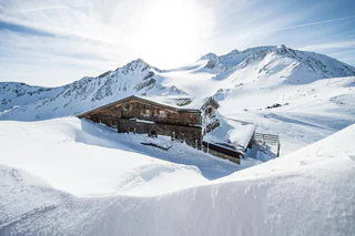
1/3
Falzeben/Falzeben, Hafling/Avelengo, Meran/Merano and environs
difficult
Obtížnost
752 m
Převýšení
2h:34 min
doba trvání

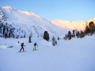
Tablà/Tabland - Parcines/Partschins, Moos in Passeier/Moso in Passiria, Meran/Merano and environs
difficult
Obtížnost
1600 m
Převýšení
5h:00 min
doba trvání
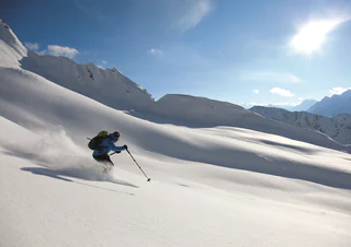
Stulles/Stuls, Moos in Passeier/Moso in Passiria, Meran/Merano and environs
medium
Obtížnost
1152 m
Převýšení
3h:30 min
doba trvání
S. Giacomo/St. Jakob - Val di Vizze/Pfitsch, Pfitsch/Val di Vizze, Sterzing/Vipiteno and environs
difficult
Obtížnost
1408 m
Převýšení
4h:46 min
doba trvání
1/2
Santa Gertrude/St. Gertraud, Ulten/Ultimo, Meran/Merano and environs
medium
Obtížnost
1524 m
Převýšení
5h:49 min
doba trvání
1/4
S. Giacomo/St. Jakob - Val di Vizze/Pfitsch, Pfitsch/Val di Vizze, Sterzing/Vipiteno and environs
medium
Obtížnost
1266 m
Převýšení
3h:58 min
doba trvání
Vipiteno/Sterzing, Sterzing/Vipiteno, Sterzing/Vipiteno and environs
difficult
Obtížnost
980 m
Převýšení
3h:30 min
doba trvání
Resia/Reschen, Graun im Vinschgau/Curon Venosta, Vinschgau/Val Venosta
medium
Obtížnost
964 m
Převýšení
3h:21 min
doba trvání
1/5
Plata/Platt, Moos in Passeier/Moso in Passiria, Meran/Merano and environs
medium
Obtížnost
1073 m
Převýšení
4h:00 min
doba trvání
Plan/Pfelders, Riffian/Rifiano, Meran/Merano and environs
difficult
Obtížnost
1661 m
Převýšení
4h:00 min
doba trvání
1/2
Resia/Reschen, Graun im Vinschgau/Curon Venosta, Vinschgau/Val Venosta
medium
Obtížnost
0 m
Převýšení
4h:00 min
doba trvání
Ponticolo/Pontigl, Brenner/Brennero, Sterzing/Vipiteno and environs
medium
Obtížnost
1244 m
Převýšení
4h:13 min
doba trvání
1/2
Maso Corto/Kurzras, Schnals/Senales, Vinschgau/Val Venosta
medium
Obtížnost
634 m
Převýšení
3h:16 min
doba trvání
1/3
Maso Corto/Kurzras, Schnals/Senales, Vinschgau/Val Venosta
difficult
Obtížnost
1517 m
Převýšení
5h:24 min
doba trvání
1/3
Plan/Pfelders, Moos in Passeier/Moso in Passiria, Meran/Merano and environs
easy
Obtížnost
664 m
Převýšení
2h:30 min
doba trvání
1/3
Certosa/Karthaus, Schnals/Senales, Vinschgau/Val Venosta
medium
Obtížnost
1600 m
Převýšení
5h:52 min
doba trvání
Stelvio/Stilfs, Stilfs/Stelvio, Vinschgau/Val Venosta
medium
Obtížnost
1119 m
Převýšení
3h:49 min
doba trvání
S.Valentino /St. Valentin, Graun im Vinschgau/Curon Venosta, Vinschgau/Val Venosta
medium
Obtížnost
1141 m
Převýšení
4h:25 min
doba trvání
Plata/Platt, Moos in Passeier/Moso in Passiria, Meran/Merano and environs
medium
Obtížnost
856 m
Převýšení
3h:00 min
doba trvání
Stulles/Stuls, Moos in Passeier/Moso in Passiria, Meran/Merano and environs
difficult
Obtížnost
1294 m
Převýšení
3h:30 min
doba trvání
1/4
Maso Corto/Kurzras, Schnals/Senales, Vinschgau/Val Venosta
medium
Obtížnost
1099 m
Převýšení
3h:46 min
doba trvání
S.Martino/Reinswald, Sarntal/Sarentino, Bolzano/Bozen and environs
medium
Obtížnost
890 m
Převýšení
2h:46 min
doba trvání
1/3
Casateia/Gasteig, Freienfeld/Campo di Trens, Sterzing/Vipiteno and environs
medium
Obtížnost
1373 m
Převýšení
4h:10 min
doba trvání
1/3
Certosa/Karthaus, Schnals/Senales, Vinschgau/Val Venosta
difficult
Obtížnost
1677 m
Převýšení
6h:45 min
doba trvání
1/4
Maso Corto/Kurzras, Schnals/Senales, Vinschgau/Val Venosta
medium
Obtížnost
843 m
Převýšení
5h:20 min
doba trvání
1/2
Resia/Reschen, Graun im Vinschgau/Curon Venosta, Vinschgau/Val Venosta
medium
Obtížnost
0 m
Převýšení
3h:00 min
doba trvání
S.Valentino /St. Valentin, Graun im Vinschgau/Curon Venosta, Vinschgau/Val Venosta
medium
Obtížnost
1013 m
Převýšení
3h:07 min
doba trvání

1/4
Plan/Pfelders, Moos in Passeier/Moso in Passiria, Meran/Merano and environs
difficult
Obtížnost
1307 m
Převýšení
3h:30 min
doba trvání
San Leonardo i.P./St. Leonhard i.P., St.Leonhard in Passeier/San Leonardo in Passiria, Meran/Merano and environs
difficult
Obtížnost
1898 m
Převýšení
4h:30 min
doba trvání
1/2
S. Giacomo/St. Jakob - Val di Vizze/Pfitsch, Pfitsch/Val di Vizze, Sterzing/Vipiteno and environs
difficult
Obtížnost
1649 m
Převýšení
5h:00 min
doba trvání


