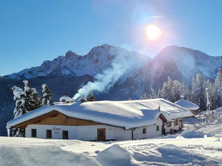
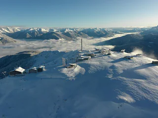
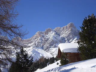
1/2
Winter Hike - Hut path
Valdaora di Sopra/Oberolang, Olang/Valdaora, Dolomites Region Kronplatz/Plan de Corones
easy
Obtížnost
291 m
Převýšení
1h:07 min
doba trvání
| Kronplatz je rájem pro milovníky zimní turistiky. Užijte si procházky zasněženou krajinou. |
1/2
Valdaora di Sopra/Oberolang, Olang/Valdaora, Dolomites Region Kronplatz/Plan de Corones
easy
Obtížnost
291 m
Převýšení
1h:07 min
doba trvání
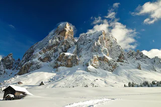
1/5
Longiarù/Campill, San Martin /San Martino, Dolomites Region Kronplatz/Plan de Corones
medium
Obtížnost
284 m
Převýšení
1h:40 min
doba trvání
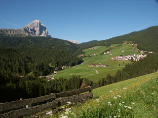
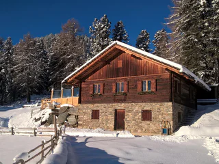
1/2
Longiarù/Campill, San Martin /San Martino, Dolomites Region Kronplatz/Plan de Corones
easy
Obtížnost
157 m
Převýšení
1h:00 min
doba trvání

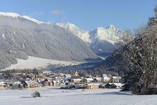
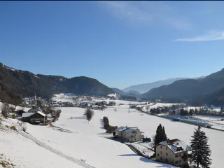
Nove Case/Neunhäusern, Rasen-Antholz/Rasun Anterselva, Dolomites Region Kronplatz/Plan de Corones
medium
Obtížnost
166 m
Převýšení
1h:00 min
doba trvání
San Vigilio, Al Plan/San Vigilio, Dolomites Region Kronplatz/Plan de Corones
easy
Obtížnost
96 m
Převýšení
0h:55 min
doba trvání
San Vigilio, Al Plan/San Vigilio, Dolomites Region Kronplatz/Plan de Corones
easy
Obtížnost
248 m
Převýšení
0h:54 min
doba trvání
Anterselva di Sopra/Antholz-Obertal, Rasen-Antholz/Rasun Anterselva, Dolomites Region Kronplatz/Plan de Corones
easy
Obtížnost
4 m
Převýšení
0h:30 min
doba trvání
1/2
Valdaora di Mezzo/Mitterolang, Olang/Valdaora, Dolomites Region Kronplatz/Plan de Corones
easy
Obtížnost
5 m
Převýšení
0h:25 min
doba trvání
Nove Case/Neunhäusern, Rasen-Antholz/Rasun Anterselva, Dolomites Region Kronplatz/Plan de Corones
easy
Obtížnost
42 m
Převýšení
2h:19 min
doba trvání
Rasun di Sopra/Oberrasen, Rasen-Antholz/Rasun Anterselva, Dolomites Region Kronplatz/Plan de Corones
easy
Obtížnost
173 m
Převýšení
1h:18 min
doba trvání
San Vigilio, Al Plan/San Vigilio, Dolomites Region Kronplatz/Plan de Corones
medium
Obtížnost
540 m
Převýšení
2h:01 min
doba trvání
1/2
San Vigilio, Al Plan/San Vigilio, Dolomites Region Kronplatz/Plan de Corones
easy
Obtížnost
1109 m
Převýšení
3h:28 min
doba trvání
Anterselva di Sopra/Antholz-Obertal, Rasen-Antholz/Rasun Anterselva, Dolomites Region Kronplatz/Plan de Corones
easy
Obtížnost
263 m
Převýšení
1h:19 min
doba trvání
Valdaora di Sopra/Oberolang, Olang/Valdaora, Dolomites Region Kronplatz/Plan de Corones
easy
Obtížnost
24 m
Převýšení
0h:16 min
doba trvání
Valdaora di Sopra/Oberolang, Olang/Valdaora, Dolomites Region Kronplatz/Plan de Corones
easy
Obtížnost
25 m
Převýšení
0h:15 min
doba trvání
Valdaora di Mezzo/Mitterolang, Olang/Valdaora, Dolomites Region Kronplatz/Plan de Corones
medium
Obtížnost
506 m
Převýšení
1h:49 min
doba trvání
Anterselva di Sotto/Antholz-Niedertal, Rasen-Antholz/Rasun Anterselva, Dolomites Region Kronplatz/Plan de Corones
easy
Obtížnost
30 m
Převýšení
1h:00 min
doba trvání
Onies/Onach, St.Lorenzen/San Lorenzo di Sebato, Dolomites Region Kronplatz/Plan de Corones
easy
Obtížnost
30 m
Převýšení
1h:30 min
doba trvání
Plata/Platten - Falzes/Pfalzen, Pfalzen/Falzes, Dolomites Region Kronplatz/Plan de Corones
easy
Obtížnost
126 m
Převýšení
2h:00 min
doba trvání
Anterselva di Sopra/Antholz-Obertal, Rasen-Antholz/Rasun Anterselva, Dolomites Region Kronplatz/Plan de Corones
medium
Obtížnost
360 m
Převýšení
1h:45 min
doba trvání
Valdaora di Sopra/Oberolang, Olang/Valdaora, Dolomites Region Kronplatz/Plan de Corones
easy
Obtížnost
14 m
Převýšení
0h:40 min
doba trvání
Nove Case/Neunhäusern, Rasen-Antholz/Rasun Anterselva, Dolomites Region Kronplatz/Plan de Corones
easy
Obtížnost
26 m
Převýšení
0h:45 min
doba trvání
Rasun di Sopra/Oberrasen, Rasen-Antholz/Rasun Anterselva, Dolomites Region Kronplatz/Plan de Corones
easy
Obtížnost
147 m
Převýšení
1h:22 min
doba trvání
1/2
Longiarù/Campill, Al Plan/San Vigilio, Dolomites Region Kronplatz/Plan de Corones
medium
Obtížnost
449 m
Převýšení
1h:26 min
doba trvání
Nove Case/Neunhäusern, Rasen-Antholz/Rasun Anterselva, Dolomites Region Kronplatz/Plan de Corones
easy
Obtížnost
81 m
Převýšení
1h:00 min
doba trvání
1/3
Chienes/Kiens, Kiens/Chienes, Dolomites Region Kronplatz/Plan de Corones
medium
Obtížnost
418 m
Převýšení
2h:43 min
doba trvání
1/6
Chienes/Kiens, Kiens/Chienes, Dolomites Region Kronplatz/Plan de Corones
easy
Obtížnost
50 m
Převýšení
1h:30 min
doba trvání
1/4
San Vigilio, San Martin /San Martino, Dolomites Region Kronplatz/Plan de Corones
medium
Obtížnost
769 m
Převýšení
2h:43 min
doba trvání
1/2
Riscone/Reischach, St.Lorenzen/San Lorenzo di Sebato, Dolomites Region Kronplatz/Plan de Corones
easy
Obtížnost
343 m
Převýšení
1h:00 min
doba trvání
Valdaora di Mezzo/Mitterolang, Olang/Valdaora, Dolomites Region Kronplatz/Plan de Corones
medium
Obtížnost
262 m
Převýšení
1h:16 min
doba trvání


