1/5
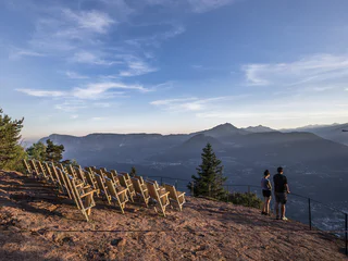
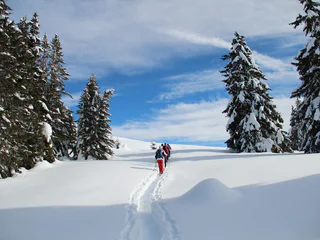
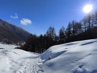
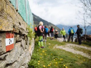
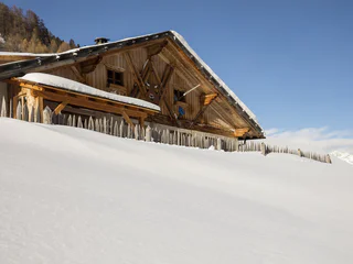
Knottnkino - Hike starting from Hafling
Avelengo Paese/Hafling Dorf, Hafling/Avelengo, Meran/Merano and environs
medium
Poziom trudności
477 m
Wzlot
3h:25 min
czas trwania
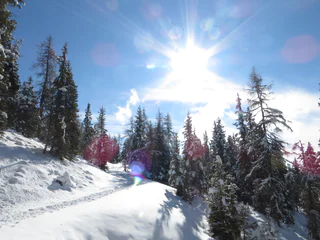
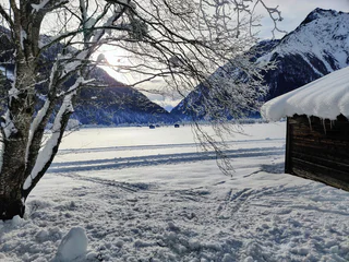
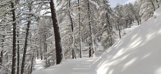
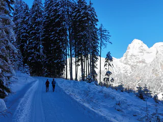
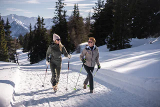
Odkryj spektakularne punkty widokowe w regionie Ortler lub Dolomitach, ośnieżone lasy w cichych bocznych dolinach na głównym grzbiecie Alp i ciesz się sobą i przyrodą w absolutnej ciszy. To sprawia, że zimowe wędrówki stają się przeżyciem.
1/5
Avelengo Paese/Hafling Dorf, Hafling/Avelengo, Meran/Merano and environs
medium
Poziom trudności
477 m
Wzlot
3h:25 min
czas trwania

Christl/Cresta, Moos in Passeier/Moso in Passiria, Meran/Merano and environs
easy
Poziom trudności
91 m
Wzlot
0h:39 min
czas trwania

1/4
Avelengo Paese/Hafling Dorf, Hafling/Avelengo, Meran/Merano and environs
easy
Poziom trudności
79 m
Wzlot
0h:49 min
czas trwania
Novale/Ried - San Martino i.P./St. Martin i.P., St.Martin in Passeier/San Martino in Passiria, Meran/Merano and environs
easy
Poziom trudności
262 m
Wzlot
1h:38 min
czas trwania
1/3
Avelengo Paese/Hafling Dorf, Hafling/Avelengo, Meran/Merano and environs
medium
Poziom trudności
546 m
Wzlot
3h:37 min
czas trwania
1/5
Avenes/Afens, Pfitsch/Val di Vizze, Sterzing/Vipiteno and environs
easy
Poziom trudności
12 m
Wzlot
0h:55 min
czas trwania
Prati/Auen, Sarntal/Sarentino, Bolzano/Bozen and environs
medium
Poziom trudności
446 m
Wzlot
2h:30 min
czas trwania
1/2
Mazia/Matsch, Mals/Malles, Vinschgau/Val Venosta
medium
Poziom trudności
365 m
Wzlot
2h:04 min
czas trwania
Solda/Sulden, Stilfs/Stelvio, Vinschgau/Val Venosta
easy
Poziom trudności
172 m
Wzlot
2h:04 min
czas trwania
1/4
Avelengo Paese/Hafling Dorf, Hafling/Avelengo, Meran/Merano and environs
medium
Poziom trudności
643 m
Wzlot
4h:34 min
czas trwania
1/3
Novale/Ried - San Martino i.P./St. Martin i.P., St.Martin in Passeier/San Martino in Passiria, Meran/Merano and environs
medium
Poziom trudności
303 m
Wzlot
2h:47 min
czas trwania
Montechiaro/Lichtenberg, Prad am Stilfser Joch/Prato allo Stelvio, Vinschgau/Val Venosta
medium
Poziom trudności
627 m
Wzlot
3h:45 min
czas trwania
1/3
Falzeben/Falzeben, Hafling/Avelengo, Meran/Merano and environs
easy
Poziom trudności
145 m
Wzlot
0h:52 min
czas trwania
San Leonardo i.P./St. Leonhard i.P., St.Leonhard in Passeier/San Leonardo in Passiria, Meran/Merano and environs
medium
Poziom trudności
183 m
Wzlot
1h:31 min
czas trwania
1/6
Magdfeld/Magdfeld, Riffian/Rifiano, Meran/Merano and environs
easy
Poziom trudności
69 m
Wzlot
1h:15 min
czas trwania
1/2
Slingia/Schlinig, Mals/Malles, Vinschgau/Val Venosta
easy
Poziom trudności
414 m
Wzlot
1h:28 min
czas trwania
Moncucco/Giggelberg, Brenner/Brennero, Sterzing/Vipiteno and environs
easy
Poziom trudności
123 m
Wzlot
2h:00 min
czas trwania
Prati/Auen, Sarntal/Sarentino, Bolzano/Bozen and environs
medium
Poziom trudności
570 m
Wzlot
5h:37 min
czas trwania
Stelvio/Stilfs, Stilfs/Stelvio, Vinschgau/Val Venosta
medium
Poziom trudności
401 m
Wzlot
2h:10 min
czas trwania
S.Valentino /St. Valentin, Graun im Vinschgau/Curon Venosta, Vinschgau/Val Venosta
easy
Poziom trudności
516 m
Wzlot
3h:12 min
czas trwania
1/3
Plata/Platt, Moos in Passeier/Moso in Passiria, Meran/Merano and environs
medium
Poziom trudności
622 m
Wzlot
3h:04 min
czas trwania
Avenes/Afens, Pfitsch/Val di Vizze, Sterzing/Vipiteno and environs
easy
Poziom trudności
481 m
Wzlot
1h:25 min
czas trwania
Sulden/Solda, Stilfs/Stelvio, Vinschgau/Val Venosta
easy
Poziom trudności
426 m
Wzlot
2h:00 min
czas trwania
1/5
Verano/Vöran, Vöran/Verano, Meran/Merano and environs
easy
Poziom trudności
250 m
Wzlot
1h:49 min
czas trwania
1/6
Avelengo Paese/Hafling Dorf, Hafling/Avelengo, Meran/Merano and environs
easy
Poziom trudności
64 m
Wzlot
0h:40 min
czas trwania
1/3
Novale/Ried - San Martino i.P./St. Martin i.P., St.Martin in Passeier/San Martino in Passiria, Meran/Merano and environs
medium
Poziom trudności
516 m
Wzlot
1h:45 min
czas trwania
1/4
Fleres/Pflersch, Brenner/Brennero, Sterzing/Vipiteno and environs
easy
Poziom trudności
218 m
Wzlot
1h:30 min
czas trwania
1/5
Hafling Oberdorf/Avelengo di sopra, Hafling/Avelengo, Meran/Merano and environs
easy
Poziom trudności
85 m
Wzlot
0h:45 min
czas trwania
1/2
Vipiteno/Sterzing, Sterzing/Vipiteno, Sterzing/Vipiteno and environs
easy
Poziom trudności
160 m
Wzlot
2h:00 min
czas trwania
1/2
Burgusio/Burgeis, Graun im Vinschgau/Curon Venosta, Vinschgau/Val Venosta
medium
Poziom trudności
504 m
Wzlot
2h:47 min
czas trwania
Dziękujemy za zapisanie się!
Rejestracja już aktywna
Potwierdź rejestrację
Aby zakończyć rejestrację, otwórz e-mail, który właśnie wysłaliśmy, i kliknij link potwierdzający.
Nie widzisz wiadomości? Sprawdź folder spam.
Otrzymujesz już nasze wyjątkowe oferty, przydatne wskazówki i specjalne propozycje, aby w pełni cieszyć się wakacjami.
Już próbowałeś zapisać się do naszego newslettera, ale nie potwierdziłeś rejestracji. Właśnie wysłaliśmy ci ponownie e‑mail. Sprawdź swoją skrzynkę odbiorczą i folder ze spamem i potwierdź teraz.


