1/4
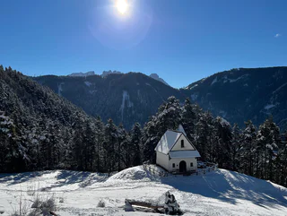
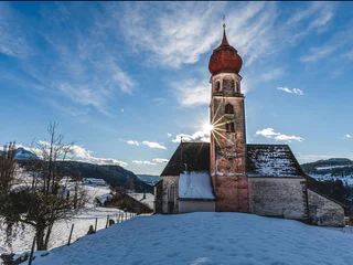
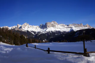
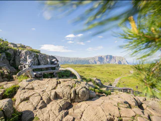
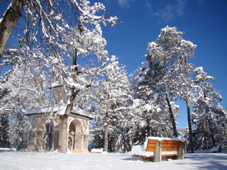
Winter hike to the Wuhnleger and to the St. Sebastian chapel
Tires/Tiers, Tiers am Rosengarten/Tires al Catinaccio, Dolomites Region Seiser Alm
medium
Difficulty
448 m
Elevation gain
2h:30 min
duration
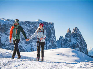
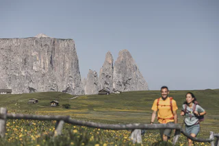
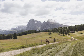
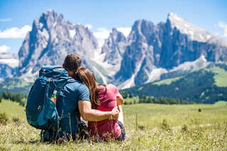
Walking is the best way to enjoy wonderful stretches of greenery. During your spring in South Tyrol, you can witness the awakening of nature in the valley and on the alpine meadows in bloom. Midsummer days are equally surprising: people are lured to mountain peaks, marvel at sweeping views and indulge in the traditional dishes served in quaint mountain huts. Go on a hike to watch the spectacle of autumn’s glorious colours and relax in nature.
1/4
Tires/Tiers, Tiers am Rosengarten/Tires al Catinaccio, Dolomites Region Seiser Alm
medium
Difficulty
448 m
Elevation gain
2h:30 min
duration

1/3
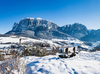
Alpe di Siusi/Seiseralm, Kastelruth/Castelrotto, Dolomites Region Seiser Alm
medium
Difficulty
1066 m
Elevation gain
6h:16 min
duration
1/4
Siusi/Seis, Kastelruth/Castelrotto, Dolomites Region Seiser Alm
medium
Difficulty
77 m
Elevation gain
1h:49 min
duration
1/2
Collepietra/Steinegg, Tiers am Rosengarten/Tires al Catinaccio, Dolomites Region Seiser Alm
medium
Difficulty
1138 m
Elevation gain
5h:31 min
duration
1/3
Tires/Tiers, Tiers am Rosengarten/Tires al Catinaccio, Dolomites Region Seiser Alm
medium
Difficulty
564 m
Elevation gain
3h:45 min
duration
1/6
Siusi/Seis, Kastelruth/Castelrotto, Dolomites Region Seiser Alm
medium
Difficulty
312 m
Elevation gain
2h:55 min
duration

Alpe di Siusi/Seiseralm, Kastelruth/Castelrotto, Dolomites Region Seiser Alm
easy
Difficulty
85 m
Elevation gain
2h:00 min
duration
1/2
Alpe di Siusi/Seiseralm, Kastelruth/Castelrotto, Dolomites Region Seiser Alm
medium
Difficulty
415 m
Elevation gain
2h:28 min
duration
1/5
Siusi/Seis, Kastelruth/Castelrotto, Dolomites Region Seiser Alm
medium
Difficulty
308 m
Elevation gain
1h:48 min
duration
1/4
Castelrotto/Kastelruth, Kastelruth/Castelrotto, Dolomites Region Seiser Alm
medium
Difficulty
289 m
Elevation gain
2h:19 min
duration

1/3
Fiè/Völs, Völs am Schlern/Fiè allo Sciliar, Dolomites Region Seiser Alm
medium
Difficulty
247 m
Elevation gain
2h:04 min
duration
Fiè/Völs, Völs am Schlern/Fiè allo Sciliar, Dolomites Region Seiser Alm
easy
Difficulty
41 m
Elevation gain
0h:16 min
duration
1/2
Alpe di Siusi/Seiseralm, Kastelruth/Castelrotto, Dolomites Region Seiser Alm
medium
Difficulty
431 m
Elevation gain
2h:47 min
duration

1/3
Tires/Tiers, Tiers am Rosengarten/Tires al Catinaccio, Dolomites Region Seiser Alm
easy
Difficulty
348 m
Elevation gain
2h:02 min
duration
1/5
Ortisei/Urtijëi/St. Ulrich/Urtijëi, Kastelruth/Castelrotto, Dolomites Region Seiser Alm
medium
Difficulty
330 m
Elevation gain
1h:30 min
duration
1/2
Alpe di Siusi/Seiseralm, Kastelruth/Castelrotto, Dolomites Region Seiser Alm
medium
Difficulty
138 m
Elevation gain
1h:53 min
duration
1/3
Tires/Tiers, Tiers am Rosengarten/Tires al Catinaccio, Dolomites Region Seiser Alm
medium
Difficulty
321 m
Elevation gain
2h:04 min
duration
1/3
Alpe di Siusi/Seiseralm, Kastelruth/Castelrotto, Dolomites Region Seiser Alm
easy
Difficulty
118 m
Elevation gain
1h:00 min
duration
1/3
Carezza/Karersee, Tiers am Rosengarten/Tires al Catinaccio, Dolomites Region Seiser Alm
difficult
Difficulty
1792 m
Elevation gain
6h:25 min
duration
1/2
Nova Levante/Welschnofen, Tiers am Rosengarten/Tires al Catinaccio, Dolomites Region Seiser Alm
easy
Difficulty
242 m
Elevation gain
1h:16 min
duration
Tires/Tiers, Tiers am Rosengarten/Tires al Catinaccio, Dolomites Region Seiser Alm
difficult
Difficulty
0 m
Elevation gain
7h:00 min
duration
1/2
S.Cristina Gherdëina/S.Cristina Val Gardena/S.Cristina Gherdëina/St.Christina in Gröden, Kastelruth/Castelrotto, Dolomites Region Seiser Alm
difficult
Difficulty
648 m
Elevation gain
4h:00 min
duration
Castelrotto/Kastelruth, Kastelruth/Castelrotto, Dolomites Region Seiser Alm
easy
Difficulty
528 m
Elevation gain
3h:28 min
duration
1/6
Alpe di Siusi/Seiseralm, Kastelruth/Castelrotto, Dolomites Region Seiser Alm
medium
Difficulty
413 m
Elevation gain
2h:36 min
duration
1/2
Siusi/Seis, Kastelruth/Castelrotto, Dolomites Region Seiser Alm
easy
Difficulty
164 m
Elevation gain
1h:01 min
duration
Corvara/Corvara, Tiers am Rosengarten/Tires al Catinaccio, Dolomites Region Seiser Alm
difficult
Difficulty
11447 m
Elevation gain
1575h:00 min
duration
Kastelruth/Castelrotto, Dolomites Region Seiser Alm
medium
Difficulty
206 m
Elevation gain
0h:45 min
duration
1/5
Fiè/Völs, Kastelruth/Castelrotto, Dolomites Region Seiser Alm
medium
Difficulty
5 m
Elevation gain
1h:46 min
duration
1/4
Fiè/Völs, Völs am Schlern/Fiè allo Sciliar, Dolomites Region Seiser Alm
easy
Difficulty
130 m
Elevation gain
1h:10 min
duration
1/2
Castelrotto/Kastelruth, Kastelruth/Castelrotto, Dolomites Region Seiser Alm
easy
Difficulty
41 m
Elevation gain
0h:40 min
duration
Thank you for signing up!
You are already subscribed
Confirm your registration
To complete your subscription, open the email we just sent you and click on the confirmation link.
Can’t find it? Check your spam folder too.
We noticed that you are already subscribed to our Newsletter. We will update you on exclusive offers, fun adventures and more so you can make the best out of your vacation.
We noticed that you already tried to subscribe to our Newsletter in the past but didn’t confirmed the subscription. We have resent you an email now, please check your inbox and spam folder to confirm.


