
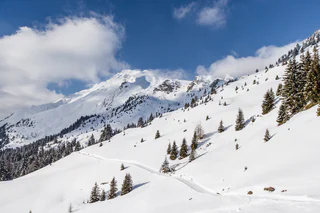
Winter hike from Bichl to the mountain station of Ratschings-Jaufen
Valgiovo/Jaufental, Ratschings/Racines, Sterzing/Vipiteno and environs
medium
Obtížnost
569 m
Převýšení
2h:31 min
doba trvání
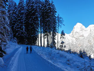
| Sterzing a okolí je rájem pro milovníky zimní turistiky. Užijte si procházky zasněženou krajinou. |
Valgiovo/Jaufental, Ratschings/Racines, Sterzing/Vipiteno and environs
medium
Obtížnost
569 m
Převýšení
2h:31 min
doba trvání
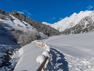
Ponticolo/Pontigl, Brenner/Brennero, Sterzing/Vipiteno and environs
medium
Obtížnost
529 m
Převýšení
1h:49 min
doba trvání
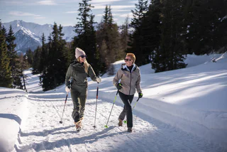
Jaufental/Valgiovo, Ratschings/Racines, Sterzing/Vipiteno and environs
medium
Obtížnost
211 m
Převýšení
1h:23 min
doba trvání
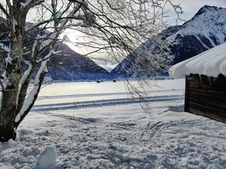
Ridnaun/Ridanna, Ratschings/Racines, Sterzing/Vipiteno and environs
easy
Obtížnost
203 m
Převýšení
1h:28 min
doba trvání
Jaufental/Valgiovo, Ratschings/Racines, Sterzing/Vipiteno and environs
easy
Obtížnost
55 m
Převýšení
1h:06 min
doba trvání
Ridanna/Ridnaun, Ratschings/Racines, Sterzing/Vipiteno and environs
medium
Obtížnost
494 m
Převýšení
2h:22 min
doba trvání
Avenes/Afens, Pfitsch/Val di Vizze, Sterzing/Vipiteno and environs
easy
Obtížnost
481 m
Převýšení
1h:25 min
doba trvání
1/3
Vipiteno/Sterzing, Sterzing/Vipiteno, Sterzing/Vipiteno and environs
easy
Obtížnost
176 m
Převýšení
1h:10 min
doba trvání
Ridnaun/Ridanna, Ratschings/Racines, Sterzing/Vipiteno and environs
easy
Obtížnost
62 m
Převýšení
0h:28 min
doba trvání
1/2
Colle Isarco/Gossensaß, Brenner/Brennero, Sterzing/Vipiteno and environs
easy
Obtížnost
135 m
Převýšení
2h:30 min
doba trvání
1/3
Vipiteno/Sterzing, Sterzing/Vipiteno, Sterzing/Vipiteno and environs
easy
Obtížnost
160 m
Převýšení
2h:00 min
doba trvání
Moncucco/Giggelberg, Brenner/Brennero, Sterzing/Vipiteno and environs
easy
Obtížnost
123 m
Převýšení
2h:00 min
doba trvání
Ridanna/Ridnaun, Ratschings/Racines, Sterzing/Vipiteno and environs
medium
Obtížnost
404 m
Převýšení
2h:43 min
doba trvání
1/5
Avenes/Afens, Pfitsch/Val di Vizze, Sterzing/Vipiteno and environs
easy
Obtížnost
12 m
Převýšení
0h:55 min
doba trvání
Stange/Stanghe, Ratschings/Racines, Sterzing/Vipiteno and environs
medium
Obtížnost
290 m
Převýšení
2h:10 min
doba trvání
Colle Isarco/Gossensaß, Brenner/Brennero, Sterzing/Vipiteno and environs
medium
Obtížnost
586 m
Převýšení
2h:22 min
doba trvání
Gasteig/Casateia, Ratschings/Racines, Sterzing/Vipiteno and environs
easy
Obtížnost
104 m
Převýšení
2h:37 min
doba trvání
1/2
Telves/Telfes, Ratschings/Racines, Sterzing/Vipiteno and environs
medium
Obtížnost
471 m
Převýšení
2h:16 min
doba trvání
Fleres/Pflersch, Brenner/Brennero, Sterzing/Vipiteno and environs
easy
Obtížnost
279 m
Převýšení
1h:10 min
doba trvání
1/4
Fleres/Pflersch, Brenner/Brennero, Sterzing/Vipiteno and environs
easy
Obtížnost
218 m
Převýšení
1h:30 min
doba trvání
Ridanna/Ridnaun, Ratschings/Racines, Sterzing/Vipiteno and environs
easy
Obtížnost
208 m
Převýšení
1h:16 min
doba trvání


