
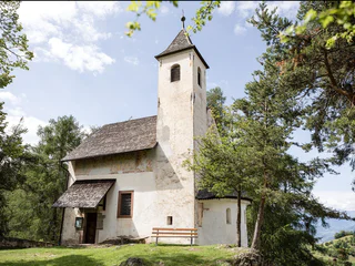
Gereuther Höfeweg farm trail
Monteponente/Pfeffersberg, Brixen/Bressanone, Brixen/Bressanone and environs
easy
Poziom trudności
280 m
Wzlot
2h:00 min
czas trwania
Przejrzyj oferty specjalnych wędrówek tematycznych, wysokogórskich, dalekobieżnych itp. w Południowym Tyrolu.
Monteponente/Pfeffersberg, Brixen/Bressanone, Brixen/Bressanone and environs
easy
Poziom trudności
280 m
Wzlot
2h:00 min
czas trwania
Piavenna/Plawenn, Graun im Vinschgau/Curon Venosta, Vinschgau/Val Venosta
medium
Poziom trudności
1010 m
Wzlot
5h:42 min
czas trwania
1/3
Lazfons/Latzfons, Klausen/Chiusa, Brixen/Bressanone and environs
medium
Poziom trudności
539 m
Wzlot
3h:15 min
czas trwania
San Vigilio, Badia, Dolomites Region Alta Badia
difficult
Poziom trudności
3174 m
Wzlot
17h:28 min
czas trwania
Bressanone città/Brixen Stadt, Brixen/Bressanone, Brixen/Bressanone and environs
easy
Poziom trudności
286 m
Wzlot
1h:37 min
czas trwania
medium
Poziom trudności
339 m
Wzlot
6h:30 min
czas trwania
San Leonardo i.P./St. Leonhard i.P., St.Leonhard in Passeier/San Leonardo in Passiria, Meran/Merano and environs
medium
Poziom trudności
183 m
Wzlot
1h:31 min
czas trwania
1/4
Caines/Kuens, Tirol/Tirolo, Meran/Merano and environs
easy
Poziom trudności
73 m
Wzlot
1h:10 min
czas trwania
S. Pietro/St. Peter - Valle Aurina/Ahrntal, Sand in Taufers/Campo Tures, Ahrntal/Valle Aurina
medium
Poziom trudności
916 m
Wzlot
3h:22 min
czas trwania
1/11
Parcines/Partschins, Partschins/Parcines, Meran/Merano and environs
easy
Poziom trudności
118 m
Wzlot
0h:58 min
czas trwania
1/4
Certosa/Karthaus, Moos in Passeier/Moso in Passiria, Meran/Merano and environs
medium
Poziom trudności
1232 m
Wzlot
4h:30 min
czas trwania
Merano/Meran, Meran/Merano, Meran/Merano and environs
easy
Poziom trudności
109 m
Wzlot
0h:55 min
czas trwania
1/4
Radein/Redagno, Aldein/Aldino
difficult
Poziom trudności
3700 m
Wzlot
23h:04 min
czas trwania
1/2
Maso Corto/Kurzras, Mals/Malles, Vinschgau/Val Venosta
difficult
Poziom trudności
1109 m
Wzlot
5h:00 min
czas trwania
1/17
Wolkenstein/Sëlva/Selva/Sëlva, S.Crestina Gherdëina/Santa Cristina Val Gardana, Dolomites Region Val Gardena
easy
Poziom trudności
37 m
Wzlot
1h:19 min
czas trwania
1/3
Ponte Gardena/Waidbruck, Waidbruck/Ponte Gardena, Brixen/Bressanone and environs
medium
Poziom trudności
458 m
Wzlot
3h:17 min
czas trwania
1/2
Prissiano/Prissian, Tisens/Tesimo, Meran/Merano and environs
medium
Poziom trudności
377 m
Wzlot
2h:22 min
czas trwania
1/3
Tirolo/Tirol, Tirol/Tirolo, Meran/Merano and environs
easy
Poziom trudności
100 m
Wzlot
0h:49 min
czas trwania
1/2
San Vigilio, Prags/Braies, Dolomites Region 3 Zinnen
medium
Poziom trudności
1305 m
Wzlot
6h:22 min
czas trwania
1/6
Solda/Sulden, Stilfs/Stelvio, Vinschgau/Val Venosta
easy
Poziom trudności
358 m
Wzlot
2h:13 min
czas trwania
Varna/Vahrn, Vahrn/Varna, Brixen/Bressanone and environs
easy
Poziom trudności
172 m
Wzlot
0h:58 min
czas trwania
1/4
Riobianco/Weissenbach - Valle Aurina/Ahrntal, Ahrntal/Valle Aurina, Ahrntal/Valle Aurina
medium
Poziom trudności
504 m
Wzlot
4h:00 min
czas trwania
1/4
Taisten/Tesido, Welsberg-Taisten/Monguelfo-Tesido
easy
Poziom trudności
202 m
Wzlot
1h:55 min
czas trwania
1/3
Anterselva di Mezzo/Antholz-Mittertal, Rasen-Antholz/Rasun Anterselva, Dolomites Region Kronplatz/Plan de Corones
medium
Poziom trudności
716 m
Wzlot
2h:13 min
czas trwania
Ciardes/Tschars, Kastelbell-Tschars/Castelbello-Ciardes, Vinschgau/Val Venosta
medium
Poziom trudności
420 m
Wzlot
2h:00 min
czas trwania
1/3
Maranza/Meransen, Mühlbach/Rio di Pusteria, Brixen/Bressanone and environs
easy
Poziom trudności
253 m
Wzlot
1h:40 min
czas trwania
1/5
S. Giacomo/St. Jakob - Val di Vizze/Pfitsch, Pfitsch/Val di Vizze, Sterzing/Vipiteno and environs
easy
Poziom trudności
38 m
Wzlot
0h:25 min
czas trwania
Tubre/Taufers i. M., Mals/Malles, Vinschgau/Val Venosta
difficult
Poziom trudności
918 m
Wzlot
6h:00 min
czas trwania
1/3
Velloi/Vellau, Algund/Lagundo, Meran/Merano and environs
easy
Poziom trudności
423 m
Wzlot
3h:00 min
czas trwania
1/3
Monte S. Caterina/Katharinaberg, Schnals/Senales, Vinschgau/Val Venosta
medium
Poziom trudności
868 m
Wzlot
5h:16 min
czas trwania
Dziękujemy za zapisanie się!
Subskrypcja jest już aktywna
Potwierdź rejestrację
Aby zakończyć rejestrację, otwórz e-mail, który właśnie wysłaliśmy, i kliknij link potwierdzający.
Nie widzisz wiadomości? Sprawdź folder spam.
Zauważyliśmy, że próbowałeś(-aś) zapisać się do newslettera, ale Twój adres e-mail jest już zarejestrowany. Nadal będziesz otrzymywać nasze oferty, wskazówki i inspiracje na Twój urlop.
Już próbowałeś zapisać się do naszego newslettera, ale nie potwierdziłeś rejestracji. Właśnie wysłaliśmy ci ponownie e‑mail. Sprawdź swoją skrzynkę odbiorczą i folder ze spamem i potwierdź teraz.


