1/3
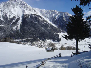
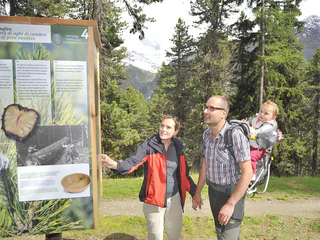
rumbling tour: Resia - Vallierteck - Froj
Resia/Reschen, Graun im Vinschgau/Curon Venosta, Vinschgau/Val Venosta
easy
Poziom trudności
252 m
Wzlot
1h:04 min
czas trwania
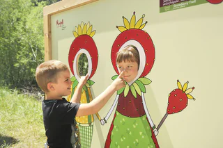
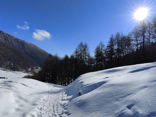
| Przeżyj zimową przygodę podczas wędrówek w regionie Vinschgau. Odkryj urokliwe trasy, które oferują piękne widoki i doskonałe warunki do zimowego trekkingu. |
1/3
Resia/Reschen, Graun im Vinschgau/Curon Venosta, Vinschgau/Val Venosta
easy
Poziom trudności
252 m
Wzlot
1h:04 min
czas trwania
1/3
Monte di Tramontana/Nördersberg, Schlanders/Silandro, Vinschgau/Val Venosta
easy
Poziom trudności
70 m
Wzlot
0h:31 min
czas trwania

Transacqua/Ennewasser, Martell/Martello, Vinschgau/Val Venosta
difficult
Poziom trudności
1424 m
Wzlot
4h:16 min
czas trwania
Solda/Sulden, Stilfs/Stelvio, Vinschgau/Val Venosta
difficult
Poziom trudności
1210 m
Wzlot
8h:45 min
czas trwania
Slingia/Schlinig, Mals/Malles, Vinschgau/Val Venosta
easy
Poziom trudności
154 m
Wzlot
1h:00 min
czas trwania
Solda/Sulden, Stilfs/Stelvio, Vinschgau/Val Venosta
easy
Poziom trudności
697 m
Wzlot
1h:30 min
czas trwania
Tarres/Tarsch, Latsch/Laces, Vinschgau/Val Venosta
difficult
Poziom trudności
1362 m
Wzlot
5h:05 min
czas trwania
1/2
Mazia/Matsch, Mals/Malles, Vinschgau/Val Venosta
medium
Poziom trudności
365 m
Wzlot
2h:04 min
czas trwania
Transacqua/Ennewasser, Martell/Martello, Vinschgau/Val Venosta
easy
Poziom trudności
472 m
Wzlot
2h:16 min
czas trwania
Ganda/Gand - Martello/Martell, Martell/Martello, Vinschgau/Val Venosta
easy
Poziom trudności
430 m
Wzlot
3h:00 min
czas trwania
Sulden/Solda, Stilfs/Stelvio, Vinschgau/Val Venosta
easy
Poziom trudności
426 m
Wzlot
2h:00 min
czas trwania
Ganda/Gand - Martello/Martell, Martell/Martello, Vinschgau/Val Venosta
difficult
Poziom trudności
1326 m
Wzlot
4h:25 min
czas trwania
1/4
Monte di Tramontana/Nördersberg, Schlanders/Silandro, Vinschgau/Val Venosta
medium
Poziom trudności
348 m
Wzlot
2h:37 min
czas trwania
Oris/Eyrs, Laas/Lasa, Vinschgau/Val Venosta
easy
Poziom trudności
11 m
Wzlot
0h:16 min
czas trwania
Mazia/Matsch, Mals/Malles, Vinschgau/Val Venosta
easy
Poziom trudności
234 m
Wzlot
0h:51 min
czas trwania
1/2
Martello/Martell, Martell/Martello, Vinschgau/Val Venosta
easy
Poziom trudności
147 m
Wzlot
1h:46 min
czas trwania
Altavalle/Hintermartell, Martell/Martello, Vinschgau/Val Venosta
difficult
Poziom trudności
1289 m
Wzlot
3h:55 min
czas trwania
1/2
Slingia/Schlinig, Mals/Malles, Vinschgau/Val Venosta
easy
Poziom trudności
414 m
Wzlot
1h:28 min
czas trwania
Solda/Sulden, Stilfs/Stelvio, Vinschgau/Val Venosta
easy
Poziom trudności
172 m
Wzlot
2h:04 min
czas trwania
Altavalle/Hintermartell, Martell/Martello, Vinschgau/Val Venosta
difficult
Poziom trudności
1424 m
Wzlot
4h:16 min
czas trwania
Mazia/Matsch, Taufers im Münstertal/Tubre, Vinschgau/Val Venosta
easy
Poziom trudności
502 m
Wzlot
1h:43 min
czas trwania
1/2
Burgusio/Burgeis, Graun im Vinschgau/Curon Venosta, Vinschgau/Val Venosta
medium
Poziom trudności
504 m
Wzlot
2h:47 min
czas trwania
Transacqua/Ennewasser, Martell/Martello, Vinschgau/Val Venosta
easy
Poziom trudności
269 m
Wzlot
1h:33 min
czas trwania
Vinschgau/Val Venosta
medium
Poziom trudności
445 m
Wzlot
2h:45 min
czas trwania
1/3
Slingia/Schlinig, Mals/Malles, Vinschgau/Val Venosta
medium
Poziom trudności
419 m
Wzlot
1h:30 min
czas trwania
1/2
Transacqua/Ennewasser, Martell/Martello, Vinschgau/Val Venosta
easy
Poziom trudności
430 m
Wzlot
3h:00 min
czas trwania
S.Valentino /St. Valentin, Graun im Vinschgau/Curon Venosta, Vinschgau/Val Venosta
easy
Poziom trudności
516 m
Wzlot
3h:12 min
czas trwania
Stelvio/Stilfs, Stilfs/Stelvio, Vinschgau/Val Venosta
easy
Poziom trudności
843 m
Wzlot
2h:30 min
czas trwania
1/8
Oris/Eyrs, Laas/Lasa, Vinschgau/Val Venosta
easy
Poziom trudności
132 m
Wzlot
0h:49 min
czas trwania
1/3
Resia/Reschen, Graun im Vinschgau/Curon Venosta, Vinschgau/Val Venosta
medium
Poziom trudności
326 m
Wzlot
2h:00 min
czas trwania
Dziękujemy za zapisanie się!
Subskrypcja jest już aktywna
Potwierdź rejestrację
Aby zakończyć rejestrację, otwórz e-mail, który właśnie wysłaliśmy, i kliknij link potwierdzający.
Nie widzisz wiadomości? Sprawdź folder spam.
Zauważyliśmy, że próbowałeś(-aś) zapisać się do newslettera, ale Twój adres e-mail jest już zarejestrowany. Nadal będziesz otrzymywać nasze oferty, wskazówki i inspiracje na Twój urlop.
Już próbowałeś zapisać się do naszego newslettera, ale nie potwierdziłeś rejestracji. Właśnie wysłaliśmy ci ponownie e‑mail. Sprawdź swoją skrzynkę odbiorczą i folder ze spamem i potwierdź teraz.


