
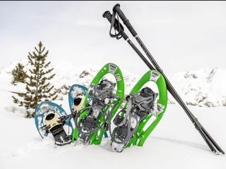
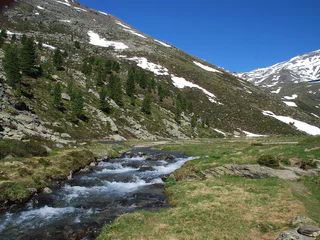
1/3
Snow Shoe Trail mountain pasture Lafetz
Madonna/Unser Frau, Schnals/Senales, Vinschgau/Val Venosta
medium
Poziom trudności
489 m
Wzlot
2h:12 min
czas trwania
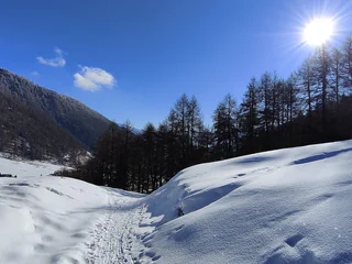
| Odkryj urok zimowych krajobrazów regionu Vinschgau podczas wędrówek na rakietach śnieżnych. Przemierzaj zasypane śniegiem szlaki, ciesząc się spokojem i pięknem natury. |
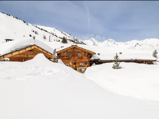
1/3
Madonna/Unser Frau, Schnals/Senales, Vinschgau/Val Venosta
medium
Poziom trudności
489 m
Wzlot
2h:12 min
czas trwania

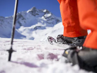
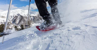
Trafoi/Trafoi, Stilfs/Stelvio, Vinschgau/Val Venosta
medium
Poziom trudności
610 m
Wzlot
2h:00 min
czas trwania

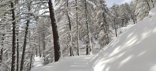
1/3
Unser Frau/Madonna, Schnals/Senales, Vinschgau/Val Venosta
medium
Poziom trudności
301 m
Wzlot
1h:16 min
czas trwania
1/3
Madonna/Unser Frau, Schnals/Senales, Vinschgau/Val Venosta
medium
Poziom trudności
301 m
Wzlot
1h:16 min
czas trwania
1/3
Madonna/Unser Frau, Schnals/Senales, Vinschgau/Val Venosta
easy
Poziom trudności
0 m
Wzlot
0h:22 min
czas trwania
Transacqua/Ennewasser, Martell/Martello, Vinschgau/Val Venosta
easy
Poziom trudności
269 m
Wzlot
1h:33 min
czas trwania
Ganda/Gand - Martello/Martell, Martell/Martello, Vinschgau/Val Venosta
easy
Poziom trudności
430 m
Wzlot
3h:00 min
czas trwania
Tubre/Taufers i. M., Taufers im Münstertal/Tubre, Vinschgau/Val Venosta
medium
Poziom trudności
792 m
Wzlot
3h:00 min
czas trwania
Sulden/Solda, Stilfs/Stelvio, Vinschgau/Val Venosta
easy
Poziom trudności
500 m
Wzlot
1h:40 min
czas trwania
1/2
Martello/Martell, Martell/Martello, Vinschgau/Val Venosta
easy
Poziom trudności
147 m
Wzlot
1h:46 min
czas trwania
1/2
Slingia/Schlinig, Mals/Malles, Vinschgau/Val Venosta
medium
Poziom trudności
406 m
Wzlot
1h:18 min
czas trwania
1/3
Maso Corto/Kurzras, Schnals/Senales, Vinschgau/Val Venosta
easy
Poziom trudności
24 m
Wzlot
1h:00 min
czas trwania
1/2
Burgusio/Burgeis, Graun im Vinschgau/Curon Venosta, Vinschgau/Val Venosta
medium
Poziom trudności
504 m
Wzlot
2h:47 min
czas trwania

1/3
Maso Corto/Kurzras, Schnals/Senales, Vinschgau/Val Venosta
easy
Poziom trudności
272 m
Wzlot
3h:15 min
czas trwania
Mazia/Matsch, Mals/Malles, Vinschgau/Val Venosta
easy
Poziom trudności
234 m
Wzlot
0h:51 min
czas trwania
1/2
Slingia/Schlinig, Mals/Malles, Vinschgau/Val Venosta
easy
Poziom trudności
414 m
Wzlot
1h:28 min
czas trwania
Sulden/Solda, Stilfs/Stelvio, Vinschgau/Val Venosta
easy
Poziom trudności
492 m
Wzlot
2h:00 min
czas trwania
Transacqua/Ennewasser, Martell/Martello, Vinschgau/Val Venosta
easy
Poziom trudności
136 m
Wzlot
0h:46 min
czas trwania
1/2
S.Valentino /St. Valentin, Graun im Vinschgau/Curon Venosta, Vinschgau/Val Venosta
easy
Poziom trudności
0 m
Wzlot
2h:30 min
czas trwania
1/2
Altavalle/Hintermartell, Martell/Martello, Vinschgau/Val Venosta
easy
Poziom trudności
324 m
Wzlot
1h:58 min
czas trwania
Transacqua/Ennewasser, Martell/Martello, Vinschgau/Val Venosta
medium
Poziom trudności
404 m
Wzlot
1h:15 min
czas trwania
Stilfs/Stelvio, Vinschgau/Val Venosta
easy
Poziom trudności
576 m
Wzlot
2h:08 min
czas trwania
Transacqua/Ennewasser, Martell/Martello, Vinschgau/Val Venosta
easy
Poziom trudności
430 m
Wzlot
3h:00 min
czas trwania
1/3
Maso Corto/Kurzras, Schnals/Senales, Vinschgau/Val Venosta
medium
Poziom trudności
284 m
Wzlot
2h:46 min
czas trwania
Altavalle/Hintermartell, Martell/Martello, Vinschgau/Val Venosta
medium
Poziom trudności
0 m
Wzlot
2h:30 min
czas trwania
1/3
Planol/Planeil, Mals/Malles, Vinschgau/Val Venosta
difficult
Poziom trudności
600 m
Wzlot
4h:30 min
czas trwania
S.Valentino /St. Valentin, Graun im Vinschgau/Curon Venosta, Vinschgau/Val Venosta
medium
Poziom trudności
0 m
Wzlot
5h:00 min
czas trwania
Transacqua/Ennewasser, Martell/Martello, Vinschgau/Val Venosta
medium
Poziom trudności
379 m
Wzlot
1h:37 min
czas trwania
1/2
Mazia/Matsch, Mals/Malles, Vinschgau/Val Venosta
medium
Poziom trudności
365 m
Wzlot
2h:04 min
czas trwania
Sulden/Solda, Stilfs/Stelvio, Vinschgau/Val Venosta
easy
Poziom trudności
426 m
Wzlot
2h:00 min
czas trwania
Dziękujemy za zapisanie się!
Rejestracja już aktywna
Potwierdź rejestrację
Aby zakończyć rejestrację, otwórz e-mail, który właśnie wysłaliśmy, i kliknij link potwierdzający.
Nie widzisz wiadomości? Sprawdź folder spam.
Otrzymujesz już nasze wyjątkowe oferty, przydatne wskazówki i specjalne propozycje, aby w pełni cieszyć się wakacjami.
Już próbowałeś zapisać się do naszego newslettera, ale nie potwierdziłeś rejestracji. Właśnie wysłaliśmy ci ponownie e‑mail. Sprawdź swoją skrzynkę odbiorczą i folder ze spamem i potwierdź teraz.


