
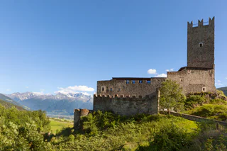
"Schlietplott"
Tubre/Taufers i. M., Taufers im Münstertal/Tubre, Vinschgau/Val Venosta
Tubre/Taufers i. M., Taufers im Münstertal/Tubre, Vinschgau/Val Venosta
1/2
Sluderno/Schluderns, Schluderns/Sluderno, Vinschgau/Val Venosta
1/5
Glorenza/Glurns, Glurns/Glorenza, Vinschgau/Val Venosta

1/5
Malles/Mals, Mals/Malles, Vinschgau/Val Venosta
1/2
Glorenza/Glurns, Glurns/Glorenza, Vinschgau/Val Venosta
1/4
Tubre/Taufers i. M., Taufers im Münstertal/Tubre, Vinschgau/Val Venosta
1/4
Tarces/Tartsch, Mals/Malles, Vinschgau/Val Venosta
1/4
Tubre/Taufers i. M., Taufers im Münstertal/Tubre, Vinschgau/Val Venosta
1/6
Glorenza/Glurns, Glurns/Glorenza, Vinschgau/Val Venosta
1/8
Sluderno/Schluderns, Schluderns/Sluderno, Vinschgau/Val Venosta
1/5
Malles/Mals, Mals/Malles, Vinschgau/Val Venosta
1/8
Tubre/Taufers i. M., Taufers im Münstertal/Tubre, Vinschgau/Val Venosta
1/5
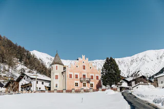
Burgusio/Burgeis, Mals/Malles, Vinschgau/Val Venosta
1/5
Burgusio/Burgeis, Mals/Malles, Vinschgau/Val Venosta
1/4
Tartsch/Tarces, Mals/Malles, Vinschgau/Val Venosta

1/11
Glorenza/Glurns, Glurns/Glorenza, Vinschgau/Val Venosta
1/3
Sluderno/Schluderns, Schluderns/Sluderno, Vinschgau/Val Venosta
1/5
Tubre/Taufers i. M., Taufers im Münstertal/Tubre, Vinschgau/Val Venosta
1/4
Laudes/Laatsch, Mals/Malles, Vinschgau/Val Venosta
1/3
Slingia/Schlinig, Mals/Malles, Vinschgau/Val Venosta
1/5
Malles/Mals, Mals/Malles, Vinschgau/Val Venosta
1/3
Glorenza/Glurns, Glurns/Glorenza, Vinschgau/Val Venosta
1/5
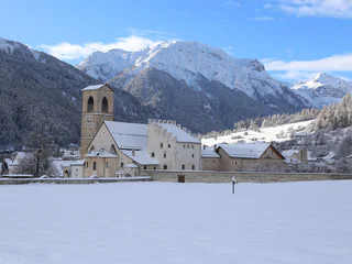
Burgusio/Burgeis, Mals/Malles, Vinschgau/Val Venosta
Burgusio/Burgeis, Mals/Malles, Vinschgau/Val Venosta
1/5
Tubre/Taufers i. M., Taufers im Münstertal/Tubre, Vinschgau/Val Venosta
1/2
Plawenn/Piavenna, Mals/Malles, Vinschgau/Val Venosta
1/2
Malles/Mals, Mals/Malles, Vinschgau/Val Venosta
1/5
Glorenza/Glurns, Glurns/Glorenza, Vinschgau/Val Venosta
1/7
Burgusio/Burgeis, Mals/Malles, Vinschgau/Val Venosta
1/2
Sluderno/Schluderns, Schluderns/Sluderno, Vinschgau/Val Venosta


