Ga meteen naar de inhoud
toegevoegd aan favorieten
verwijderd uit favorieten
Helaas is er een probleem opgetreden. Probeer het opnieuw.
Uw account wordt aangemaakt
Je account is succesvol aangemaakt en je bent nu ingelogd
U bent uitgelogd
Filteren
Geselecteerde filters
    Moeilijkheidsgraad
    Duur
    Afstand in km

    Fietsen

    Ga op spannende fietstochten in Zuid-Tirol, waarbij je door betoverende wijngaarden, schilderachtige valleien en majestueuze bergen fietst. Ontdek adembenemende landschappen, bedwing uitdagende trails en geniet van de rijke cultuur en gastronomie van de regio. Een onvergetelijk avontuur voor elke fietsliefhebber!
    Resultaten
    Cycling
    Passeiertal Valley bike route (Merano-S. Leonardo)
    St.Leonhard in Passeier/San Leonardo in Passiria, Meran/Merano and environs

    A relaxing cycling path for nature lovers
    Length: about 20 km; difference in altitude: about 370 m.

    This slightly ascending and largely natural bike path leads from the center of Meran/Merano (the Sissi Statue in Elisabeth Park - Summer Promenade) along the Passer River, and ends in St. Leonhard/San Leonardo. This path does not lead directly through the villages that lie along its route, but cyclists can take a detour into anyone of them.

    Please note that the bus line 240 from Meran to St. Leonhard is not equipped for bicycle transport.

    Moeilijkheidsgraad: gemakkelijk
    0 Hoogtemeters
    20 Km Route
    Cycling
    Cycling Path Niederdorf/Villabassa - Val Casies/ Gsiesertal Valley
    Niederdorf/Villabassa, Dolomites Region 3 Zinnen

    You start your bike ride in Villabassa/Niederdorf. Along the `Platari` road you will arrive in Monguelfo/Welsberg. Once in the center of the village, follow the road on the banks of the river. You reach the hamlets of `Oberplanken` and` Preindl`, where you cross the river and the road. From here follow the road to San Martino. Apart from two climbs, this tour is easy and also suitable for e-bikes.

    Moeilijkheidsgraad: gemakkelijk
    369 Hoogtemeters
    21.9 Km Route
    Cycling
    Etsch Bike Route: Vinschgau Valley, Mals/Malles-Meran/Merano
    Marling/Marlengo, Meran/Merano and environs
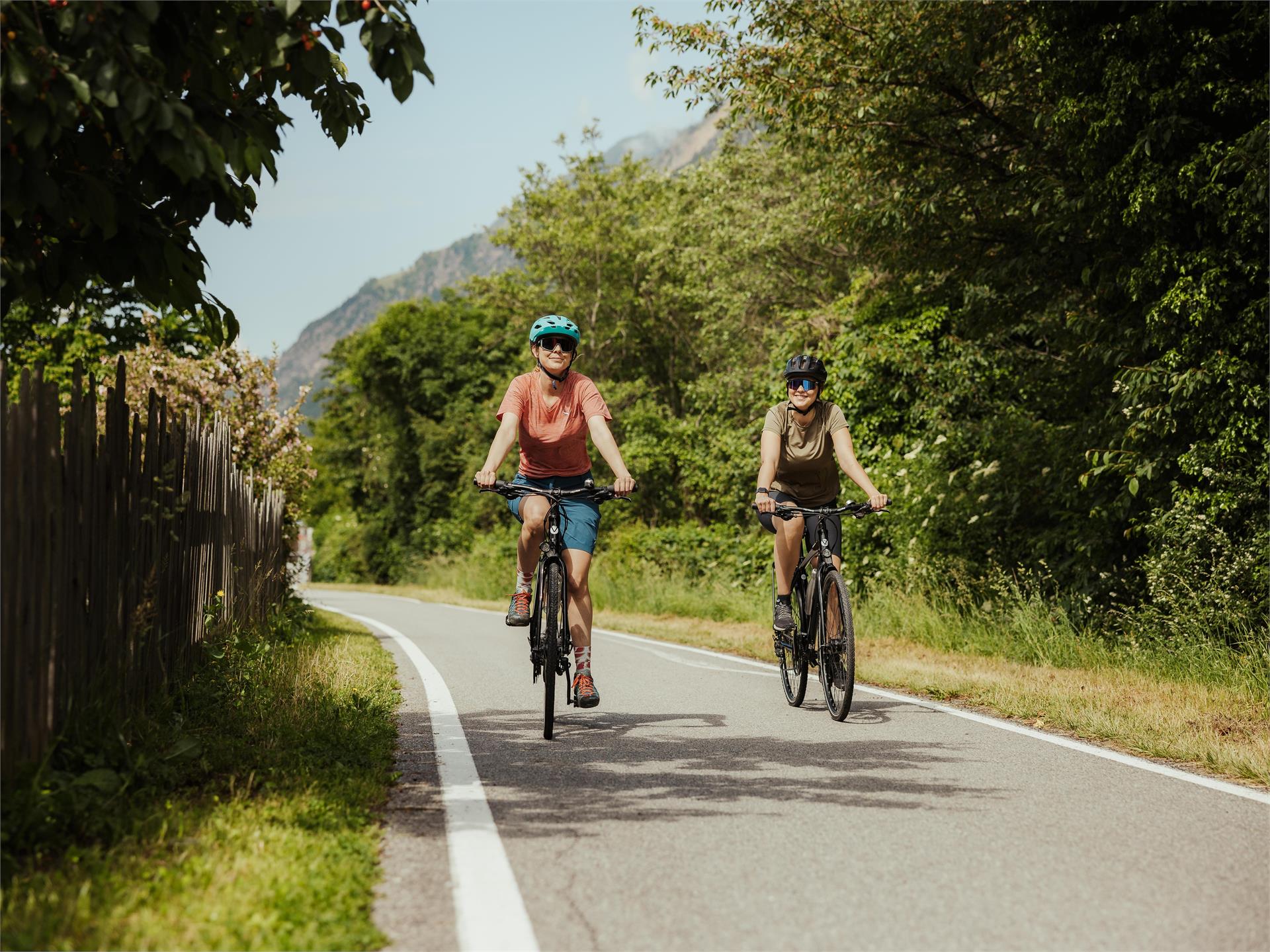
    Starting from Meran/Merano, you can explore the Vinschgau Valley while taking advantage of a beneficial combination: bike and train. The Vinschgau Valley Line, known as the "Vinschgerbahn" in German, offers a spectacular landscape. At the terminal station, located in Mals/Malles (56 km from Meran), you can pick up a bike at the local "Südtirol Rad" or "Papin Sport" point, and then ride all the way back to Merano on a well-maintained bike path. If the way back is too long, you can return the bike at any of the bike rentals along the way and continue the journey to Meran by train. For the latter option, you may want to purchase the bikemobil Card, which combines two different offers: unlimited travelling on all of South Tyrol’s means of public transport and a day trip on a borrowed bicycle. 

    The bike rentals of "Papin Sport" are located in Mals, Spondinig/Spondigna, Schlanders/Silandro, Latsch/Laces and Meran, while the bike rentals of "Südtirol Rad" are located in Mals (by the water tower at the train station), Naturns (train station) and Meran (Palamainardo). The bike must be returned to the same rental company.
     
    If you want to cover more kilometers, there is the possibility to take the bus line 273 from Mals to Reschen/Resia and to rent a bicycle there from "Papin Sport". The bike path from Reschen to Mals is about 20 km long with a difference in altitude of about 500 meters.
     
    If you would like to reach the Vinschgau Valley (Mals or Reschen) from Meran by public transport (including transport of your bike), you should keep in mind that:
    • Taking bicycles on the train is subject to a charge and is only possible to a limited extent due to space and security reasons. In any case, priority is given to the transportation of people.
    • During winter, max. 10-20 bicycles can be taken on the train (supplementary daily bike ticket € 7)
    • From July 1st, 2020 to September 30th, 2020, it is not allowed, between 9 a.m. and 1 p.m. and between 3 and 5.30 p.m., to take bikes on the train. Your bike will be transported (for a fee of € 7) by a shuttle service (only bicycle transport) which departs from the railway station in Merano at 9.16, 10.16 and 11.16 a.m. and at 3.16, 4.16 and 5.16 p.m. If the shuttle service is available from mid-June and/or until mid-October, it will be published on the website www.suedtirolmobil.info. The bicycles will be transported to the railway stations of Naturns, Latsch, Schlanders, Spondinig und Mals. For the transport of the bicycle, you need to purchase a daily ticket of € 7 (supplementary daily bike ticket).
    • The bus line 273 runs from Mals to Reschen, and has a bicycle rack for max. 5-6 bikes (supplementary daily bike ticket € 7). E-bikes will not be transported. The bus 273 can not be booked in advance. You can also reach Reschen from Meran or Mals with two private shuttle services that carry bikes (including e-bikes): "Südtirolbike" and "Taxi Iris". Find out more at www.suedtirolbike.infowww.taxi-iris.com
    Moeilijkheidsgraad: gemakkelijk
    0 Hoogtemeters
    56 Km Route
    Cycling
    Bolzano Bike Experience
    Bolzano/Bozen, The South Tyrolean Wine Road
    Discover the diversity of Bolzano on this 45 km bike tour. From urban attractions to idyllic vineyards, this route traverses this historic region with a gentle elevation gain of 380 m, ideal for an active outing in spring, summer, or autumn.
    Moeilijkheidsgraad: gemakkelijk
    252 Hoogtemeters
    46.0 Km Route
    Cycling
    Pustertal Valley Bike Route Leg Bruneck - Franzenfeste
    Innichen/San Candido, Brixen/Bressanone and environs

    The Brunico|Bruneck to Fortezza|Franzensfeste leg is rich in cultural and historical treasures that make the route unique. The settlements, fortresses, and historical monuments from Roman times through the Middle Ages line the bike path along the Rienza|Rienz, offering interesting insights into the history of the valley.

    Moeilijkheidsgraad: gemakkelijk
    369 Hoogtemeters
    34.8 Km Route
    Cycling
    Drava Cycle Path (Drau-Radweg): Innichen/San Candido - Lienz (AUT)
    Innichen/San Candido, Dolomites Region 3 Zinnen

    This cycling tour takes you along a marked cycle trail from San Candido (or from Villabassa/Niederdorf or Dobbiaco/Toblach) via Versciaco/Vierschach and Prato Drava/Winnebach along the Drava (Drau) river to Lienz and is suitable for all types of bikes.

    Characteristics: The route goes from San Candido in Italy to Lienz in East Tirol. This part of the Drava cycle trail was the first to be developed and is currently the best maintained section. You can also start in Villabassa or Dobbiaco, which would make the tour longer accordingly. The section from Dobbiaco to Sillian is downhill. The cycle trail is almost always away from the road on the other side of the river and, because of its width and gradient, is also suitable for families with young children. Along the way there are several bus stops so that sections can be shortened if necessary. The route is well signposted and asphalted throughout. There are many opportunities for rest and refreshment along the way.

    Starting points: Villabassa/Niederdorf (52,5 km), Dobbiaco/Toblach (47,8 km), San Candido/Innichen (44,8 km)

    This tour is also suitable for e-bikes.

    flyer & train information

    Moeilijkheidsgraad: gemakkelijk
    0 Hoogtemeters
    44.8 Km Route
    Cycling
    Aldein/Aldino - Joch Grimm/Passo Occllini
    Aldein/Aldino, Bolzano/Bozen and environs
    The mountain bike tour from Aldein / Lerch to Auer-Leger Alm near Jochgrimm traverses some of the most spectacular landscapes of South Tyrol. Spanning a total distance of about 30 km with an elevation gain of approximately 450 m, the route blends asphalt and predominantly gravel paths, with a consistent incline of about 10%. In addition to the physical challenge, cyclists are rewarded with the natural beauty of the Dolomites, diverse flora, and the geological uniqueness of the Geoparc Bletterbach, a UNESCO World Heritage site. The best months for this tour are late spring, summer, and autumn when nature is at its most vibrant.
    Moeilijkheidsgraad: gemakkelijk
    558 Hoogtemeters
    10.6 Km Route
    Mountain bike
    Around the yoke
    Villnöss/Funes, Dolomites Region Villnösstal

    Starting point: St. Peter, kilometres: 10.3 km; altitude difference: 324 m; altitude of starting point: 1145 m; altitude of end: 1145 m; Best season: May to October

    Tour description: The starting point of the tour is the village centre of St. Peter in the Villnöss valley. Here the route first passes by St. Jakob on an asphalted road. This tour leads you along the slopes of the foresty mountain, which parts the Afer and the Villnöss Valleys. After you reach the beautifully situated “Jochhöfe” (farm houses), you make your way across the saddleback on the northern side. You will be rewarded with a panoramic view to Brixen. After about 3 km of forest road, you return to the south side, past the Tschaufisserhöfe farmsteads to Coll. Crossing the road Coll, continue to the Gsoier Bild and via the Sunnseitenweg back to St. Peter.

    Moeilijkheidsgraad: gemakkelijk
    410 Hoogtemeters
    10.4 Km Route
    Cycling
    Unterland Tour
    Tramin an der Weinstraße/Termeno sulla Strada del Vino, The South Tyrolean Wine Road
    Through the villages in Unterland down as far as the language barrier at Salurn.

    Through the vineyards and orchards you go from Tramin past the neighbouring village of Kurtatsch to Margreid. In this small little village we can find the oldest grape vine in Europe from the year 1601. You continue on through Kurtinig to Salurn where we can visit Haderburg castle after a short walk. For the return route we cycle through Laag on the cycle path which takes us along the Etsch river to Auer. We leave the cycle path at Auer and cross the bridge over the Adige. After approx. 500 metres, we turn right into the hamlet of Gmund (Pfatten). We cycle along this path until we reach the Laimburg crossroads. Here we turn sharp left and ride down to the lake. Cycle around the lake and after the St. Josef campsite you will come back to the cycle path towards Tramin. The home village of Tramin isn’t far from there.
    Moeilijkheidsgraad: gemakkelijk
    406 Hoogtemeters
    34.4 Km Route
    Cycling
    Cycling through Val Venosta Via Claudia Augusta
    Partschins/Parcines, Meran/Merano and environs

    The 80 km long Val d'Adige/Etschtal Cycle Path (Etschradweg) leads along the Via Claudia Augusta, an ancient Roman road. 

    The trail is mainly flat or downhill. The fantastic bike trail network in the Val Venosta/Vinschgau valley makes for relaxed biking on a good surface, i.e. either asphalt or rolled gravel.

    The Val d’Adige Cycle Path (Etschradroute) is especially popular with cyclists looking for a moderate challenge. It is also possible to rent bikes at various train stations and to return them elsewhere, meaning that you do not have to bring your own bike with you. The bike tour can also be shortened or simplified at any time by using the Vinschgerbahn train.

    From the Adige Valley to the mountains, visitors can cycle with constant temperatures through shady forests and flowering meadows, far away from the hustle and bustle of traffic.


    Moeilijkheidsgraad: gemakkelijk
    1432 Hoogtemeters
    79.1 Km Route
    Mountain bike
    E-Bike Tour Albeins-Nafen-St. Peter-Ranui
    Villnöss/Funes, Dolomites Region Villnösstal

    Enjoy mountain bike tours also on steeper trails with the latest e-bike. Even beginners will be impressed by the electric mobility! Explore effortlessly the Geisler mountain landscape with an E-Bike. It’s emission-free, climate-friendly and without being stiff and sore.
    E-Bikes are for everyone due to the very simple operation. Overcome steep inclines with ease and cycle into the wind with a smile on your face, because that makes your bike trip even more fun.

    Moeilijkheidsgraad: gemakkelijk
    1082 Hoogtemeters
    23.1 Km Route
    Cycling
    Cycling Path Niederdorf/Villabassa - Sexten/Sesto
    Sexten/Sesto, Dolomites Region 3 Zinnen

    You start your tour to Sexten/Sesto in Niederdorf/Villabassa. You leave the village in an easterly direction. Then turn right at Camping Olympia. Here you follow the bike path past the beautiful villages of Toblach/Dobbiaco and Innichen/San Candido, which are worth a visit. Your tour continues into the Sexten/Sesto Valley. Also suitable for e-bikes.


    Moeilijkheidsgraad: gemiddeld
    233 Hoogtemeters
    17.4 Km Route
    Cycling
    Cycle Route Niederdorf/Villabassa - Lienz
    Dolomites Region 3 Zinnen
    From Niederdorf/Villabassa the cycle path leads in the direction of Toblach/Dobbiaco to Innichen/San Candido where along the Drau cycle path the wonderful mountain panorama can be admired. The route leads over a slight gradient almost always off the road along the river bank and is particularly suitable for families. A popular stop along the route is the Loacker factory in Heinfels where the delicious South Tyrolean waffles can be made and nibbled. The route continues down the valley to the Dolomite town of Lienz, the capital of East Tyrol, which you reach after about 50 km of total distance and where there are numerous places to stop for refreshments. The return journey can be made comfortably by train, which runs in hourly shifts from Lienz directly to Niederdorf/Villabassa.
    Moeilijkheidsgraad: gemakkelijk
    158 Hoogtemeters
    54.2 Km Route
    Cycling
    Pitzoner circular route
    Meran/Merano and environs

    The tour starts from Nalles and leads past the church to the castle Schwanburg (private property). From here, turn right in the direction of Sirmiano. Above the castle Payersberg (private property), a road will lead you to the Bittnerhof and onwards to the Pitzoner-route back to Nalles. This tour can also be done in the opposite direction: Turn left when you see the castle Schwanburg (private property).

    • Total length: 12 km
    • Driving time: 2 hours
    • Difference in altitude: 380 m
    Moeilijkheidsgraad: gemakkelijk
    0 Hoogtemeters
    12 Km Route
    Cycling
    Bike route Tauferer Ahrntal
    Sand in Taufers/Campo Tures, Brixen/Bressanone and environs

    The “Ahrtour” bike route runs through the entire Valli di Tures Aurina - Tauferer Ahrntal and promises an adventurous trip through nature itself. From the start in Brunico - Bruneck until Campo Tures - Sand in Taufers, the Ahrtour is a fairly flat and easy ride. This bike tour is an adventure for athletes and amateur bikers alike and of course it can also be enjoyed in individual sections.

    Moeilijkheidsgraad: gemiddeld
    92 Hoogtemeters
    15.9 Km Route
    Cycling
    Altrei/Antrevio Panorama Tour
    Altrei/Anterivo, The South Tyrolean Wine Road
    The Altrei circuit is an easy beginner tour, perfect for novice riders and those looking for a leisurely biking experience. The route covers approximately 13.90 km with an elevation gain of about 462 m, primarily on gravel forest roads. With an estimated riding time of about 1.5 hours, this tour offers spectacular insights into the natural diversity of the Trudner Horn Nature Park, known for its unique flora. The tour is especially recommended in late spring, summer, and autumn.
    Moeilijkheidsgraad: gemakkelijk
    447 Hoogtemeters
    11.6 Km Route
    Cycling
    Bike Trail Via Claudia Augusta
    Graun im Vinschgau/Curon Venosta, Bolzano/Bozen and environs
    After 2000 years of history, Via Claudia Augusta, the ancient Roman road that led from the Po River lowlands and the Adriatic Sea all the way to Bavaria and the Danube, is enjoying a renaissance. With the end of conflict and a united Europe, the Via Claudia Augusta has become a bridge joining and blending cultures, places and emotions. It is a symbolic route that spans three nations, each with its own diverse landscape and traditions, artistic treasures and culinary specialities, marked by a more approachable, youthful and ecologically sustainable tourism.

    The South Tyrolean part of the trail goes through Passo Resia, Val Venosta, Merano, Bolzano and Val d'Adige until Salorno.
    Moeilijkheidsgraad: gemakkelijk
    290 Hoogtemeters
    140.8 Km Route
    Cycling
    Premstl-Stallwies Tour
    Martell/Martello, Vinschgau/Val Venosta

    Start at the visitor center culturamartell in Trattla and take the Val Martello path until Ganda and then towards Stallwies. Turn right above the Premstl inn and follow the road towards Radund. Take the forest road towards "Platzer Mahd". Continue on the forest road and enjoy the nature passing by mighty larches and lush mountain meadows. We warmly recommend you to stop at the Stallwies mountain inn that awaits you with excellent South Tyrolean cuisine. Return on the same route and don’t forget to make a detour to the "Suachbichl" viewpoint.

    Moeilijkheidsgraad: gemakkelijk
    819 Hoogtemeters
    11.1 Km Route
    Cycling
    Around the Mitterberg
    Tramin an der Weinstraße/Termeno sulla Strada del Vino, The South Tyrolean Wine Road

    From Tramin to Neumarkt. After the Etsch bridge you have to turn left in the Etsch cycle path and to follow until Bozen. In Bozen you pass Castel Firmiano with the Messner Mountain Museum, then in direction to Appiano and at the return over Caldaro back to Tramin.
    Don't forget your swimwear!

    Moeilijkheidsgraad: gemakkelijk
    799 Hoogtemeters
    46.7 Km Route
    Cycling
    Resia Lake Round
    Graun im Vinschgau/Curon Venosta, Vinschgau/Val Venosta

    This route is suitable for a leisurely excursion, for families, and for mountain bike or e-bike tours for warm-up. The Resia lake can be cycled in both directions. Almost exclusively on asphalt, start along the cycle and gravel path from the famous church tower in Graun northwards to Reschen - past the sailing boats waiting for wind. Don't cycle straight forward to the Austrian state border. Instead, follow the cycle path in Reschen towards the western lakeside, past the Schöneben valley station, and calmly tackle the incline along the lake. The route is leisurely - until the southern lakeside with the dam wall and there is a fantastic view over the Malser Haide and King Ortler (3,905 m). At the dam, turn north and enjoy the panorama with the lake and the approaching mountains back to Graun. If the wind is strong, kiters and sailors can be spotted on Lake Reschen. There are cozy stops along the lake at the Sciuri at the Schöneben valley station, at the taverns Greinhof and Giernhof, at the new kitestation or at the businesses in Reschen and Graun.

    Moeilijkheidsgraad: gemakkelijk
    70 Hoogtemeters
    15.2 Km Route
    Mountain bike
    MTB Area in Anterselva di Sotto / Antholz Niedertal
    Rasen-Antholz/Rasun Anterselva, Dolomites Region Kronplatz/Plan de Corones

    "Are you searching a change to cycling? The true bike adventure begins by mountain biking in the Anterselva Valley! "

    Both children and adults will enjoy the new MTB area behind the fish pond in Anterselva di Sotto. 3 downhill tracks with different degrees of difficulty and a pumptrack for children awaits you.

    Moeilijkheidsgraad: gemakkelijk
    48 Hoogtemeters
    1.5 Km Route
    Cycling
    Pustertal Valley Bike Route Mühlbach - Innichen
    Mühlbach/Rio di Pusteria, Brixen/Bressanone and environs

    The Pustertal Valley Bike Route is particularly suitable for bicycle tours and family cycling tours, for beginners but also for experts.

    Moeilijkheidsgraad: gemakkelijk
    564 Hoogtemeters
    62.3 Km Route
    Cycling
    Brenner-Bozen Bicycle Route
    Mühlbach/Rio di Pusteria, Brixen/Bressanone and environs

    This bike route through the Isarco Valley is a pleasure tour that offers idyllic scenery. Rolling hills, small towns and cultural treasures line this well-marked bike route, which leads from Brennero to South Tyrol’s capital city of Bolzano. The Brennero/Brenner–Bolzano/Bozen Bike Route starts at the Brenner Pass and runs along the former railway line, which is at a slight downhill grade, to Vipiteno/Sterzing. The marked bike path then continues, partly flat and with a light ascent, through picturesque villages and small hamlets up to Franzensfeste Fortress, past Lake Vahrn, and along the Kastanienweg (Chestnut) Trail towards Novacella/Neustift Abbey and then continuing on towards Bressanone/Brixen. The section from Bressanone to Bolzano is again a brisk ride through the narrow Isarco Valley, with a stopover in the little artists’ town of Chiusa/Klausen, known for its imposing hilltop Säben Abbey. From there, the route continues to the capital city of Bolzano. The Brennero/Brenner–Bolzano/Bozen Bike Route runs a total length of 96 kilometers from Brennero to Bolzano.

    Moeilijkheidsgraad: gemakkelijk
    327 Hoogtemeters
    103 Km Route
    Cycling
    Cicling route Monguelfo - S. Candido
    Welsberg-Taisten/Monguelfo-Tesido
    On your bikes, get set, go! A leisurely way to explore the Upper Pustertal Valley and its villages by bike. From Monguelfo to San Candido by bike.
    Start: Monguelfo village
    Destination: San Candido village
    Distance: 16,5 km
    Difference in altitude: 178 m
    Moeilijkheidsgraad: gemakkelijk
    178 Hoogtemeters
    16.4 Km Route
    Cycling
    Pustertal Valley Bike Route : Leg Innichen - Bruneck
    Toblach/Dobbiaco, Brixen/Bressanone and environs

    On the San Candido|Innichen to Brunico|Bruneck leg, the green color of the meadows, fields, and forests dominates the view. Along the railway route, sometimes through inhabited areas and sometimes through an undisturbed natural landscape, the bike path runs with a constant up and down from village to village as far as Brunico, the economic center of the Pustertal|Val Pusteria. 

    Moeilijkheidsgraad: gemakkelijk
    684 Hoogtemeters
    35.0 Km Route
    Cycling
    BIKE ROUTE Val Fiscalina/Fischleintal Valley Sexten to San Candido
    Sexten/Sesto, Dolomites Region 3 Zinnen

    Easy bicycle tour. Partly on an asphalted cycle path, partly gravelled road. Road description: At Sexten/Sesto to the Valley Fiscalina and to San Candido. Pass the cable-car facility and ride in the direction of Toblach.  Return journey on the same route. Forthis route fromSexten/Sestoto theFischleintal/Valley Fiscalina andto the RifugioFondo Valle/Talschlußhütteand againgo back to SanCandidotakes ca. 1 hour.

    Moeilijkheidsgraad: gemakkelijk
    483 Hoogtemeters
    18 Km Route
    Mountain bike
    Bosco di Monticolo
    Eppan an der Weinstaße/Appiano sulla Strada del Vino, The South Tyrolean Wine Road
    Wild trails, forestry routes or flow trails - Montiggl Forest is a sensational mountain bike territory.
    Moeilijkheidsgraad: gemakkelijk
    306 Hoogtemeters
    14.1 Km Route
    1 2 3 4 5 6 7 8 9