Südtirol Guide App
South Tyrol´s digital travel guide
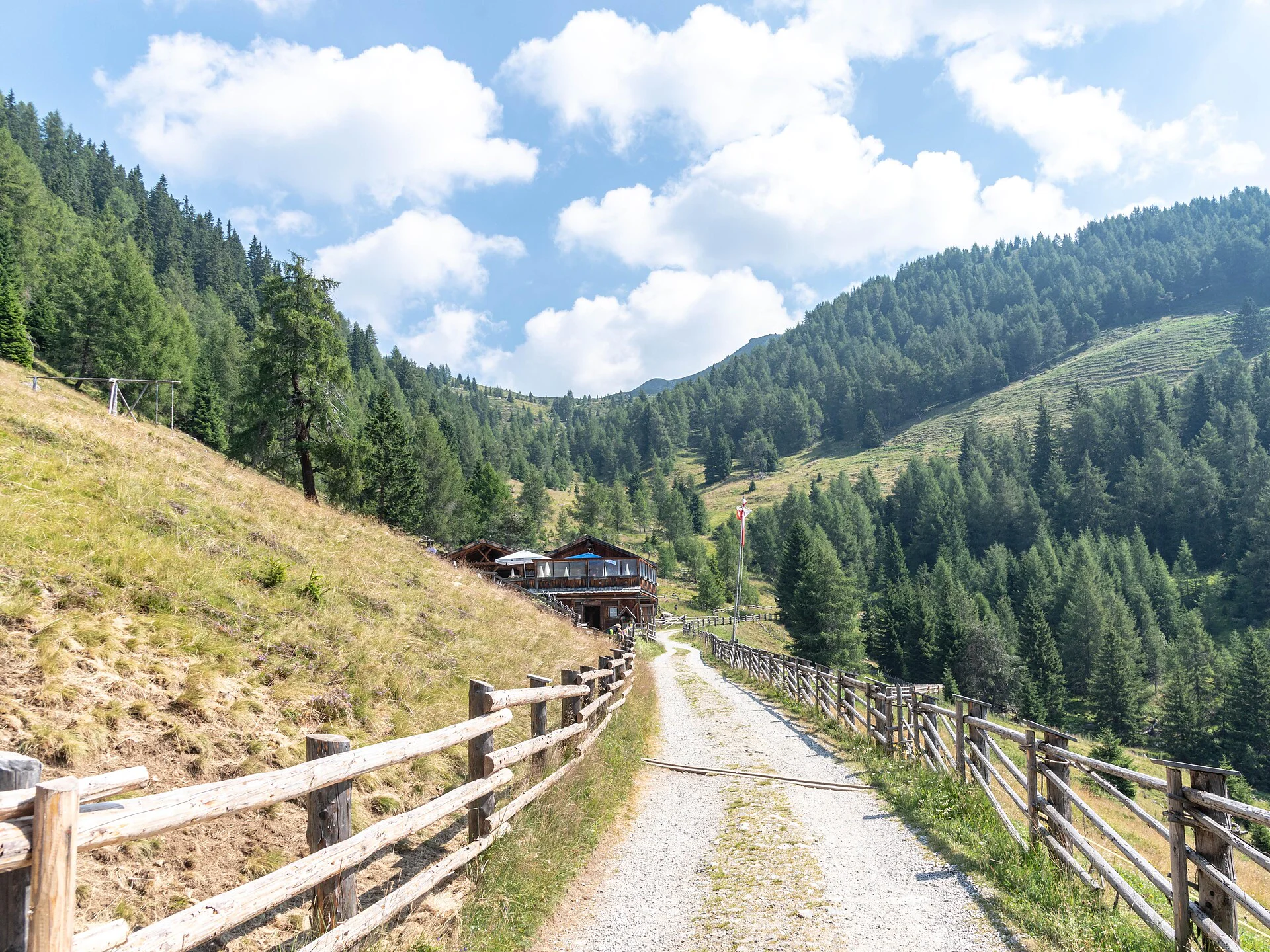
The hike to the Moarhof Alm in Hofern starts at the Gelenke parking lot. From there, follow the "Murmeltierweg" trail, which takes you to the alpine hut in about one hour. This hike involves an elevation gain of approximately 240 meters. The path is pleasant and leads through a picturesque landscape of meadows and forests, with occasional views of the surrounding mountains. The Murmeltierweg trail is well-marked and particularly popular with families due to its ease and the interesting glimpses of nature it offers. Once you reach the Moarhof Alm, you can enjoy local specialties and soak in the relaxing atmosphere of the hut.
Coming from Innsbruck/Brenner (A): Drive on the Highway of Brenner (A22) until the exit Brixen/Pustertal, then go on along the SS49-E66 for about 50kms until you arrive in Olang/Valdaora.
Coming from Lienz (A): You can reach us also padding by Lienz in Westtyrol (A). You have to cross the Austrian-Italian border between Ahrnbach and Winnebach (B100-E66) and drive on the SS46-E66 until Olang/Valdaora
Coming from Bozen: Highway of Brenner (A22) until the exit Brixen/Pustertal, then go on along the SS49-E66 for about 50kms until you arrive in Olang/Valdaora.

Thank you for signing up!
You are already subscribed
Confirm your registration
To complete your subscription, open the email we just sent you and click on the confirmation link.
Can’t find it? Check your spam folder too.
We noticed that you are already subscribed to our Newsletter. We will update you on exclusive offers, fun adventures and more so you can make the best out of your vacation.
We noticed that you already tried to subscribe to our Newsletter in the past but didn’t confirmed the subscription. We have resent you an email now, please check your inbox and spam folder to confirm.