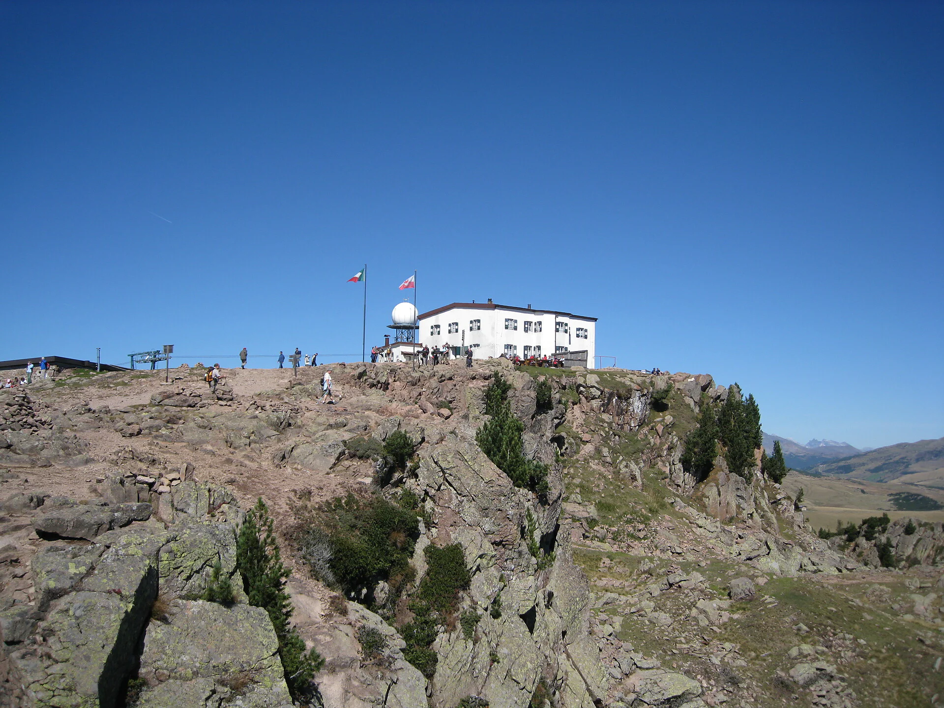
The high-level hike begins at the Schwarzseespitze peak, the mountain station of the Rittnerhorn cable car. The highlight of the tour is a fascinating panorama of the Dolomites, including more than 40 peaks of over 3,000 m which can be seen in good visibility. Arolla and mountain pine trees are features of this tour.
Route: follow trail no. 19 on the panoramic trail (Panoramaweg) to the Runder Tisch viewpoint. Continue to the Unterhorn inn and on trail no. 15 via the Barbianer Almen Alpine pastures to the mountain pine distillery (Latschenölbrennerei). Continue on trail no. 4 past the mystical Pfannenstiel and up to the Rittnerhorn mountain. Take trail no. 2 downhill across the Rittner Almwiesen meadows onto the Heusteig trail. Rustic benches and the lapping of water in wooden troughs invite hikers to take a rest. Trail no. 2A joins trail no. 19 which ends at the cable car station. Walking time: approx. 6 hours. Alternative route via the Rittnerhorn mountain on trail no. 1 to the Unterhorn inn: approx. 4 hours.
Route: follow trail no. 19 on the panoramic trail (Panoramaweg) to the Runder Tisch viewpoint. Continue to the Unterhorn inn and on trail no. 15 via the Barbianer Almen Alpine pastures to the mountain pine distillery (Latschenölbrennerei). Continue on trail no. 4 past the mystical Pfannenstiel and up to the Rittnerhorn mountain. Take trail no. 2 downhill across the Rittner Almwiesen meadows onto the Heusteig trail. Rustic benches and the lapping of water in wooden troughs invite hikers to take a rest. Trail no. 2A joins trail no. 19 which ends at the cable car station. Walking time: approx. 6 hours. Alternative route via the Rittnerhorn mountain on trail no. 1 to the Unterhorn inn: approx. 4 hours.
Getting there from Bolzano/Bozen:
By car: from Munich in approximately 3,5 hours via the motorway (Rosenheim-Kufstein-Innsbruck-Brenner) until you come to the motorway exitz Bolzano/Bozen NORD. Take this exit, drive in the direction of Bolzano and toward the Renon/Ritten mountain.
By train: On the Munich-Innsbruck_Verona line to Bolzano wehre alal trains stop. Bus stop near the train station, whrere buses 165 go to Collalbo/Renon. Or walk 10 minutes to the start of ropeways to Soprabolzano/Renon. The ropeway goes in only 12 minutes to Soprabolzano/Renon. There starts the Renon railway every half hour and after 18 minutes you arrive to Collalbo/Renon. The bus 166 starte under the station Collalbo on 9:08, 10:08, 11:08, 12:08, 14:08, 15:08 an 16:08 to the starte of the cablecar Corno del Renon.

To complete your subscription, open the email we just sent you and click on the confirmation link.
Can’t find it? Check your spam folder too.