The Speikboden is more than just a favorite ski area. It is also an ideal hiking area. The mountain got its name from a little flower that grows in the high mountains – Alpine valerian, or “Speik” in German – and that is in fact because this lovely flower is often found in the hiking area.
With the cable cars you can reach the "Speikboden Alm" at 2000 metres of altitude or the Sonnklar mountain at 2400 metres above sea level. Both are starting points for fantastic walks and hikes along well maintained trails. Particularly popular are the sunrise walks - to spot the first sunrays while the valley still lies in darkness is a memorable experience.
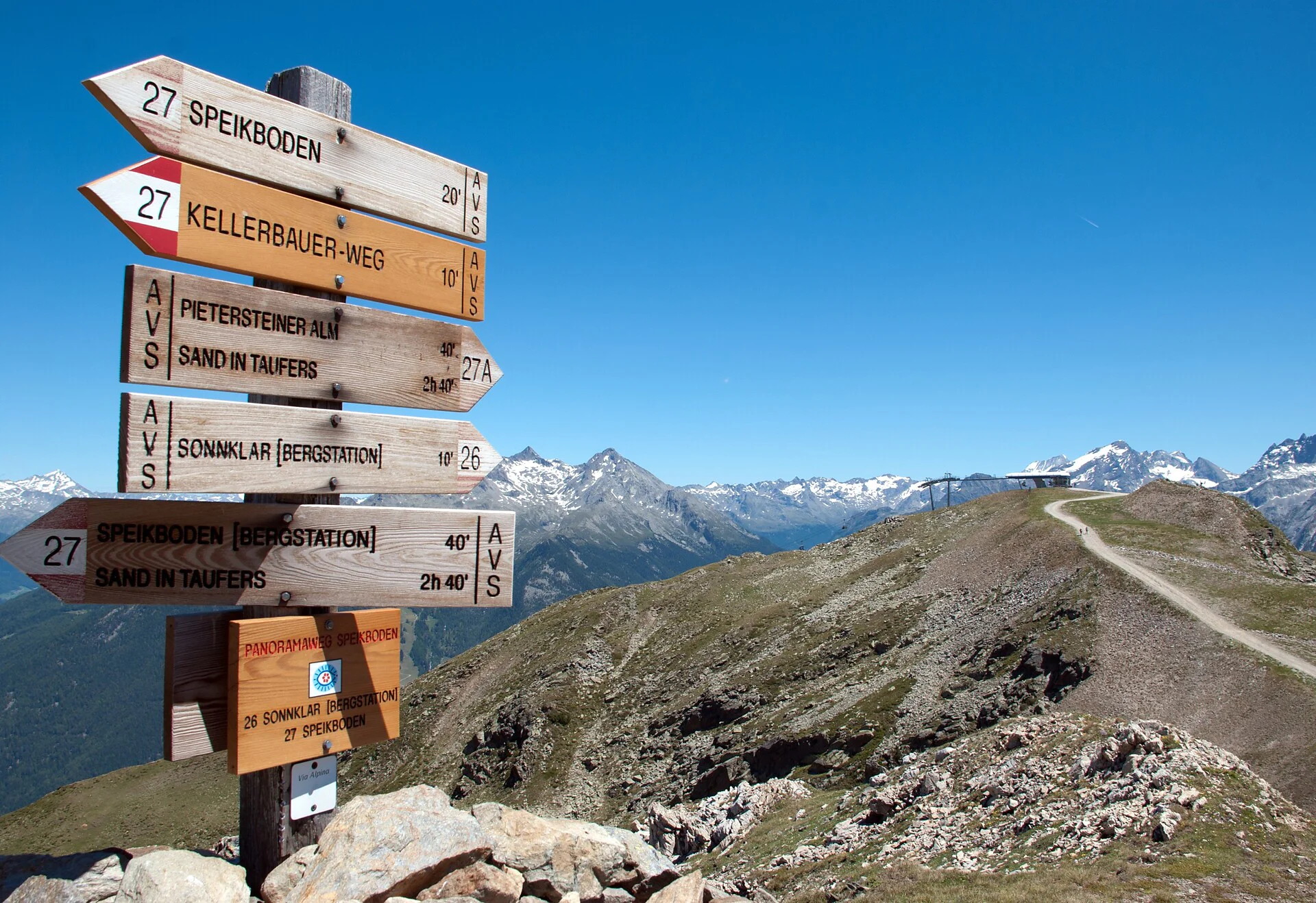
Daimerweg [trail] – Kellerbauerweg [trail] – Mühlwalder Jöchl [yoke] – Mitterberg Alm [alpine hut] – Weißenbach.
Using the cable car Speikboden to reach an altitude of 2000m. Use the trail "Daimerweg" (n. 27) and from the ridge the trail "Kellerbauerweg" (n. 27) to reach the yoke Mühlwalder Jöchl. At this way it is possible to go the summit of Speikboden too. At the yoke go to the right at the trail n. 28 to reach the hut Mitterberg Alm (no service) and the village Weißenbach. From Weißenbach you can take the regular bus at 4 or 6 pm to go back to the valley station of Speikboden.
Alternatively you can use the chair lift Sonnklar to ascent from 2000m to 2400m.
Numbers of paths: 27, 28.
Unique panoramic view on the entire Zillertaler Alps, Durreck- und Rieserferner group und the Dolomites, among others the Drei Zinnen.
Walking time: 3h 30 min, Distance: 8.68 km, Ascent: 481 m, Descent: 1104 m, Difficulty: easy.
Speikboden Cableways

To complete your subscription, open the email we just sent you and click on the confirmation link.
Can’t find it? Check your spam folder too.