An extremely varied and demanding high-altitude trail that crosses rock faces in the southern part. Starting in Laives/Leifers, the trail takes you to the Flavon Castle in Bolzano/Bozen.
Change of path along the hike: 12, 3
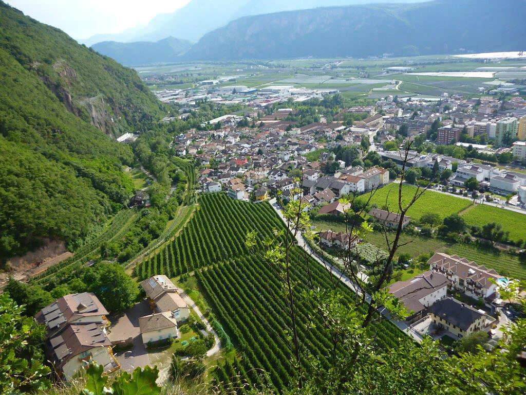
From the centre of Laives/Leifers, at the crossroads, you walk along Via Pietralba for about 4 km into the Brantental valley until you cross the river and reach the refreshment point "Schwobmiel". Until here the road is paved. From there, path no. 12 climbs steeply northwards until after 10 minutes you reach the "Schwabhof" inn (approx. 700m). After a short ascent, a partly narrow but well-secured path leads through the sunny porphyry walls of the Brantental valley. After approx. 1 hour you reach a magnificent vantage point, where the view covers the entire Val d'Adige/Etschtal valley. From there a wide path, shaded by chestnut trees, leads past the farms "Hocheggerhof", on to the "Brunnerhof" and then to the "Steinerhöfe", a double farm with chapel. The walk from the "Schwabhof" inn to here takes about 2 hours.
Alternatively, it is possible to follow path no. 11 from the "Steinerhöfe" and get back to Laives/Leifers in about 1 hour.
Continue on path no. 12, below the "Alplerhof" farm, along the forest road to the "Altebnerhof" farm, then on to the Rechtebner inn and to La Costa/Seit (868m). The walk from the "Steinerhöfe" to here takes about 1.5 hours. Path no. 3 begins below the small chapel in La Costa/Seit and it takes approx. 1 hour to reach the Flavon Castle in Bolzano where you can stop for refreshments. In about 15 minutes you reach Aslago/Haslach from where you can take the bus (line 110) to get back to Laives/Leifers.
Surefootedness and a good head for heights are a prerequisite, as some parts of the high altitute trail are somewhat exposed (secured by steel cables).
We recommend to wear sturdy walking shoes.
Arrival by public transport from Bolzano/Bozen: by bus with the lines 110, 111 or 112 until the bus stop "Laives Centro/Leifers Zentrum" (approx. 30 min.).
Arrival by public transport from the south: take bus line 120 to the bus stop "Laives Centro/Leifers Zentrum".

To complete your subscription, open the email we just sent you and click on the confirmation link.
Can’t find it? Check your spam folder too.