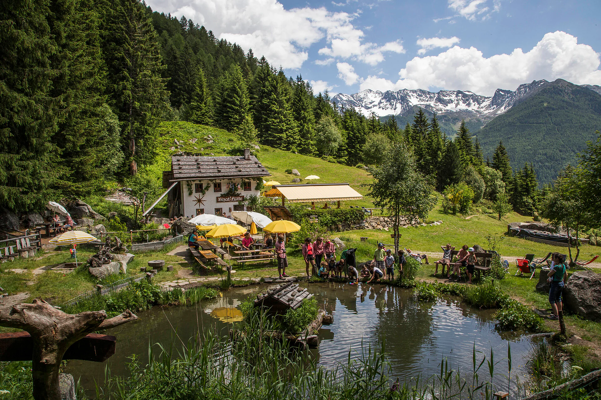
The family-friendly hut Bizat Hütte lies at 1.416 m above St. Johann/San Giovanni and can also be reached with a baby stroller.
- St. Johann/San Giovanni (church), path n. 8 and 18
- Mühlegg/Costa Molini (Hotel Gallhaus) - street
- Mühlegg/Costa Molini (Hotel Alpin Royal) n. 18 - waterfalls Frankbach
- Steinhaus/Cadipietra (Hotel Amonti) n. 8 and 18
- St. Jakob/San Giacomo (church) n. 12 sun path
Sustainable with the public transport
By bus (line 450) to St. Johann/San Giovanni, to the bus stop Steinpent
By bus (line 450) to St. Johann/San Giovanni, to the bus stop Mühlegg
By bus (line 450) to Steinhaus/Cadipietra, to the bus stop Klausberg
By bus (line 450) to St. Jakob/San Giacomo, to the bus stop Garber
By car
Bruneck/Brunico - St. Johann/San Giovanni - 23 km / - Steinhaus/Cadipietra - 27 km / St. Jakob/San Giacomo - 29
Kasern/Casere - St. Johann/San Giovanni - 17 km / - Steinhaus/Cadipietra - 14 km / - St. Jakob/San Giacomo - 12 km
Parking
Mühlegg/Costa Molini, next to the Hotel Molin
Steinhaus/Cadipietra, cable way station Klausberg
St. Jakob/San Giacomo, church
Route to Mühlegg/Costa Molini parking Bizat:
Google Maps
Route to Klausberg:
Google Maps
Route to St. Jakob/S. Giacomo:
Google Maps

To complete your subscription, open the email we just sent you and click on the confirmation link.
Can’t find it? Check your spam folder too.