Südtirol Guide App Logo
Skip to content

added to favourites

removed from favourites

Oops! Something went wrong. Try again

Your account is being created

Your account has been successfully created and you are now logged in

You’ve been logged in successfully!

Your account was created successfully, but we couldn't log you in automatically

You are logged out.

Hiking

Spronser Lakes Circuit – Route from Vellau

Algund/Lagundo, Meran/Merano and environs
Challenging alpine circuit to the Spronser Lakes via Hochgangscharte and Taufenscharte, returning to Leiter Alm mountain hut. Spectacular high-mountain scenery guaranteed.
from center

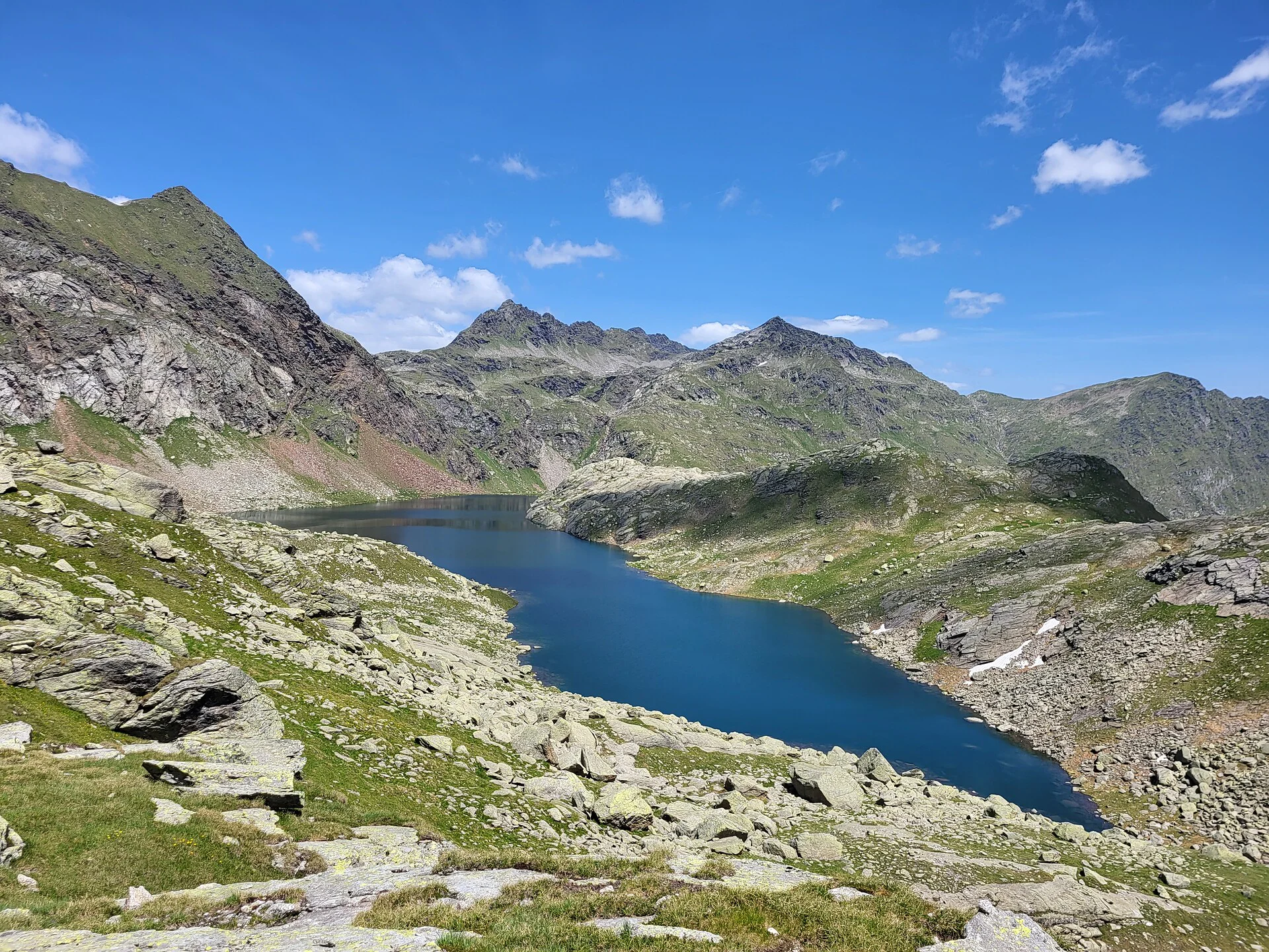
The Spronser Lakes form the heart of the Texel Group Nature Park and represent South Tyrol’s highest alpine lake plateau, shaped by glacial activity. Ten lakes lie between 2,117 and 2,589 metres above sea level.

This demanding circular hike leads through high alpine terrain with dramatic passes, traditional mountain huts and breathtaking lake scenery. Sure-footedness and a head for heights are required.

Itinerary

Starting point

Leiter Alm mountain hut (approx. 1,552 m)

End point

Leiter Alm mountain hut

Leiter Alm mountain hut – Hochganghaus mountain hut – Hochgangscharte – Spronser Lakes – Oberkaser mountain hut– Pfitscher Schartl – Taufenscharte – Leiter Alm mountain hut

From Leiter Alm mountain hut, follow the Merano High Mountain Trail Nr. 24 to the Hochganghaus mountain hut (1,839 m). Here turn right onto trail 7 and climb steeply to the Hochgangscharte (2,441 m) – an exposed section suitable only for experienced hikers.

From the pass continue towards the Spronser Lakes (short detour possible to the Milchseen), then along the Langsee lake to the Grünsee lake.

Descend on trail 6 into the Spronser valley to the Oberkaser mountain hut(2,131 m). Turn right onto trail 22, passing the Mückenlacke lake and Pfitscherlacke lake , then climb moderately to the Taufenscharte (2,230 m).

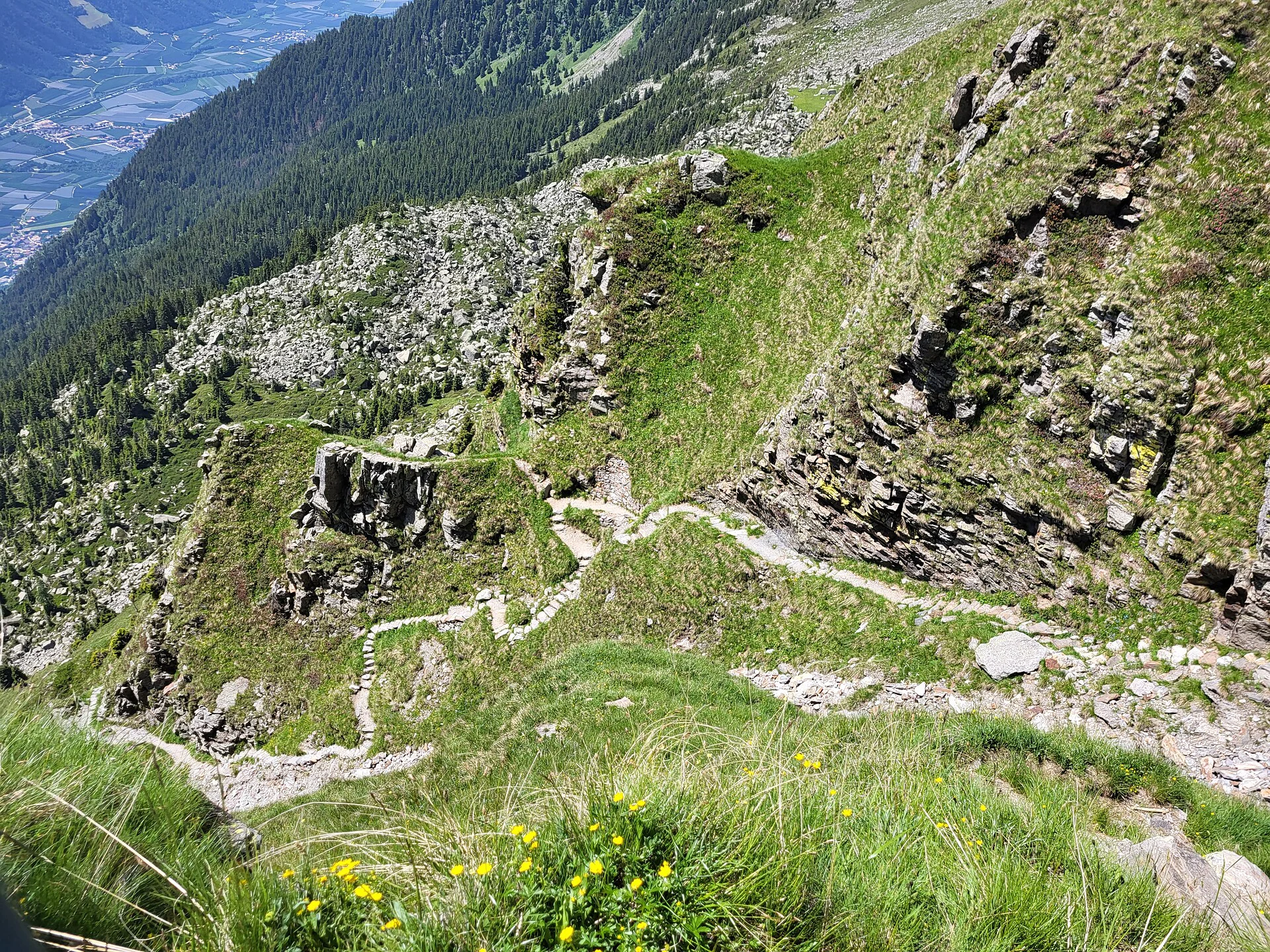
A steep descent with switchbacks leads back down to Leiter Alm, completing the circuit.

Sure-footedness and a head for heights are essential.

Did you know?

At the Pfitscher Schartl (approx. 2,130 m), located shortly after the Pfitscherlacke lake near Oberkaser mountain hut, hikers pass through a unique Bronze Age cult site.

In 1933, painter Josef Tscholl discovered more than 1,300 cup marks on 40 stone slabs, some arranged within the remains of a pentagon-shaped stone structure.

Particularly well known are:

  • the Cult Stone (169 cup marks)
  • the Sun Stone (186 cup marks, especially striking in morning light)
  • the Star Stone, whose markings may have astronomical significance

Their exact meaning remains uncertain. They may have served ritual purposes, been offering sites or even early astronomical calendars.

Distance 13.4 Km
Duration 6h:25 min
Elevation gain 1113 m
Elevation loss 1114 m
Highest point 2482 m
Lowest point 1517 m
Details
Directions

The starting points of our hiking tours can be reached comfortably and in an environmentally friendly way by bus and train. With the South Tyrol Guest Pass, all public transport throughout South Tyrol can be used free of charge – no need to search for parking. Tip: timetables and connections are available at www.suedtirolmobil.info.

Parking

Parking options in Partschins are limited. In order to protect the local natural area and support sustainable travel, we recommend using public transport. Thank you for helping to protect this area!

Accommodation image
Finish your booking for
Accommodation name
0  room rooms Not selected No board Breakfast Half board Full board All inclusive
Total price: 0 €
(incl. VAT / excl. local tourism tax)