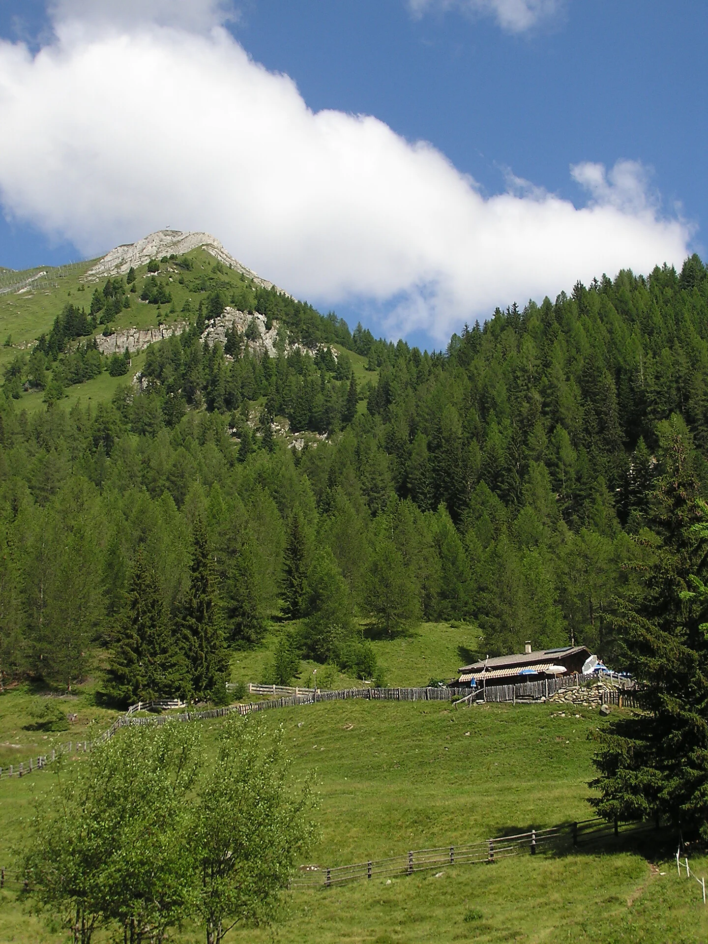
„Nomen est omen“ - Schönberg is like a pulpit offering a great view in a low mountain range between the peaks of Turnerkamp and Schwarzenstein. Beautiful is the sight of these two higher mountains, beautiful is the path to the alpine pasture, beautiful is the summit and beautiful is the panoramic view of the Ahrntal valley reaching to the Dolomites in the distance. Schönberg is situated at the southernmost point of a lateral mountain range dividing the Schwarzbach and the Mitterbach valleys. Another mountain which is well seen from the peak and is situated a bit higher above in the north is called Schafbretter, a perfect name disclosing the true form of the mountain, which looks like boards descending down to the timber line. Because of the danger of avalanches, mighty barriers were installed above the Schönbergalm.
In the centre of Weißenbach/Rio Bianco, behind Gasthof Mösenhof, we drive up the road leading to the Bruneggerhof (1,429 m; small car park) where the road ends. We hike along the nr. 5 forest road and, after several turns, we reach the Schönbergalm (1,792 m; walking time about one hour). Leaving the pasture behind us, we follow the forest road to its end, from there a narrow path leads to the Oberhütten (2,164 m); now we keep on the right-hand side heading east and we cross some rocky terrain to reach the Schönberg summit (2,273 m). The top of the mountain is rather exposed so this hike requires sure footedness. Take the same route back.
Sustainable with the public transport
By bus (line 454) to Weißenbach/Rio Bianco, to the bus stop Kirche
By car
Bruneck/Brunico - Weißenbach/Rio Bianco - 25 km
Kasern/Casere - Weißenbach/Rio Bianco - 27 km
Parking
Weißenbach/Rio Bianco, car park after Bruneggerhof
Route:
Google Maps

To complete your subscription, open the email we just sent you and click on the confirmation link.
Can’t find it? Check your spam folder too.