
Sport centre - Pfösl
Nova Ponente Centro/Deutschnofen Dorf, Deutschnofen/Nova Ponente, Dolomites Region Eggental
easy
Moeilijkheidsgraad
38 m
Hoogteverschil
0h:00 min
Duur
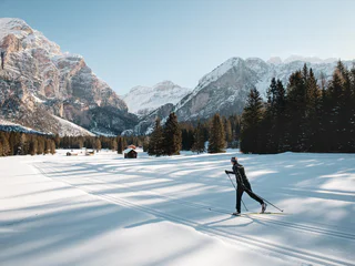
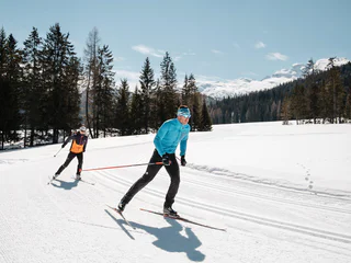
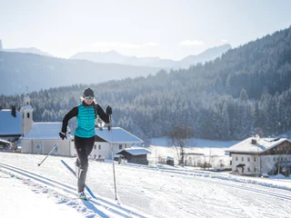
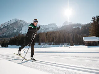
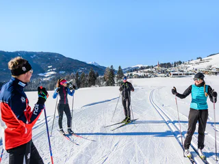
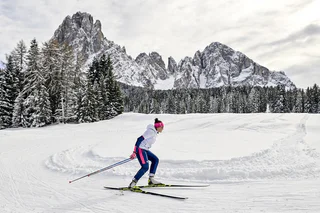
Met haar 1800 kilometer aan loipes is Zuid-Tirol een waar langlaufparadijs. Kies voor Dolomiti NordicSki (het grootste langlaufnetwerk van Europa) of voor nordic³ in het westen. Het gezamenlijke loipenetwerk is geschikt voor het hele gezin, maar omvat ook afgelegen paden, hoogteloipes met spectaculaire uitzichten en verlichte loipes van elke moeilijkheidsgraad.
Nova Ponente Centro/Deutschnofen Dorf, Deutschnofen/Nova Ponente, Dolomites Region Eggental
easy
Moeilijkheidsgraad
38 m
Hoogteverschil
0h:00 min
Duur
1/5
San Cassiano/San Cassiano, Badia, Dolomites Region Alta Badia
easy
Moeilijkheidsgraad
29 m
Hoogteverschil
0h:00 min
Duur
Villabassa/Niederdorf, Prags/Braies, Dolomites Region 3 Zinnen
easy
Moeilijkheidsgraad
28 m
Hoogteverschil
0h:00 min
Duur
1/3
Ridanna/Ridnaun, Ratschings/Racines, Sterzing/Vipiteno and environs
easy
Moeilijkheidsgraad
0 m
Hoogteverschil
0h:00 min
Duur
Gandelle-Franadega-Fienili/Kandellen-Frondeigen-Stadlern, Toblach/Dobbiaco, Dolomites Region 3 Zinnen
difficult
Moeilijkheidsgraad
95 m
Hoogteverschil
0h:00 min
Duur
Alpe di Siusi/Seiseralm, Kastelruth/Castelrotto, Dolomites Region Seiser Alm
easy
Moeilijkheidsgraad
154 m
Hoogteverschil
0h:00 min
Duur
Aldino/Aldein, Aldein/Aldino
difficult
Moeilijkheidsgraad
118 m
Hoogteverschil
0h:00 min
Duur
Gandelle-Franadega-Fienili/Kandellen-Frondeigen-Stadlern, Toblach/Dobbiaco, Dolomites Region 3 Zinnen
difficult
Moeilijkheidsgraad
147 m
Hoogteverschil
0h:00 min
Duur
Nove Case/Neunhäusern, Rasen-Antholz/Rasun Anterselva, Dolomites Region Kronplatz/Plan de Corones
easy
Moeilijkheidsgraad
33 m
Hoogteverschil
0h:00 min
Duur
Braies di Fuori/Ausserprags, Prags/Braies, Dolomites Region 3 Zinnen
difficult
Moeilijkheidsgraad
246 m
Hoogteverschil
0h:00 min
Duur
Aldino/Aldein, Aldein/Aldino
medium
Moeilijkheidsgraad
57 m
Hoogteverschil
0h:00 min
Duur
Braies di Fuori/Ausserprags, Prags/Braies, Dolomites Region 3 Zinnen
easy
Moeilijkheidsgraad
38 m
Hoogteverschil
0h:00 min
Duur
1/2
S. Maddalena/St. Magdalena - Funes/Villnöss, Villnöss/Funes, Dolomites Region Lüsen Villnöss
easy
Moeilijkheidsgraad
0 m
Hoogteverschil
0h:00 min
Duur
Vallelunga/Langtaufers, Graun im Vinschgau/Curon Venosta, Vinschgau/Val Venosta
medium
Moeilijkheidsgraad
153 m
Hoogteverschil
0h:00 min
Duur
1/15
S.Cristina Gherdëina/S.Cristina Val Gardena/S.Cristina Gherdëina/St.Christina in Gröden, S.Crestina Gherdëina/Santa Cristina Val Gardana, Dolomites Region Val Gardena
difficult
Moeilijkheidsgraad
254 m
Hoogteverschil
0h:00 min
Duur
Anterselva di Sopra/Antholz-Obertal, Rasen-Antholz/Rasun Anterselva, Dolomites Region Kronplatz/Plan de Corones
difficult
Moeilijkheidsgraad
75 m
Hoogteverschil
0h:00 min
Duur
1/4
San Cassiano/San Cassiano, Badia, Dolomites Region Alta Badia
medium
Moeilijkheidsgraad
42 m
Hoogteverschil
0h:00 min
Duur
Anterselva di Sopra/Antholz-Obertal, Rasen-Antholz/Rasun Anterselva, Dolomites Region Kronplatz/Plan de Corones
medium
Moeilijkheidsgraad
31 m
Hoogteverschil
0h:00 min
Duur
Martello/Martell, Martell/Martello, Vinschgau/Val Venosta
medium
Moeilijkheidsgraad
27 m
Hoogteverschil
0h:00 min
Duur
1/16
Tesido/Taisten, Welsberg-Taisten/Monguelfo-Tesido
easy
Moeilijkheidsgraad
648 m
Hoogteverschil
0h:00 min
Duur
Obereggen/Obereggen
easy
Moeilijkheidsgraad
10 m
Hoogteverschil
0h:00 min
Duur
Gandelle-Franadega-Fienili/Kandellen-Frondeigen-Stadlern, Toblach/Dobbiaco, Dolomites Region 3 Zinnen
easy
Moeilijkheidsgraad
76 m
Hoogteverschil
0h:00 min
Duur
1/15
S.Cristina Gherdëina/S.Cristina Val Gardena/S.Cristina Gherdëina/St.Christina in Gröden, S.Crestina Gherdëina/Santa Cristina Val Gardana, Dolomites Region Val Gardena
easy
Moeilijkheidsgraad
65 m
Hoogteverschil
0h:00 min
Duur
Alpe di Siusi/Seiseralm, Kastelruth/Castelrotto, Dolomites Region Seiser Alm
easy
Moeilijkheidsgraad
39 m
Hoogteverschil
0h:00 min
Duur
Anterselva di Sopra/Antholz-Obertal, Rasen-Antholz/Rasun Anterselva, Dolomites Region Kronplatz/Plan de Corones
easy
Moeilijkheidsgraad
19 m
Hoogteverschil
0h:00 min
Duur
Alpe di Siusi/Seiseralm, Kastelruth/Castelrotto, Dolomites Region Seiser Alm
easy
Moeilijkheidsgraad
30 m
Hoogteverschil
0h:00 min
Duur
1/2
San Cassiano/San Cassiano, Badia, Dolomites Region Alta Badia
difficult
Moeilijkheidsgraad
83 m
Hoogteverschil
0h:00 min
Duur
1/4
Tesido/Taisten, Welsberg-Taisten/Monguelfo-Tesido
easy
Moeilijkheidsgraad
23 m
Hoogteverschil
0h:00 min
Duur
Obereggen/Obereggen
medium
Moeilijkheidsgraad
0 m
Hoogteverschil
0h:00 min
Duur
1/14
S.Cristina Gherdëina/S.Cristina Val Gardena/S.Cristina Gherdëina/St.Christina in Gröden, S.Crestina Gherdëina/Santa Cristina Val Gardana, Dolomites Region Val Gardena
easy
Moeilijkheidsgraad
69 m
Hoogteverschil
0h:00 min
Duur
Bedankt voor je inschrijving!
Inschrijving al actief
Bevestig je inschrijving
Om je inschrijving te voltooien, open de e-mail die we je net hebben gestuurd en klik op de bevestigingslink.
Niet gevonden? Kijk ook even in je spammap.
We hebben gezien dat je je probeerde aan te melden voor de nieuwsbrief, maar je e-mailadres is al geregistreerd. Je blijft onze aanbiedingen, tips en inspiratie voor je vakantie ontvangen.
Je hebt je al geprobeerd in te schrijven voor onze nieuwsbrief maar deze nog niet bevestigd. We hebben je de e‑mail zojuist opnieuw gestuurd. Controleer je inbox en je spammap en bevestig nu.


