1/4
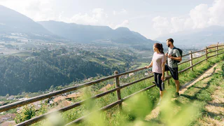
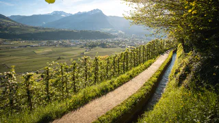
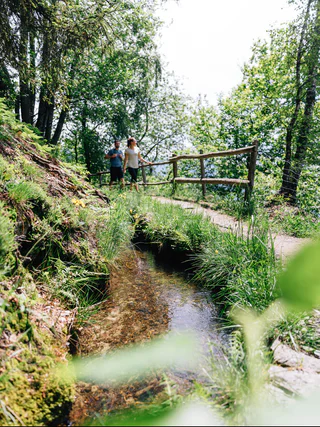
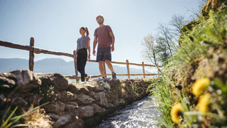
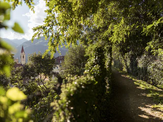
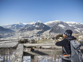
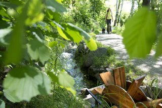
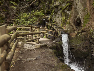
Riffianer Waalweg Trail
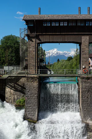
Rifiano/Riffian, Riffian/Rifiano, Meran/Merano and environs
easy
Moeilijkheidsgraad
239 m
Hoogteverschil
1h:18 min
Duur
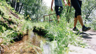
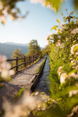
De Waalwege zijn toegankelijke en makkelijke wandelpaden die je langs de historische irrigatiekanalen van Zuid-Tirol leiden. Deze laagdrempelige wandelroutes zijn ideaal voor wandelaars van alle leeftijden, het hele jaar door. De meeste Waalwegen vind je in Val Venosta / Vinschgau en rond Merano / Meran. Deze kanaalpaden worden gekenmerkt door de lichte hellingen en het adembenemende uitzicht op de omliggende bergen en de Dolomieten. Wandelen langs het water van de Waalwege zorgt elk seizoen opnieuw voor een onvergetelijke ervaring in de Italiaanse bergen.
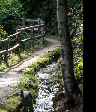
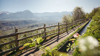
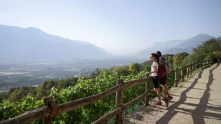
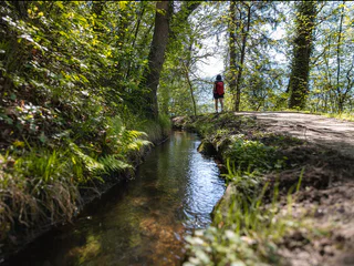
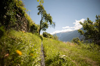
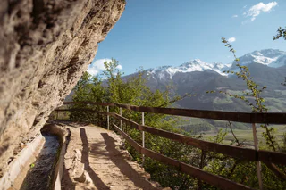
1/4
Rifiano/Riffian, Riffian/Rifiano, Meran/Merano and environs
easy
Moeilijkheidsgraad
239 m
Hoogteverschil
1h:18 min
Duur
1/7
Parcines/Partschins, Partschins/Parcines, Meran/Merano and environs
easy
Moeilijkheidsgraad
223 m
Hoogteverschil
2h:00 min
Duur

Ganda/Gand - Martello/Martell, Martell/Martello, Vinschgau/Val Venosta
easy
Moeilijkheidsgraad
215 m
Hoogteverschil
1h:15 min
Duur
1/3
Lana di Sotto/Niederlana, Lana, Meran/Merano and environs
easy
Moeilijkheidsgraad
458 m
Hoogteverschil
3h:12 min
Duur
1/4
Lana di Sotto/Niederlana, Lana, Meran/Merano and environs
easy
Moeilijkheidsgraad
287 m
Hoogteverschil
2h:00 min
Duur
1/3
Marlengo/Marling, Marling/Marlengo, Meran/Merano and environs
easy
Moeilijkheidsgraad
220 m
Hoogteverschil
2h:00 min
Duur

1/5
Naturno/Naturns, Naturns/Naturno, Meran/Merano and environs
medium
Moeilijkheidsgraad
235 m
Hoogteverschil
2h:25 min
Duur
1/4
Caines/Kuens, Kuens/Caines, Meran/Merano and environs
medium
Moeilijkheidsgraad
414 m
Hoogteverschil
2h:04 min
Duur
1/3
Marlengo/Marling, Marling/Marlengo, Meran/Merano and environs
medium
Moeilijkheidsgraad
515 m
Hoogteverschil
3h:45 min
Duur
1/2
Tarces/Tartsch
easy
Moeilijkheidsgraad
30 m
Hoogteverschil
1h:30 min
Duur
1/4
Scena/Schenna, Schenna/Scena, Meran/Merano and environs
easy
Moeilijkheidsgraad
320 m
Hoogteverschil
2h:00 min
Duur
1/4
Sorgente/Quellenhof, Schenna/Scena, Meran/Merano and environs
easy
Moeilijkheidsgraad
260 m
Hoogteverschil
1h:40 min
Duur
1/2
Silandro/Schlanders, Schlanders/Silandro, Vinschgau/Val Venosta
medium
Moeilijkheidsgraad
300 m
Hoogteverschil
1h:06 min
Duur
Lagundo/Algund, Algund/Lagundo, Meran/Merano and environs
easy
Moeilijkheidsgraad
506 m
Hoogteverschil
3h:30 min
Duur
1/6
Monte di Tramontana/Nördersberg, Schlanders/Silandro, Vinschgau/Val Venosta
easy
Moeilijkheidsgraad
150 m
Hoogteverschil
1h:03 min
Duur
1/8
Rablà/Rabland, Partschins/Parcines, Meran/Merano and environs
easy
Moeilijkheidsgraad
83 m
Hoogteverschil
0h:49 min
Duur
Tablà/Tabland - Naturno/Naturns, Naturns/Naturno, Vinschgau/Val Venosta
easy
Moeilijkheidsgraad
160 m
Hoogteverschil
2h:00 min
Duur
1/3
Saltusio/Saltaus, St.Martin in Passeier/San Martino in Passiria, Meran/Merano and environs
easy
Moeilijkheidsgraad
46 m
Hoogteverschil
2h:30 min
Duur
1/4
Lagundo/Algund, Algund/Lagundo, Meran/Merano and environs
easy
Moeilijkheidsgraad
252 m
Hoogteverschil
2h:58 min
Duur

1/3
Marlengo/Marling, Marling/Marlengo, Meran/Merano and environs
medium
Moeilijkheidsgraad
878 m
Hoogteverschil
4h:30 min
Duur
Morter/Morter, Latsch/Laces, Vinschgau/Val Venosta
easy
Moeilijkheidsgraad
292 m
Hoogteverschil
2h:47 min
Duur
Laces/Latsch, Kastelbell-Tschars/Castelbello-Ciardes, Vinschgau/Val Venosta
easy
Moeilijkheidsgraad
65 m
Hoogteverschil
1h:30 min
Duur
1/4
Malles/Mals, Mals/Malles, Vinschgau/Val Venosta
medium
Moeilijkheidsgraad
392 m
Hoogteverschil
5h:00 min
Duur
1/2
Sluderno/Schluderns, Schluderns/Sluderno, Vinschgau/Val Venosta
easy
Moeilijkheidsgraad
290 m
Hoogteverschil
3h:00 min
Duur
Tarres/Tarsch, Latsch/Laces, Vinschgau/Val Venosta
medium
Moeilijkheidsgraad
493 m
Hoogteverschil
3h:32 min
Duur
Laces/Latsch, Latsch/Laces, Vinschgau/Val Venosta
easy
Moeilijkheidsgraad
0 m
Hoogteverschil
0h:54 min
Duur
1/4
Sorgente/Quellenhof, Riffian/Rifiano, Meran/Merano and environs
easy
Moeilijkheidsgraad
285 m
Hoogteverschil
2h:30 min
Duur
1/3
Marlengo/Marling, Marling/Marlengo, Meran/Merano and environs
easy
Moeilijkheidsgraad
195 m
Hoogteverschil
1h:30 min
Duur
1/3
Covelano/Göflan, Schlanders/Silandro, Vinschgau/Val Venosta
medium
Moeilijkheidsgraad
462 m
Hoogteverschil
2h:55 min
Duur
1/5
Montesole/Sonnenberg - Parcines/Partschins, Marling/Marlengo, Meran/Merano and environs
easy
Moeilijkheidsgraad
24 m
Hoogteverschil
3h:15 min
Duur
Bedankt voor je inschrijving!
Inschrijving al actief
Bevestig je inschrijving
Om je inschrijving te voltooien, open de e-mail die we je net hebben gestuurd en klik op de bevestigingslink.
Niet gevonden? Kijk ook even in je spammap.
We hebben gezien dat je je probeerde aan te melden voor de nieuwsbrief, maar je e-mailadres is al geregistreerd. Je blijft onze aanbiedingen, tips en inspiratie voor je vakantie ontvangen.
Je hebt je al geprobeerd in te schrijven voor onze nieuwsbrief maar deze nog niet bevestigd. We hebben je de e‑mail zojuist opnieuw gestuurd. Controleer je inbox en je spammap en bevestig nu.


