
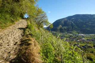
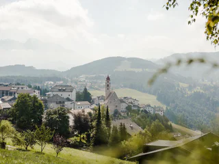
360° Alta Val Venosta: San Valentino a.M. - Reschen
Piavenna/Plawenn, Graun im Vinschgau/Curon Venosta, Vinschgau/Val Venosta
medium
Moeilijkheidsgraad
1010 m
Hoogteverschil
5h:42 min
Duur
Piavenna/Plawenn, Graun im Vinschgau/Curon Venosta, Vinschgau/Val Venosta
medium
Moeilijkheidsgraad
1010 m
Hoogteverschil
5h:42 min
Duur
San Vigilio, Badia, Dolomites Region Alta Badia
difficult
Moeilijkheidsgraad
3174 m
Hoogteverschil
17h:28 min
Duur
1/4
Radein/Redagno, Aldein/Aldino
difficult
Moeilijkheidsgraad
3700 m
Hoogteverschil
23h:04 min
Duur
1/2
Maso Corto/Kurzras, Mals/Malles, Vinschgau/Val Venosta
difficult
Moeilijkheidsgraad
1109 m
Hoogteverschil
5h:00 min
Duur
1/2
San Vigilio, Prags/Braies, Dolomites Region 3 Zinnen
medium
Moeilijkheidsgraad
1305 m
Hoogteverschil
6h:22 min
Duur
1/3
Anterselva di Mezzo/Antholz-Mittertal, Rasen-Antholz/Rasun Anterselva, Dolomites Region Kronplatz/Plan de Corones
medium
Moeilijkheidsgraad
716 m
Hoogteverschil
2h:13 min
Duur
Tubre/Taufers i. M., Mals/Malles, Vinschgau/Val Venosta
difficult
Moeilijkheidsgraad
918 m
Hoogteverschil
6h:00 min
Duur
1/3
Velloi/Vellau, Algund/Lagundo, Meran/Merano and environs
easy
Moeilijkheidsgraad
423 m
Hoogteverschil
3h:00 min
Duur
1/2
Mazia/Matsch, Mals/Malles, Vinschgau/Val Venosta
difficult
Moeilijkheidsgraad
388 m
Hoogteverschil
5h:30 min
Duur
1/2
Radein/Redagno, Aldein/Aldino
difficult
Moeilijkheidsgraad
3699 m
Hoogteverschil
23h:04 min
Duur
Passo Stelvio/Stilfserjoch, Stilfs/Stelvio, Vinschgau/Val Venosta
difficult
Moeilijkheidsgraad
1776 m
Hoogteverschil
8h:00 min
Duur
S. Maddalena/St. Magdalena - Casies/Gsies, Gsies/Valle di Casies
difficult
Moeilijkheidsgraad
1666 m
Hoogteverschil
8h:07 min
Duur
1/3
Tires/Tiers, Völs am Schlern/Fiè allo Sciliar, Dolomites Region Seiser Alm
difficult
Moeilijkheidsgraad
772 m
Hoogteverschil
6h:24 min
Duur
Luson/Lüsen, Villnöss/Funes, Dolomites Region Lüsen Villnöss
medium
Moeilijkheidsgraad
742 m
Hoogteverschil
4h:31 min
Duur
Velloi/Vellau, Marling/Marlengo, Meran/Merano and environs
medium
Moeilijkheidsgraad
459 m
Hoogteverschil
2h:16 min
Duur
1/2
Collepietra/Steinegg, Tiers am Rosengarten/Tires al Catinaccio, Dolomites Region Seiser Alm
medium
Moeilijkheidsgraad
1138 m
Hoogteverschil
5h:31 min
Duur
1/6
Passo Stelvio/Stilfserjoch, Stilfs/Stelvio, Vinschgau/Val Venosta
difficult
Moeilijkheidsgraad
8126 m
Hoogteverschil
55h:15 min
Duur
1/14
S.Cristina Gherdëina/S.Cristina Val Gardena/S.Cristina Gherdëina/St.Christina in Gröden, Sëlva/Selva di Val Gardena, Dolomites Region Val Gardena
difficult
Moeilijkheidsgraad
3627 m
Hoogteverschil
8h:00 min
Duur
1/2
Vallesina/Versein, Mölten/Meltina, Bolzano/Bozen and environs
medium
Moeilijkheidsgraad
722 m
Hoogteverschil
4h:54 min
Duur
Malles/Mals, Mals/Malles, Vinschgau/Val Venosta
medium
Moeilijkheidsgraad
5 m
Hoogteverschil
5h:00 min
Duur
Laghetti/Laag, Montan/Montagna, Alto Adige Wine Road
medium
Moeilijkheidsgraad
376 m
Hoogteverschil
3h:28 min
Duur
1/4
Deutschnofen Dorf/Nova Ponente Centro, Deutschnofen/Nova Ponente, Dolomites Region Eggental
medium
Moeilijkheidsgraad
591 m
Hoogteverschil
3h:40 min
Duur
1/4
Falzeben/Falzeben, Hafling/Avelengo, Meran/Merano and environs
difficult
Moeilijkheidsgraad
1300 m
Hoogteverschil
5h:30 min
Duur
Predoi/Prettau, Prettau/Predoi, Ahrntal/Valle Aurina
difficult
Moeilijkheidsgraad
1659 m
Hoogteverschil
9h:09 min
Duur
1/5
Selva/Sëlva/Wolkenstein/Sëlva, Sëlva/Selva di Val Gardena, Dolomites Region Val Gardena
medium
Moeilijkheidsgraad
878 m
Hoogteverschil
3h:37 min
Duur
Altrei/Anterivo
medium
Moeilijkheidsgraad
429 m
Hoogteverschil
2h:55 min
Duur
1/4
Vellau/Velloi, Algund/Lagundo, Meran/Merano and environs
difficult
Moeilijkheidsgraad
2431 m
Hoogteverschil
8h:58 min
Duur
Passo Stelvio/Stilfserjoch, Stilfs/Stelvio, Vinschgau/Val Venosta
difficult
Moeilijkheidsgraad
898 m
Hoogteverschil
8h:30 min
Duur
S. Martino al Monte/St. Martin - Laces/Latsch, Latsch/Laces, Vinschgau/Val Venosta
difficult
Moeilijkheidsgraad
1300 m
Hoogteverschil
8h:00 min
Duur
Gomagoi/Gomagoi, Stilfs/Stelvio, Vinschgau/Val Venosta
difficult
Moeilijkheidsgraad
323 m
Hoogteverschil
3h:00 min
Duur
Bedankt voor je inschrijving!
Inschrijving al actief
Bevestig je inschrijving
Om je inschrijving te voltooien, open de e-mail die we je net hebben gestuurd en klik op de bevestigingslink.
Niet gevonden? Kijk ook even in je spammap.
We hebben gezien dat je je probeerde aan te melden voor de nieuwsbrief, maar je e-mailadres is al geregistreerd. Je blijft onze aanbiedingen, tips en inspiratie voor je vakantie ontvangen.
Je hebt je al geprobeerd in te schrijven voor onze nieuwsbrief maar deze nog niet bevestigd. We hebben je de e‑mail zojuist opnieuw gestuurd. Controleer je inbox en je spammap en bevestig nu.


