
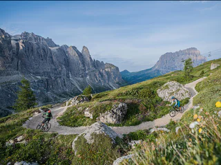
1/3
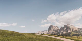
424 Schlern-Rosengarten Ronda counterclockwise
Nova Levante/Welschnofen, Welschnofen/Nova Levante, Dolomites Region Eggental
difficult
Moeilijkheidsgraad
1970 m
Hoogteverschil
93.8 Km
Route
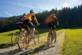
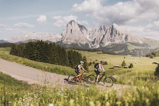
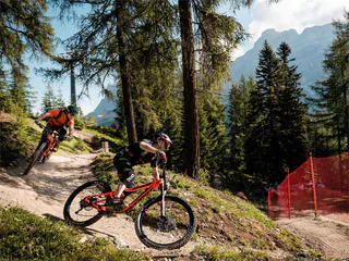
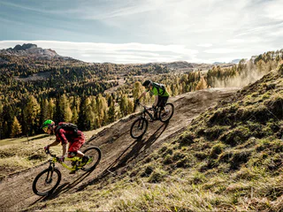
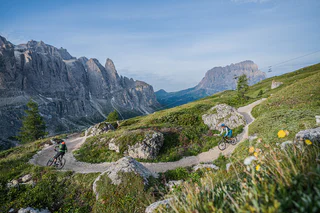
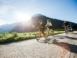
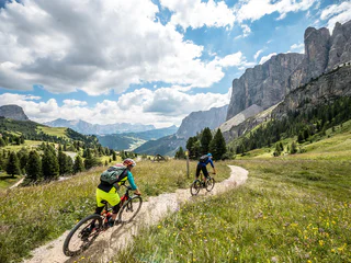
Verken als freerider de open of beboste valleien en doorkruis het door boeren onderhouden cultuurlandschap. Deze geselecteerde tochten voor mountainbikes of e-bikes voeren je langs idyllische gehuchten, rustieke boerderijen en naar zonovergoten alpenweiden. Neem een adempauze in de uitnodigende berghutten of herbergen en geniet van het uitzicht op de majestueuze toppen van de Dolomieten.
1/3
Nova Levante/Welschnofen, Welschnofen/Nova Levante, Dolomites Region Eggental
difficult
Moeilijkheidsgraad
1970 m
Hoogteverschil
93.8 Km
Route
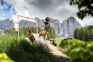
1/3
Sorafurcia/Geiselsberg, Olang/Valdaora, Dolomites Region Kronplatz/Plan de Corones
medium
Moeilijkheidsgraad
711 m
Hoogteverschil
6.6 Km
Route
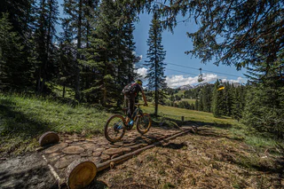
1/5
Alpe di Siusi/Seiseralm, Kastelruth/Castelrotto, Dolomites Region Seiser Alm
medium
Moeilijkheidsgraad
825 m
Hoogteverschil
22.6 Km
Route
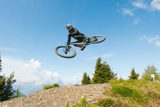
1/3
Colfosco/Colfosco, Badia, Dolomites Region Alta Badia
easy
Moeilijkheidsgraad
49 m
Hoogteverschil
368.0 m
Route
1/2
Colfosco/Colfosco, Badia, Dolomites Region Alta Badia
easy
Moeilijkheidsgraad
0 m
Hoogteverschil
157.0 m
Route
1/2
Seis/Siusi, Kastelruth/Castelrotto, Dolomites Region Seiser Alm
difficult
Moeilijkheidsgraad
3913 m
Hoogteverschil
96.4 Km
Route
1/2
Riscone/Reischach, Olang/Valdaora, Dolomites Region Kronplatz/Plan de Corones
easy
Moeilijkheidsgraad
0 m
Hoogteverschil
2.0 Km
Route

Anterselva di Sotto/Antholz-Niedertal, Rasen-Antholz/Rasun Anterselva, Dolomites Region Kronplatz/Plan de Corones
difficult
Moeilijkheidsgraad
583 m
Hoogteverschil
25.7 Km
Route
Sesto/Sexten, Sexten/Sesto, Dolomites Region 3 Zinnen
difficult
Moeilijkheidsgraad
1 m
Hoogteverschil
90.0 m
Route
Nove Case/Neunhäusern, Rasen-Antholz/Rasun Anterselva, Dolomites Region Kronplatz/Plan de Corones
difficult
Moeilijkheidsgraad
1309 m
Hoogteverschil
47.9 Km
Route
1/5
Selva/Sëlva/Wolkenstein/Sëlva, Sëlva/Selva di Val Gardena, Dolomites Region Val Gardena
difficult
Moeilijkheidsgraad
2018 m
Hoogteverschil
29.2 Km
Route
Lüsen/Luson, Dolomites Region Lüsen Villnöss
medium
Moeilijkheidsgraad
231 m
Hoogteverschil
8.0 Km
Route
1/3
Campo Tures/Sand in Taufers, Bruneck/Brunico, Dolomites Region Kronplatz/Plan de Corones
easy
Moeilijkheidsgraad
47 m
Hoogteverschil
17 Km
Route
1/4
Selva/Sëlva/Wolkenstein/Sëlva, Sëlva/Selva di Val Gardena, Dolomites Region Val Gardena
medium
Moeilijkheidsgraad
843 m
Hoogteverschil
15.3 Km
Route
1/3
Nova Levante/Welschnofen, Welschnofen/Nova Levante, Dolomites Region Eggental
medium
Moeilijkheidsgraad
0 m
Hoogteverschil
4.5 Km
Route
1/4
San Cassiano/San Cassiano, Badia, Dolomites Region Alta Badia
easy
Moeilijkheidsgraad
0 m
Hoogteverschil
1.9 Km
Route
Kastelruth/Castelrotto, Dolomites Region Seiser Alm
difficult
Moeilijkheidsgraad
1346 m
Hoogteverschil
55.4 Km
Route
1/2
Riscone/Reischach, Al Plan/San Vigilio, Dolomites Region Kronplatz/Plan de Corones
medium
Moeilijkheidsgraad
0 m
Hoogteverschil
491.0 m
Route
San Vigilio, Al Plan/San Vigilio, Dolomites Region Kronplatz/Plan de Corones
easy
Moeilijkheidsgraad
256 m
Hoogteverschil
7.4 Km
Route
Sesto/Sexten, Sexten/Sesto, Dolomites Region 3 Zinnen
easy
Moeilijkheidsgraad
2 m
Hoogteverschil
22.0 m
Route
Fiè/Völs, Völs am Schlern/Fiè allo Sciliar, Dolomites Region Seiser Alm
easy
Moeilijkheidsgraad
0 m
Hoogteverschil
376.0 m
Route
S.Antonio/St.Anton, Völs am Schlern/Fiè allo Sciliar, Dolomites Region Seiser Alm
easy
Moeilijkheidsgraad
467 m
Hoogteverschil
4.9 Km
Route
San Vigilio, Bruneck/Brunico, Dolomites Region Kronplatz/Plan de Corones
difficult
Moeilijkheidsgraad
26 m
Hoogteverschil
906.0 m
Route
S. Pietro/St. Peter - Funes/Villnöss, Villnöss/Funes, Dolomites Region Lüsen Villnöss
medium
Moeilijkheidsgraad
410 m
Hoogteverschil
10.4 Km
Route
1/4
Corvara/Corvara, Corvara, Dolomites Region Alta Badia
difficult
Moeilijkheidsgraad
3902 m
Hoogteverschil
62.1 Km
Route
Gandelle-Franadega-Fienili/Kandellen-Frondeigen-Stadlern, Toblach/Dobbiaco, Dolomites Region 3 Zinnen
difficult
Moeilijkheidsgraad
1438 m
Hoogteverschil
49.3 Km
Route

1/5
Ortisei/Urtijëi/St. Ulrich/Urtijëi, Urtijëi/Ortisei, Dolomites Region Val Gardena
medium
Moeilijkheidsgraad
680 m
Hoogteverschil
36 Km
Route
Gandelle-Franadega-Fienili/Kandellen-Frondeigen-Stadlern, Toblach/Dobbiaco, Dolomites Region 3 Zinnen
medium
Moeilijkheidsgraad
674 m
Hoogteverschil
21.4 Km
Route
Sesto/Sexten, Sexten/Sesto, Dolomites Region 3 Zinnen
medium
Moeilijkheidsgraad
2 m
Hoogteverschil
23.0 m
Route
Nove Case/Neunhäusern, Rasen-Antholz/Rasun Anterselva, Dolomites Region Kronplatz/Plan de Corones
medium
Moeilijkheidsgraad
1093 m
Hoogteverschil
22.8 Km
Route
Bedankt voor je inschrijving!
Inschrijving al actief
Bevestig je inschrijving
Om je inschrijving te voltooien, open de e-mail die we je net hebben gestuurd en klik op de bevestigingslink.
Niet gevonden? Kijk ook even in je spammap.
We hebben gezien dat je je probeerde aan te melden voor de nieuwsbrief, maar je e-mailadres is al geregistreerd. Je blijft onze aanbiedingen, tips en inspiratie voor je vakantie ontvangen.
Je hebt je al geprobeerd in te schrijven voor onze nieuwsbrief maar deze nog niet bevestigd. We hebben je de e‑mail zojuist opnieuw gestuurd. Controleer je inbox en je spammap en bevestig nu.


