
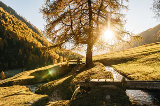
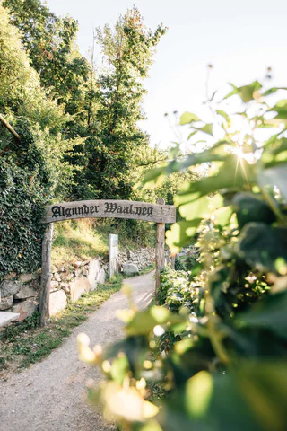
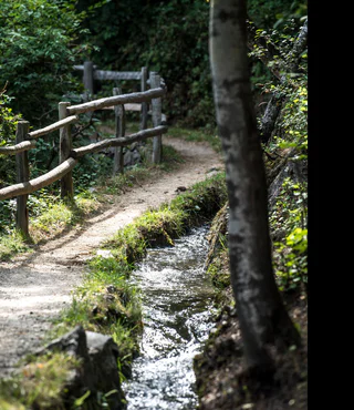
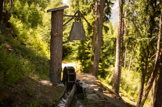
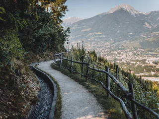
Raminiwaal irrigation channel path
Laces/Latsch, Latsch/Laces, Vinschgau/Val Venosta
easy
Moeilijkheidsgraad
0 m
Hoogteverschil
0h:54 min
Duur
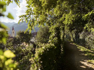
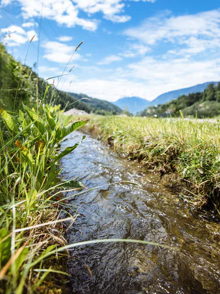
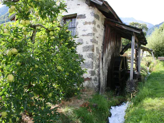
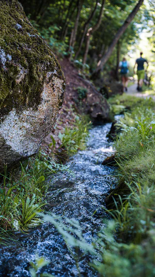
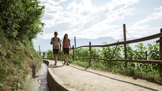
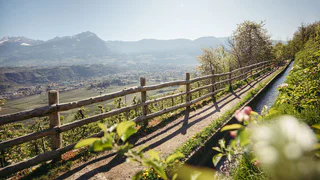
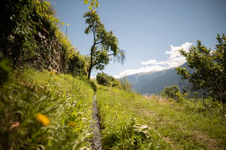
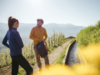
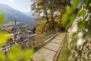
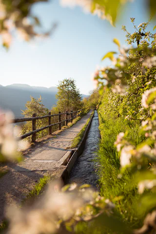
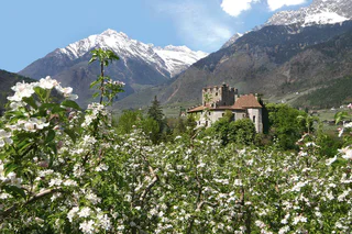
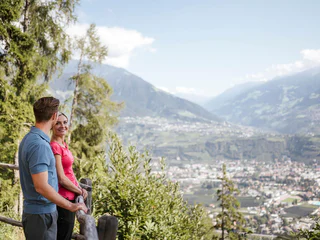
De Waalwege zijn toegankelijke en makkelijke wandelpaden die je langs de historische irrigatiekanalen van Zuid-Tirol leiden. Deze laagdrempelige wandelroutes zijn ideaal voor wandelaars van alle leeftijden, het hele jaar door. De meeste Waalwegen vind je in Val Venosta / Vinschgau en rond Merano / Meran. Deze kanaalpaden worden gekenmerkt door de lichte hellingen en het adembenemende uitzicht op de omliggende bergen en de Dolomieten. Wandelen langs het water van de Waalwege zorgt elk seizoen opnieuw voor een onvergetelijke ervaring in de Italiaanse bergen.
Laces/Latsch, Latsch/Laces, Vinschgau/Val Venosta
easy
Moeilijkheidsgraad
0 m
Hoogteverschil
0h:54 min
Duur
1/5
Mazia/Matsch
easy
Moeilijkheidsgraad
300 m
Hoogteverschil
2h:30 min
Duur
1/2
Tarces/Tartsch
easy
Moeilijkheidsgraad
30 m
Hoogteverschil
1h:30 min
Duur
1/3
Saltusio/Saltaus, St.Martin in Passeier/San Martino in Passiria, Meran/Merano and environs
easy
Moeilijkheidsgraad
46 m
Hoogteverschil
2h:30 min
Duur
1/8
Montesole/Sonnenberg - Parcines/Partschins, Partschins/Parcines, Meran/Merano and environs
easy
Moeilijkheidsgraad
123 m
Hoogteverschil
1h:30 min
Duur
1/9
Lagundo/Algund, Algund/Lagundo, Meran/Merano and environs
easy
Moeilijkheidsgraad
29 m
Hoogteverschil
1h:08 min
Duur
Laces/Latsch, Kastelbell-Tschars/Castelbello-Ciardes, Vinschgau/Val Venosta
easy
Moeilijkheidsgraad
65 m
Hoogteverschil
1h:30 min
Duur
Laces/Latsch, Latsch/Laces, Vinschgau/Val Venosta
easy
Moeilijkheidsgraad
177 m
Hoogteverschil
1h:26 min
Duur
Tarres/Tarsch, Latsch/Laces, Vinschgau/Val Venosta
medium
Moeilijkheidsgraad
493 m
Hoogteverschil
3h:32 min
Duur
1/4
Lana/Lana, Lana, Meran/Merano and environs
easy
Moeilijkheidsgraad
30 m
Hoogteverschil
0h:49 min
Duur
1/4
Sorgente/Quellenhof, Schenna/Scena, Meran/Merano and environs
easy
Moeilijkheidsgraad
260 m
Hoogteverschil
1h:40 min
Duur
Rifiano/Riffian, Riffian/Rifiano, Meran/Merano and environs
easy
Moeilijkheidsgraad
239 m
Hoogteverschil
1h:18 min
Duur
1/4
Tirolo/Tirol, Tirol/Tirolo, Meran/Merano and environs
medium
Moeilijkheidsgraad
229 m
Hoogteverschil
3h:00 min
Duur
1/7
Parcines/Partschins, Partschins/Parcines, Meran/Merano and environs
easy
Moeilijkheidsgraad
223 m
Hoogteverschil
2h:00 min
Duur
Rablà/Rabland, Partschins/Parcines, Meran/Merano and environs
easy
Moeilijkheidsgraad
0 m
Hoogteverschil
25h:45 min
Duur
1/9
Montesole/Sonnenberg - Parcines/Partschins, Partschins/Parcines, Meran/Merano and environs
easy
Moeilijkheidsgraad
194 m
Hoogteverschil
1h:34 min
Duur
1/3
Marlengo/Marling, Marling/Marlengo, Meran/Merano and environs
easy
Moeilijkheidsgraad
485 m
Hoogteverschil
2h:00 min
Duur
1/3
Lana di Sotto/Niederlana, Lana, Meran/Merano and environs
easy
Moeilijkheidsgraad
458 m
Hoogteverschil
3h:12 min
Duur
1/3
Montechiaro/Lichtenberg, Prad am Stilfser Joch/Prato allo Stelvio, Vinschgau/Val Venosta
medium
Moeilijkheidsgraad
369 m
Hoogteverschil
2h:00 min
Duur
1/4
Malles/Mals, Mals/Malles, Vinschgau/Val Venosta
medium
Moeilijkheidsgraad
392 m
Hoogteverschil
7h:00 min
Duur
1/2
Silandro/Schlanders, Schlanders/Silandro, Vinschgau/Val Venosta
medium
Moeilijkheidsgraad
300 m
Hoogteverschil
1h:06 min
Duur
Tablà/Tabland - Naturno/Naturns, Naturns/Naturno, Vinschgau/Val Venosta
easy
Moeilijkheidsgraad
160 m
Hoogteverschil
2h:00 min
Duur
1/4
Marlengo/Marling, Marling/Marlengo, Meran/Merano and environs
easy
Moeilijkheidsgraad
162 m
Hoogteverschil
1h:45 min
Duur
1/3
Monte di Tramontana/Nördersberg, Schlanders/Silandro, Vinschgau/Val Venosta
easy
Moeilijkheidsgraad
70 m
Hoogteverschil
0h:31 min
Duur
1/4
Lagundo/Algund, Algund/Lagundo, Meran/Merano and environs
easy
Moeilijkheidsgraad
252 m
Hoogteverschil
2h:58 min
Duur
1/3
Plars di Mezzo/Mitterplars, Algund/Lagundo, Meran/Merano and environs
easy
Moeilijkheidsgraad
295 m
Hoogteverschil
2h:23 min
Duur

1/3
Marlengo/Marling, Marling/Marlengo, Meran/Merano and environs
easy
Moeilijkheidsgraad
195 m
Hoogteverschil
1h:30 min
Duur
1/3
Cermes/Tscherms, Marling/Marlengo, Meran/Merano and environs
medium
Moeilijkheidsgraad
543 m
Hoogteverschil
2h:22 min
Duur
Novale/Ried - San Martino i.P./St. Martin i.P., Moos in Passeier/Moso in Passiria, Meran/Merano and environs
easy
Moeilijkheidsgraad
256 m
Hoogteverschil
2h:49 min
Duur
1/3
Cermes/Tscherms, Lana, Meran/Merano and environs
easy
Moeilijkheidsgraad
150 m
Hoogteverschil
3h:30 min
Duur
Bedankt voor je inschrijving!
Inschrijving al actief
Bevestig je inschrijving
Om je inschrijving te voltooien, open de e-mail die we je net hebben gestuurd en klik op de bevestigingslink.
Niet gevonden? Kijk ook even in je spammap.
Je ontvangt al onze exclusieve aanbiedingen, handige tips en speciale suggesties om volop van je vakantie te genieten.
Je hebt je al geprobeerd in te schrijven voor onze nieuwsbrief maar deze nog niet bevestigd. We hebben je de e‑mail zojuist opnieuw gestuurd. Controleer je inbox en je spammap en bevestig nu.


