1/3
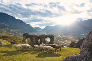
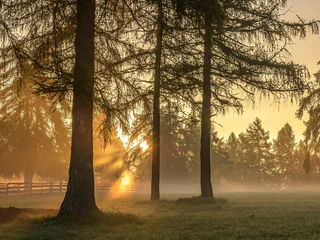
Castelfeder Biotope
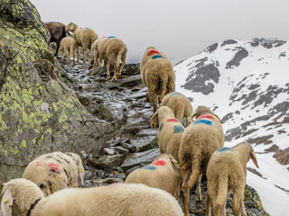
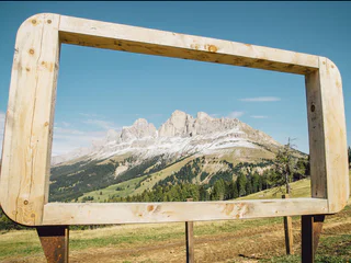
Pinzano/Pinzon, Auer/Ora, Alto Adige Wine Road
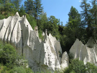
Zuid-Tirol is bijzonder rijk aan verhalen die zich slingeren rond geheime locaties en ongewone natuurlijke formaties. Bezienswaardigheden, zoals de heksenbankjes op de Alpe di Siusi/Seiser Alm, vertellen verhalen van heksen en koningen, terwijl krachtplekken, zoals de "Stoanerne Mandln" met meer dan honderd cairns of de oude ruïnes op de heuvel van Castelfeder, bezoekers uitnodigen om te ontspannen en diep adem te halen. Unieke natuurlijke formaties zoals de aardpiramides zijn plaatsen die een wandeling en verkenning waard zijn.
1/3
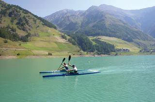
Pinzano/Pinzon, Auer/Ora, Alto Adige Wine Road

Senale/U.L. Frau i.W., U.L.Frau i.W.-St. Felix/Senale-S.Felice, Meran/Merano and environs
1/2
Brunico città/Bruneck Stadt, Bruneck/Brunico, Dolomites Region Kronplatz/Plan de Corones
Pavicolo/Pawigl, Lana, Meran/Merano and environs
Prato alla Drava/Winnebach, Toblach/Dobbiaco, Dolomites Region 3 Zinnen
Brunico città/Bruneck Stadt, Bruneck/Brunico, Dolomites Region Kronplatz/Plan de Corones
Auna di Sotto/Unterinn, Ritten/Renon, Bolzano/Bozen and environs
1/3
Sciaves/Schabs, Natz-Schabs/Naz-Sciaves, Brixen/Bressanone and environs
1/2
Tiso/Teis, Villnöss/Funes, Dolomites Region Lüsen Villnöss
Alpe di Siusi/Seiseralm, Kastelruth/Castelrotto, Dolomites Region Seiser Alm
Santa Valburga/St. Walburg, Ulten/Ultimo, Meran/Merano and environs
Merano/Meran, Meran/Merano, Meran/Merano and environs
1/2
S. Genesio Atesino/Jenesien, Jenesien/San Genesio Atesino, Bolzano/Bozen and environs
Anterivo/Altrei
Prissian/Prissiano, Tisens/Tesimo, Meran/Merano and environs
S. Pietro/St. Peter - Funes/Villnöss, Villnöss/Funes, Dolomites Region Lüsen Villnöss
1/8
Parcines/Partschins, Partschins/Parcines, Meran/Merano and environs
1/3
Corvara/Corvara, Corvara, Dolomites Region Alta Badia
1/3
Merano/Meran, Meran/Merano, Meran/Merano and environs
1/5
Vernago/Vernagt, Schnals/Senales, Vinschgau/Val Venosta
1/3
Vernago/Vernagt, Schnals/Senales, Vinschgau/Val Venosta
1/2
Verano/Vöran, Vöran/Verano, Meran/Merano and environs
1/3
Merano/Meran, Meran/Merano, Meran/Merano and environs
1/9
S.Cristina Gherdëina/S.Cristina Val Gardena/S.Cristina Gherdëina/St.Christina in Gröden, S.Crestina Gherdëina/Santa Cristina Val Gardana, Dolomites Region Val Gardena
1/10
Selva/Sëlva/Wolkenstein/Sëlva, Sëlva/Selva di Val Gardena, Dolomites Region Val Gardena
1/5
Terento/Terenten, Terenten/Terento, Brixen/Bressanone and environs
1/2
Siusi/Seis, Kastelruth/Castelrotto, Dolomites Region Seiser Alm
1/2
Carezza/Karersee, Welschnofen/Nova Levante, Dolomites Region Eggental
1/4
S.Cristina Gherdëina/S.Cristina Val Gardena/S.Cristina Gherdëina/St.Christina in Gröden, S.Crestina Gherdëina/Santa Cristina Val Gardana, Dolomites Region Val Gardena
La Villa/La Villa, Badia, Dolomites Region Alta Badia
Bedankt voor je inschrijving!
Inschrijving al actief
Bevestig je inschrijving
Om je inschrijving te voltooien, open de e-mail die we je net hebben gestuurd en klik op de bevestigingslink.
Niet gevonden? Kijk ook even in je spammap.
We hebben gezien dat je je probeerde aan te melden voor de nieuwsbrief, maar je e-mailadres is al geregistreerd. Je blijft onze aanbiedingen, tips en inspiratie voor je vakantie ontvangen.
Je hebt je al geprobeerd in te schrijven voor onze nieuwsbrief maar deze nog niet bevestigd. We hebben je de e‑mail zojuist opnieuw gestuurd. Controleer je inbox en je spammap en bevestig nu.


