1/3
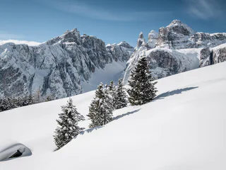
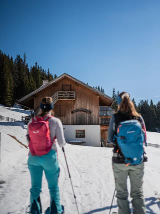
Fresh snow descent from Val Mezdí valley in the Sella group
Colfosco/Colfosco, Corvara, Dolomites Region Alta Badia
difficult
Moeilijkheidsgraad
0 m
Hoogteverschil
1h:45 min
Duur
Ervaar de spanning van skitochten door de prachtige winterlandschappen van de Dolomietenregio. Ideaal voor avontuurlijke skiërs.
1/3
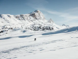
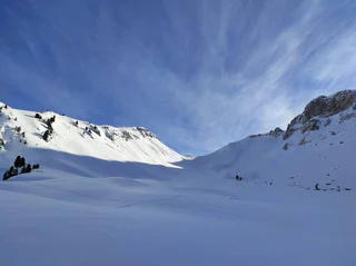
Colfosco/Colfosco, Corvara, Dolomites Region Alta Badia
difficult
Moeilijkheidsgraad
0 m
Hoogteverschil
1h:45 min
Duur

1/3
Corvara/Corvara, Corvara, Dolomites Region Alta Badia
easy
Moeilijkheidsgraad
286 m
Hoogteverschil
1h:26 min
Duur

San Vigilio, Al Plan/San Vigilio, Dolomites Region Kronplatz/Plan de Corones
medium
Moeilijkheidsgraad
682 m
Hoogteverschil
2h:28 min
Duur
Colle/Pichl, Gsies/Valle di Casies
medium
Moeilijkheidsgraad
1400 m
Hoogteverschil
5h:00 min
Duur
1/3
San Cassiano/San Cassiano, Badia, Dolomites Region Alta Badia
easy
Moeilijkheidsgraad
78 m
Hoogteverschil
0h:45 min
Duur
Valdaora di Mezzo/Mitterolang, Al Plan/San Vigilio, Dolomites Region Kronplatz/Plan de Corones
medium
Moeilijkheidsgraad
1217 m
Hoogteverschil
4h:37 min
Duur
1/4
Monghezzo/Getzenberg, Lüsen/Luson, Dolomites Region Lüsen Villnöss
medium
Moeilijkheidsgraad
640 m
Hoogteverschil
1h:55 min
Duur
Braies di Fuori/Ausserprags, Prags/Braies, Dolomites Region 3 Zinnen
medium
Moeilijkheidsgraad
867 m
Hoogteverschil
3h:45 min
Duur
Sesto/Sexten, Sexten/Sesto, Dolomites Region 3 Zinnen
difficult
Moeilijkheidsgraad
1337 m
Hoogteverschil
4h:40 min
Duur
S. Maddalena/St. Magdalena - Casies/Gsies, Gsies/Valle di Casies
medium
Moeilijkheidsgraad
1100 m
Hoogteverschil
3h:30 min
Duur
S. Maddalena/St. Magdalena - Casies/Gsies, Gsies/Valle di Casies
medium
Moeilijkheidsgraad
1270 m
Hoogteverschil
3h:30 min
Duur
S. Maddalena/St. Magdalena - Casies/Gsies, Gsies/Valle di Casies
easy
Moeilijkheidsgraad
1105 m
Hoogteverschil
4h:39 min
Duur
Chienes/Kiens, Kiens/Chienes, Dolomites Region Kronplatz/Plan de Corones
medium
Moeilijkheidsgraad
925 m
Hoogteverschil
2h:45 min
Duur
Gandelle-Franadega-Fienili/Kandellen-Frondeigen-Stadlern, Toblach/Dobbiaco, Dolomites Region 3 Zinnen
medium
Moeilijkheidsgraad
868 m
Hoogteverschil
2h:30 min
Duur
S. Martino/St. Martin - Casies/Gsies, Gsies/Valle di Casies, Dolomites Region 3 Zinnen
medium
Moeilijkheidsgraad
832 m
Hoogteverschil
3h:00 min
Duur
S. Maddalena/St. Magdalena - Casies/Gsies, Gsies/Valle di Casies
medium
Moeilijkheidsgraad
1274 m
Hoogteverschil
4h:30 min
Duur
Sesto/Sexten, Sexten/Sesto, Dolomites Region 3 Zinnen
medium
Moeilijkheidsgraad
641 m
Hoogteverschil
2h:51 min
Duur
1/2
S. Maddalena/St. Magdalena - Funes/Villnöss, Villnöss/Funes, Dolomites Region Lüsen Villnöss
medium
Moeilijkheidsgraad
744 m
Hoogteverschil
2h:25 min
Duur
Dobbiaco Vecchia/Alttoblach, Toblach/Dobbiaco, Dolomites Region 3 Zinnen
medium
Moeilijkheidsgraad
1078 m
Hoogteverschil
3h:40 min
Duur
Tesido/Taisten, Welsberg-Taisten/Monguelfo-Tesido
easy
Moeilijkheidsgraad
700 m
Hoogteverschil
3h:30 min
Duur
San Vigilio, Al Plan/San Vigilio, Dolomites Region Kronplatz/Plan de Corones
medium
Moeilijkheidsgraad
0 m
Hoogteverschil
4h:00 min
Duur
San Vigilio, Al Plan/San Vigilio, Dolomites Region Kronplatz/Plan de Corones
medium
Moeilijkheidsgraad
626 m
Hoogteverschil
2h:12 min
Duur
1/5
San Vigilio, Olang/Valdaora, Dolomites Region Kronplatz/Plan de Corones
medium
Moeilijkheidsgraad
758 m
Hoogteverschil
2h:31 min
Duur
1/2
S. Maddalena/St. Magdalena - Funes/Villnöss, Villnöss/Funes, Dolomites Region Lüsen Villnöss
medium
Moeilijkheidsgraad
748 m
Hoogteverschil
2h:23 min
Duur
Sesto/Sexten, Sexten/Sesto, Dolomites Region 3 Zinnen
easy
Moeilijkheidsgraad
551 m
Hoogteverschil
1h:40 min
Duur
Braies di Fuori/Ausserprags, Prags/Braies, Dolomites Region 3 Zinnen
medium
Moeilijkheidsgraad
989 m
Hoogteverschil
3h:51 min
Duur
Braies di Fuori/Ausserprags, Prags/Braies, Dolomites Region 3 Zinnen
medium
Moeilijkheidsgraad
856 m
Hoogteverschil
3h:07 min
Duur
Selva/Sëlva/Wolkenstein/Sëlva, Sëlva/Selva di Val Gardena, Dolomites Region Val Gardena
easy
Moeilijkheidsgraad
388 m
Hoogteverschil
1h:33 min
Duur
S. Maddalena/St. Magdalena - Funes/Villnöss, Villnöss/Funes, Dolomites Region Lüsen Villnöss
medium
Moeilijkheidsgraad
921 m
Hoogteverschil
3h:01 min
Duur
Pescosta/Pescosta, Sëlva/Selva di Val Gardena, Dolomites Region Val Gardena
easy
Moeilijkheidsgraad
182 m
Hoogteverschil
0h:58 min
Duur
Bedankt voor je inschrijving!
Inschrijving al actief
Bevestig je inschrijving
Om je inschrijving te voltooien, open de e-mail die we je net hebben gestuurd en klik op de bevestigingslink.
Niet gevonden? Kijk ook even in je spammap.
We hebben gezien dat je je probeerde aan te melden voor de nieuwsbrief, maar je e-mailadres is al geregistreerd. Je blijft onze aanbiedingen, tips en inspiratie voor je vakantie ontvangen.
Je hebt je al geprobeerd in te schrijven voor onze nieuwsbrief maar deze nog niet bevestigd. We hebben je de e‑mail zojuist opnieuw gestuurd. Controleer je inbox en je spammap en bevestig nu.


