
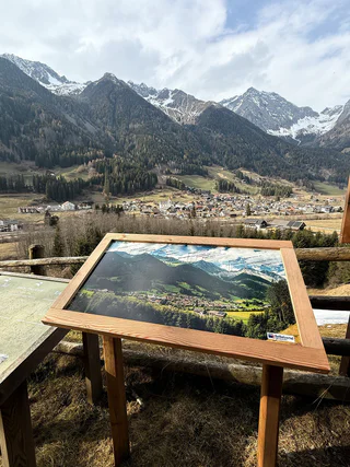
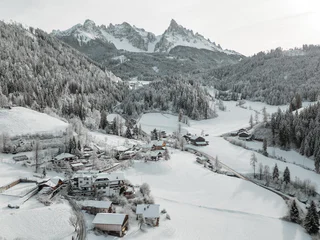
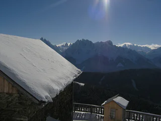
La Ferata – The old railway line featuring Bronze Sculptures and Snow Depths - Winter
Selva/Sëlva/Wolkenstein/Sëlva, Urtijëi/Ortisei, Dolomites Region Val Gardena
easy
Moeilijkheidsgraad
61 m
Hoogteverschil
2h:31 min
Duur
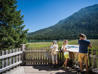
Het landschap is een geschenk waar je het beste te voet van kunt genieten. In het Zuid-Tiroolse voorjaar beleef je het ontwaken van de natuur in het dal en op de bloeiende alpenweiden, terwijl je in de midzomer wordt verleid door luchtige bergtoppen, aanbevolen berghutten en bergwandelingen op grote hoogte. Beleef herfstwandelingen met prachtige uitzichten en schitterende kleuren.
Selva/Sëlva/Wolkenstein/Sëlva, Urtijëi/Ortisei, Dolomites Region Val Gardena
easy
Moeilijkheidsgraad
61 m
Hoogteverschil
2h:31 min
Duur
1/5
Niederrasen/Rasun di Sotto, Rasen-Antholz/Rasun Anterselva, Dolomites Region Kronplatz/Plan de Corones
easy
Moeilijkheidsgraad
108 m
Hoogteverschil
0h:25 min
Duur
1/13
S.Cristina Gherdëina/S.Cristina Val Gardena/S.Cristina Gherdëina/St.Christina in Gröden, S.Crestina Gherdëina/Santa Cristina Val Gardana, Dolomites Region Val Gardena
difficult
Moeilijkheidsgraad
303 m
Hoogteverschil
2h:00 min
Duur
Braies di Fuori/Ausserprags, Prags/Braies, Dolomites Region 3 Zinnen
medium
Moeilijkheidsgraad
309 m
Hoogteverschil
1h:04 min
Duur
1/5
Siusi/Seis, Kastelruth/Castelrotto, Dolomites Region Seiser Alm
medium
Moeilijkheidsgraad
939 m
Hoogteverschil
6h:00 min
Duur
San Vigilio, Badia, Dolomites Region Alta Badia
difficult
Moeilijkheidsgraad
3174 m
Hoogteverschil
17h:28 min
Duur
Villabassa/Niederdorf, Niederdorf/Villabassa, Dolomites Region 3 Zinnen
easy
Moeilijkheidsgraad
36 m
Hoogteverschil
2h:08 min
Duur
Ausserprags/Braies di Fuori, Prags/Braies, Dolomites Region 3 Zinnen
easy
Moeilijkheidsgraad
47 m
Hoogteverschil
0h:40 min
Duur
1/2
Ortisei/Urtijëi/St. Ulrich/Urtijëi, Urtijëi/Ortisei, Dolomites Region Val Gardena
easy
Moeilijkheidsgraad
101 m
Hoogteverschil
0h:39 min
Duur
1/2
Gandelle-Franadega-Fienili/Kandellen-Frondeigen-Stadlern, Toblach/Dobbiaco, Dolomites Region 3 Zinnen
easy
Moeilijkheidsgraad
61 m
Hoogteverschil
2h:30 min
Duur
San Vigilio, Badia, Dolomites Region Alta Badia
medium
Moeilijkheidsgraad
739 m
Hoogteverschil
5h:10 min
Duur
1/2
Obereggen/Obereggen, Deutschnofen/Nova Ponente, Dolomites Region Eggental
easy
Moeilijkheidsgraad
183 m
Hoogteverschil
1h:25 min
Duur
Gandelle-Franadega-Fienili/Kandellen-Frondeigen-Stadlern, Toblach/Dobbiaco, Dolomites Region 3 Zinnen
medium
Moeilijkheidsgraad
441 m
Hoogteverschil
4h:00 min
Duur
1/3
Nove Case/Neunhäusern, Rasen-Antholz/Rasun Anterselva, Dolomites Region Kronplatz/Plan de Corones
medium
Moeilijkheidsgraad
811 m
Hoogteverschil
2h:30 min
Duur
S. Maddalena/St. Magdalena - Funes/Villnöss, Villnöss/Funes, Dolomites Region Lüsen Villnöss
medium
Moeilijkheidsgraad
785 m
Hoogteverschil
2h:38 min
Duur
Selva/Sëlva/Wolkenstein/Sëlva, Sëlva/Selva di Val Gardena, Dolomites Region Val Gardena
easy
Moeilijkheidsgraad
0 m
Hoogteverschil
1h:00 min
Duur
1/5
Carezza/Karersee, Welschnofen/Nova Levante, Dolomites Region Eggental
medium
Moeilijkheidsgraad
607 m
Hoogteverschil
3h:40 min
Duur
San Vigilio, Al Plan/San Vigilio, Dolomites Region Kronplatz/Plan de Corones
difficult
Moeilijkheidsgraad
1301 m
Hoogteverschil
4h:01 min
Duur
Villabassa/Niederdorf, Niederdorf/Villabassa, Dolomites Region 3 Zinnen
medium
Moeilijkheidsgraad
360 m
Hoogteverschil
1h:52 min
Duur
1/2
Obereggen/Obereggen, Deutschnofen/Nova Ponente, Dolomites Region Eggental
medium
Moeilijkheidsgraad
454 m
Hoogteverschil
3h:30 min
Duur
Sesto/Sexten, Sexten/Sesto, Dolomites Region 3 Zinnen
medium
Moeilijkheidsgraad
213 m
Hoogteverschil
0h:49 min
Duur
Gandelle-Franadega-Fienili/Kandellen-Frondeigen-Stadlern, Toblach/Dobbiaco, Dolomites Region 3 Zinnen
difficult
Moeilijkheidsgraad
1280 m
Hoogteverschil
3h:00 min
Duur
1/2
Sesto/Sexten, Toblach/Dobbiaco, Dolomites Region 3 Zinnen
easy
Moeilijkheidsgraad
253 m
Hoogteverschil
1h:30 min
Duur
Obereggen/Obereggen, Deutschnofen/Nova Ponente, Dolomites Region Eggental
medium
Moeilijkheidsgraad
0 m
Hoogteverschil
2h:45 min
Duur
1/17
Wolkenstein/Sëlva/Selva/Sëlva, S.Crestina Gherdëina/Santa Cristina Val Gardana, Dolomites Region Val Gardena
easy
Moeilijkheidsgraad
37 m
Hoogteverschil
1h:19 min
Duur
1/2
Valdaora di Sopra/Oberolang, Olang/Valdaora, Dolomites Region Kronplatz/Plan de Corones
easy
Moeilijkheidsgraad
291 m
Hoogteverschil
1h:07 min
Duur

1/2
Alpe di Rodengo/Rodenecker Alm, Lüsen/Luson, Dolomites Region Lüsen Villnöss
medium
Moeilijkheidsgraad
0 m
Hoogteverschil
5h:00 min
Duur
1/2
S. Candido/Innichen, Toblach/Dobbiaco, Dolomites Region 3 Zinnen
medium
Moeilijkheidsgraad
715 m
Hoogteverschil
2h:30 min
Duur
1/4
Nova Levante/Welschnofen, Welschnofen/Nova Levante, Dolomites Region Eggental
easy
Moeilijkheidsgraad
98 m
Hoogteverschil
1h:04 min
Duur
1/2
San Vigilio, Prags/Braies, Dolomites Region 3 Zinnen
medium
Moeilijkheidsgraad
1305 m
Hoogteverschil
6h:22 min
Duur
Bedankt voor je inschrijving!
Inschrijving al actief
Bevestig je inschrijving
Om je inschrijving te voltooien, open de e-mail die we je net hebben gestuurd en klik op de bevestigingslink.
Niet gevonden? Kijk ook even in je spammap.
We hebben gezien dat je je probeerde aan te melden voor de nieuwsbrief, maar je e-mailadres is al geregistreerd. Je blijft onze aanbiedingen, tips en inspiratie voor je vakantie ontvangen.
Je hebt je al geprobeerd in te schrijven voor onze nieuwsbrief maar deze nog niet bevestigd. We hebben je de e‑mail zojuist opnieuw gestuurd. Controleer je inbox en je spammap en bevestig nu.


