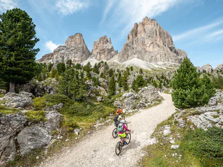
Ga meteen naar de inhoud

toegevoegd aan favorieten

verwijderd uit favorieten

Helaas is er een probleem opgetreden. Probeer het opnieuw.

Uw account wordt aangemaakt

Je account is succesvol aangemaakt en je bent nu ingelogd

U bent succesvol ingelogd!

Uw account is succesvol aangemaakt, maar we konden u niet automatisch aanmelden

U bent uitgelogd

Filteren
Geselecteerde filters
    Moeilijkheidsgraad
    Duur
    Afstand in km

    Mountainbiketochten in de Dolomieten

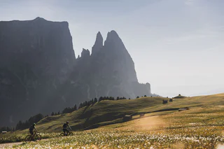
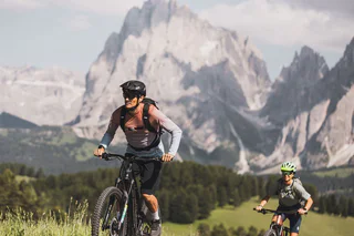
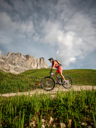
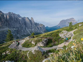
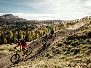
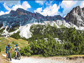
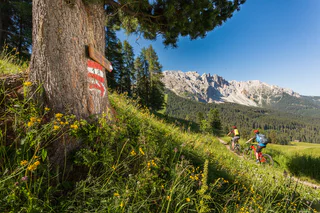
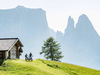
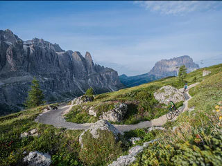
    Verken als freerider de open of beboste valleien en doorkruis het door boeren onderhouden cultuurlandschap. Deze geselecteerde tochten voor mountainbikes of e-bikes voeren je langs idyllische gehuchten, rustieke boerderijen en naar zonovergoten alpenweiden. Neem een adempauze in de uitnodigende berghutten of herbergen en geniet van het uitzicht op de majestueuze toppen van de Dolomieten. 

    Resultaten
    Downhills
    Spitzhorn Trail
    Bruneck/Brunico, Dolomites Region Kronplatz/Plan de Corones
    The Spitzhorn Trail is divided into three sections: the first part, which breaks off from the Gassl Trail, is a sequence of very smooth flowing curves, the middle section features jumps and features in an open area with great visibility to the scenic Wallride. The last section runs through the forest, alternating between natural terrain and various wooden footbridges that eventually lead back to the existing trail.
    Moeilijkheidsgraad: gemiddeld
    0 m Hoogtemeters
    1 Km Route
    E-MTB
    To the Brunst Alm Hut
    Rasen-Antholz/Rasun Anterselva, Dolomites Region Kronplatz/Plan de Corones

    The excursion to the Brunst Alm mountain hut first takes us out of the valley, past the football pitch in Niederrasen and underneath the Pustertaler Straße road. We then head towards Oberolang and cycle uphill through the village and past the parking lot of the Kids’ World Olang. From there, the challenging ascent begins on a gravel path into the forest, which then leads to our destination of the Brunst Alm. The ascent is rewarded with a breathtaking view of the Olang mountain range and the Kronplatz.

    Moeilijkheidsgraad: zwaar
    1048 m Hoogtemeters
    10.4 Km Route
    Downhills
    Dragon Trail
    Bruneck/Brunico, Dolomites Region Kronplatz/Plan de Corones
    New in summer 2022 in the Bike Park Kronplatz is the "Dragon Trail": the trail, over 2 kilometers long, winds along the hillside from the summit to the middle station of the Olang 1+2 lift. The highlight is definitely crossing the Dragon's Head and the Dragon's Tail, where you have a beautiful panorama of the surrounding Dolomites at the same time.
    Moeilijkheidsgraad: gemakkelijk
    0 m Hoogtemeters
    2.0 Km Route
    E-Bikes
    To the Staller Saddle
    Olang/Valdaora, Dolomites Region Kronplatz/Plan de Corones

    The challenging tour to the Staller Sattel ass is one of the classic routes for South Tyrolean cycling enthusiasts. A gravel track leads you from Niederrasen along the river to Antholz Niedertal. The route continues through the village of Antholz Mittertal and along the paved main road to the beautiful Lake Antholz. From there, the final ascent to the 2,052 m high Staller Sattel alpine pass begins, which boasts numerous hairpin bends and breathtaking viewpoints (Important! Temporary one-way traffic regulation with traffic light: from South Tyrol to Austria every hour from the 30th to the 45th minute; from Austria to South Tyrol every hour from the full hour to the 15th minute).

    Moeilijkheidsgraad: zwaar
    1424 m Hoogtemeters
    22.3 Km Route
    E-Bikes
    To the view of the Three Peaks
    Toblach/Dobbiaco, Dolomites Region Kronplatz/Plan de Corones

    This challenging tour of approx. 33 km first leads along the cycle path out of the valley, past the football pitch in Niederrasen and under the Pustertal Valley road. The route then continues to Oberolang and from there you join the Pustertal Valley cycle path. Continue cycling past the villages of Welsberg and Niederdorf until you reach Toblach. Turn right there and continue to Lake Toblach. Afterwards continue in the direction of Cortina until you reach the Drei Zinnen viewpoint, which is located directly next to the cycle path. In just another 5 minutes you can reach Lake Dürrensee, with the breathtaking Cristallo mountain group in the background. There are various refreshment stops for a short break along this route. The return journey then follows the same route back to the starting point.

    Moeilijkheidsgraad: gemiddeld
    562 m Hoogtemeters
    30.8 Km Route
    E-Bikes
    To the Biotope Rasner Möser
    Rasen-Antholz/Rasun Anterselva, Dolomites Region Kronplatz/Plan de Corones

    The Rasner Möser biotope is located between Oberrasen and Antholz-Niedertal. This easy cycle tour, which is also suitable for children, can therefore be started from either of these two starting points. The highlight of this tour is definitely the biotope roughly halfway along the route. In this nature reserve, there are two small lakes which invite you to relax in the shade of the trees, as well as an educational nature trail with interesting information about this moorland area.

    Moeilijkheidsgraad: gemakkelijk
    192 m Hoogtemeters
    12.3 Km Route
    Downhills
    CC Top Line
    Al Plan/San Vigilio, Dolomites Region Kronplatz/Plan de Corones

    This line is a more technical and “rocky” version of the Furcia trail featuring sections littered with roots, boulders and carved berms. Suitable for experienced riders who are comfortable handling their bike throughout rough terrain.

    Level: medium to difficult

    Moeilijkheidsgraad: gemiddeld
    0 m Hoogtemeters
    687.0 m Route
    Mountain bike
    MTB Fanes-Tour
    Al Plan/San Vigilio, Dolomites Region Kronplatz/Plan de Corones
    This difficult but breathtaking circular tour starts in St. Vigil and takes you into the Fanes-Sennes-Prags nature park. From St Vigil, the cycle path leads along the river through the forest with a moderate ascent to the Lavarella mountain hut. From there, the route becomes steeper up to Fanes alpine pasture, where a breathtaking view of the Dolomites awaits you. From the pasture, the route continues past further alpine huts and lakes up to Lake Limo, the highest point of the tour. You then cycle through the Great Fanes Valley and then starting from the Col de Locia, a difficult descent to the Capanna Alpina begins - here you may have to dismount and carry your mountain bike. From the Capanna Alpina, continue to St. Kassian and then ride along the cycle path to Zwischenwasser and from there back towards St. Vigil.
    Moeilijkheidsgraad: zwaar
    1537 m Hoogtemeters
    57.1 Km Route
    Downhills
    Furcia Trail
    Bruneck/Brunico, Dolomites Region Kronplatz/Plan de Corones

    The Herrnsteig trail's little brother too is packed with flow and curves. But while it's nowhere near as wild and bumpy, its 124 bends and turns between the top of Mount Kronplatz and Passo Furcia make it at least equally winding and dizzying. To get back up to the top, simply hop on the Ruis cable car at Passo Furcia. The big challenge on this trail is to master it without pedalling and with as little use of the brakes as possible. It is ideal for medium-advanced and pro bikers who wish to get to most out of an active riding style.

    Moeilijkheidsgraad: gemiddeld
    0 m Hoogtemeters
    4.9 Km Route
    E-Bikes
    Through Hamlet Salla to Welsberg and Taisten
    Rasen-Antholz/Rasun Anterselva, Dolomites Region Kronplatz/Plan de Corones

    This medium-difficulty tour first leads you out of the valley on the cycle path, past the football pitch in Niederrasen and under the Puster Valley road. The route then continues to Oberolang and veers towards the Pustertal Valley cycle path. After the cemetery in Oberolang, turn right, follow the road to the hamlet of Salla and cycle on to Welsberg. Follow the cycle path along the river in the direction of the Gsieser Valley. After approx. 2 km, turn off towards Taisten, cycle through the village and then reach the beautiful hill from where you have a breathtaking view of the Dolomites. Continue along the road until you reach the Obergoste, from where you descend to Rasen. After the Hotel Alte Goste, the cycle path turns right to Rasen (gravel road from here) and you return directly to Niederrasen.

    Moeilijkheidsgraad: gemiddeld
    1093 m Hoogtemeters
    22.8 Km Route
    E-Bikes
    Pustertal Valley bike route to Mühlbach
    Rasen-Antholz/Rasun Anterselva, Dolomites Region Kronplatz/Plan de Corones

    From Niederrasen, we first cycle along the cycle path out of the valley to the historic bridge. From there, we continue to Neunhäusern,, where we turn off onto the Pustertal cycle path. We then follow it until we reach Bruneck. After leaving the town behind us, we first reach St. Lorenzen. Here you will find the Mansio Sebatum Archaeological Museum, which is dedicated entirely to the Iron Age and especially the Roman period in the region. As the route continues, we pass the villages of Ehrenburg, Kiens, St. Sigmund and Vintl, each of which is always worth a detour in its own right, until we reach our destination in Mühlbach. For your return journey, you also have the possibility to take the train with bike transport back to Olang.

    Moeilijkheidsgraad: gemiddeld
    202 m Hoogtemeters
    37.3 Km Route
    Mountain bike
    Fanes Senes MTB Tour: beautiful, smart, invincible
    Al Plan/San Vigilio, Dolomites Region Kronplatz/Plan de Corones

    A heroic ride through the empire of the Ladin legend Dolasila

    She was beautiful, she was brave and she was smart: Dolasila, the Princess of Fanes and a legendary warrior, led her people on the battlefields of what is today the national park Fanes Senes Prags. Her story is packed with magical creatures and glorious victories, with treachery and deceit. Ride through the setting of this Ladin national epic on the Fanes Senes-Tour.


    A Ladin Epic:

    In ancient days the high plains of Fanes were ruled by a ruthless king. His beautiful daughter, however, was just the contrary. In a sign of gratitude for her compassion, the dwarfs at the Silver Lake in Canazei rewarded her with a white armour and unfailing arrows that made her invincible. After her first great battle at the Kronplatz the warrior led the Fanes people in a series of victories. Yet Dolasila was also exposed to treachery and deceit – from her enemies, but also from her own people...


    Moeilijkheidsgraad: zwaar
    2231 m Hoogtemeters
    55.1 Km Route
    E-Bikes
    To Innichen
    Rasen-Antholz/Rasun Anterselva, Dolomites Region Kronplatz/Plan de Corones

    The route initially leads out of the valley, past the football field in Niederrasen and under the Pustertal road. It continues to Oberolang, where you join the Pustertal cycle path. We first cycle past the beautiful Olang reservoir and then pass through the idyllic towns of Welsberg, Niederdorf, and Toblach, until we reach our destination, Innichen, the last major town before the Austrian border. Once there, there are numerous attractions to discover, such as the Acquafun water park, the DoloMythos natural history museum, and the Haunold mountain with its summer toboggan run. Furthermore, the famous Drau cycle path (44 km) leads from Innichen to Lienz in Austria. Innichen also offers a wide selection of bars and restaurants for your culinary needs. For the return journey, you can also take the train from Innichen back to Olang.

    Moeilijkheidsgraad: gemiddeld
    342 m Hoogtemeters
    25.3 Km Route
    E-Bikes
    To Sand in Taufers to the starting point of the Waterfalls Reinbach
    Rasen-Antholz/Rasun Anterselva, Dolomites Region Kronplatz/Plan de Corones

    We start this moderately difficult tour in Antholz-Mittertal and first cycle out of the valley to the historic bridge. From there, the route continues to Neunhäusern and from there onto the Pustertal Valley cycle path to Bruneck, where we then turn off into the Tauferer Ahrntal. On the way to our destination, we first cycle through the beautiful villages of St. Georgen, Gais and Uttenheim and the unspoilt nature in between. The trail continues towards Kematen and our destination at the Reinbach waterfalls, which can be explored on foot (approx. 20 minutes to walk to the waterfalls) and are the absolute highlight of this tour.

    Moeilijkheidsgraad: gemiddeld
    167 m Hoogtemeters
    32.9 Km Route
    E-Bikes
    To Welsberg
    Welsberg-Taisten/Monguelfo-Tesido, Dolomites Region Kronplatz/Plan de Corones

    The route initially leads along the cycle path out of the valley, past the football pitch in Niederrasen and under the Puster Valley road to Oberolang. At this point, we change to the Puster Valley cycle path and then cycle past the impressive Olang reservoir lake before reaching the village of Welsberg in just a few kilometres. Once you are there, you will be able to explore the idyllic village, where numerous restaurants and bars invite you to take a short break before the return journey. Welsberg is also ideal for a short shopping trip and for families with children there is plenty to discover at Prenninger Park.

    Moeilijkheidsgraad: gemiddeld
    153 m Hoogtemeters
    16.2 Km Route
    E-Bikes
    To Ried - Castle Lamprechtsburg and to Bruneck
    Rasen-Antholz/Rasun Anterselva, Dolomites Region Kronplatz/Plan de Corones

    The start of this moderately difficult tour is in Niederrasen and first leads out of the valley to the historic bridge and from there on to Neunhäusern. Shortly afterwards, turn off towards Niederolang. Shortly after the railway subway, turn right again and cycle past the farms to Ried and on to Reischach. From there, the cycle path leads down to Bruneck and then along the Puster Valley cycle path back to Niederrasen. The highlights on this route are Lamprechtsburg Castle and the Rienz Gorge along the Puster Valley cycle path.

    Moeilijkheidsgraad: gemiddeld
    446 m Hoogtemeters
    24.6 Km Route
    E-Bikes
    To Bruneck
    Bruneck/Brunico, Dolomites Region Kronplatz/Plan de Corones

    This medium-difficulty tour begins in the Antholz Valley and leads along the Antholz Valley cycle path out of the valley, where you then cycle under the historic bridge, turn right and reach Neunhäusern. We then cycle through Neunhäusern and follow the course of the River Rienz on the Pustertal Valley cycle path to Bruneck. A particular highlight is the breathtaking Rienz gorge just before the town.

    Moeilijkheidsgraad: gemakkelijk
    124 m Hoogtemeters
    11.4 Km Route
    Mountain bike
    MTB Plan de Corones-Tour
    Al Plan/San Vigilio, Dolomites Region Kronplatz/Plan de Corones


    Demanding and varied circular tour on San Vigilio local mountain. Includes some the most peaceful routes to one of the most highly developed mountains in the region. Tip: You should not forget to include a visit to the MMM Corones (Messner Mountain Museum)!


    Moeilijkheidsgraad: zwaar
    1143 m Hoogtemeters
    25.5 Km Route
    E-Bikes
    To St. Jakob in Defereggental (AUT)
    Rasen-Antholz/Rasun Anterselva, Dolomites Region Kronplatz/Plan de Corones

    This challenging route starts in Rasen and first leads into the Antholzertal valley. The cycle path leads to Antholz Mittertal, after which you cycle the last stretch to Lake Antholz on the road. From there, the steep ascent to the Staller Sattel border crossing to Austria begins (Important! Temporary one-way traffic regulation with traffic light: from South Tyrol to Austria every hour from the 30th to the 45th minute; from Austria to South Tyrol every hour from the full hour to the 15th minute). There are huts on both sides of the mountain pass where you can take a short break and enjoy the breathtaking panorama. On the Austrian side, the route then descends again through the Defereggen Valley through the rugged mountain landscape to our destination, the village of St. Jakob.

    Moeilijkheidsgraad: zwaar
    1656 m Hoogtemeters
    38.0 Km Route
    Downhills
    Gassl Trail
    Bruneck/Brunico, Dolomites Region Kronplatz/Plan de Corones

    The easiest trail in the Kronplatz family: Launched in mid-2015, it winds down the eastern face of the mountain from the middle station Olang 1+2 lift over countless bends all the way down to Casola-Gassl. Although it’s chock-full of easy jumps and low-banked curves, its ever-changing route layout won’t distract you from appreciating the stunning panoramic views – a perfect place to whip up an appetite for freeriding!

    Moeilijkheidsgraad: gemiddeld
    0 m Hoogtemeters
    6.4 Km Route
    E-Bikes
    Miri-Track
    San Martin /San Martino, Dolomites Region Kronplatz/Plan de Corones
    From the football pitch in St. Martin, this short and easy tour initially takes you along a paved side road with little traffic through the meadows and forests above the village. The route then climbs gently past fields and old farms, offering wonderful panoramic views of the valley below. The tour then ends in the small, idyllic village of Chi Plans. Before going back, it is worth making a short visit to the Cristlá Restaurant & Pizzeria, which is located just a few hundred meters further on from Chi Plans on road 29 towards Untermoi.
    Moeilijkheidsgraad: gemakkelijk
    420 m Hoogtemeters
    5.1 Km Route
    E-Bikes
    Around the Kronplatz
    Rasen-Antholz/Rasun Anterselva, Dolomites Region Kronplatz/Plan de Corones

    This circular tour around South Tyrol's number one ski resort, the Kronplatz, can be started from any of the villages surrounding the mountain and can be ridden in both directions, clockwise and counterclockwise. It takes the ardent cyclist past many idyllic villages and through the beautiful nature of the Puster and Gader Valley. A special highlight is the ascent to the 1,789 m high Furkel Pass, which offers an incomparable panorama of the valley below. Along the route, there are numerous opportunities to take a break and indulge in local delicacies in an alpine hut or at a bar or restaurant in the villages.

    Moeilijkheidsgraad: zwaar
    1309 m Hoogtemeters
    47.9 Km Route
    E-Bikes
    To the Kurpark in Niederdorf
    Niederdorf/Villabassa, Dolomites Region Kronplatz/Plan de Corones

    We start this moderately difficult tour at the sports field in Antholz-Niedertal and initially cycle out of the valley on the gravel path. We pass the Rasner-Möser biotope and the route then leads out of the valley, past the football pitch in Niederrasen and under the Puster Valley road. The route continues to Oberolang and then joins the Puster Valley cycle path. Continuing in the direction of Welsberg, the forest path first takes us past the Olang reservoir lake and once we have passed Welsberg, it is not far to Niederdorf. At the end of the village, we reach the Kurpark, where a barbecue area and large playground invite us to linger for a while.

    Moeilijkheidsgraad: gemiddeld
    423 m Hoogtemeters
    23.4 Km Route
    Downhills
    Piz de Plaies Trail
    Al Plan/San Vigilio, Dolomites Region Kronplatz/Plan de Corones

    There's nothing wrong with a bit of fun – it was this motivation which in autumn 2014 broke the ground for the Piz de Plaies trail in San Vigilio. The trail is filled to the brim with jumps and banked curves. It's only a short ride up on the Pedagà-Piz de Plaies cable car before the track winds back down into the valley on a mad series of bends. Not a single section of this trail is straight, so prepare for active riding and leave your fear of steep passages at home. It's a guaranteed buzz! Suitable for true pros and medium-advanced riders.

    Moeilijkheidsgraad: gemiddeld
    25 m Hoogtemeters
    2.8 Km Route
    E-Bikes
    To the Lake Toblach
    Toblach/Dobbiaco, Dolomites Region Kronplatz/Plan de Corones

    The route leads along the cycle path out of the valley, past the football pitch in Niederrasen and under Puster Valley road. It then continues to Oberolang, where you reach the Puster Valley cycle path. Cycle along this route past the villages of Welsberg and Niederdorf until you reach Toblach. There you then turn right towards Lake Toblach. There are numerous places to stop for refreshments along the route and at the lake itself. For the way back, you can then decide whether you want to cycle back the same way or take the train with bike transport at a station along the route.

    Moeilijkheidsgraad: gemiddeld
    385 m Hoogtemeters
    22.4 Km Route
    E-Bikes
    Redensberg - Aschbach - Nasen
    Rasen-Antholz/Rasun Anterselva, Dolomites Region Kronplatz/Plan de Corones

    This medium-difficulty tour starts in Antholz Niedertal and initially leads out of the valley past the Rasner Möser biotope to Oberrasen. There the route turns off onto the Burgfriedenstraße and the ascent to Burgfrieder Stöckl begins. The route now continues along a forest road to Redensberg and on another section of the forest, which is almost flat, to Aschbach. From there, the route descends again in wide hairpin bends to the village of Nasen. From there, you return to the Val Pusteria cycle path. The route then leads back to Neunhäusern, past the historic bridge, to Niederrasen and along the cycle path back to Antholz Niedertal.

    Moeilijkheidsgraad: zwaar
    583 m Hoogtemeters
    25.7 Km Route
    E-Bikes
    To the Pragser Wildsee Lake
    Rasen-Antholz/Rasun Anterselva, Dolomites Region Kronplatz/Plan de Corones

    The medium-difficulty tour to Lake Prags runs mostly on paved cycle paths and wide gravel roads. Between the villages of Welsberg and Niederdorf, the path takes a turn into the Prags Valley. The route extends a few kilometres into the valley until you reach the village of Außerprags. Here the valley splits up in the direction of Plätzwiese or the famous Lake Prags. The ascent to the lake is not too difficult, only the last 3 kilometres are a little steeper and from St. Veit the route runs along the main road. Once there, the breathtaking panorama of the lake makes up for the previous exertions. If you still have some stamina left, you can explore the lake on a flat circular trail by foot.

    Moeilijkheidsgraad: gemiddeld
    766 m Hoogtemeters
    27.1 Km Route
    E-MTB
    Round trip Rieserferner
    Rasen-Antholz/Rasun Anterselva, Dolomites Region Kronplatz/Plan de Corones

    This challenging tour, which requires a certain level of fitness, starts in Niederrasen and first leads into the valley, past Lake Antholz, up to the Staller Sattel mountain pass (Attention! Temporary one-way regulation with traffic light: from South Tyrol to Austria every hour from the 30th to the 45th minute). The route then descends into the Defereggen Valley and turns left just before Erlsbach. The route then leads; first on tarmac, then on gravel; along the river to the famous hunting lodges. Then it leads up to the Klammljoch Pass and from there downhill again, past the Knuttenalm mountain hut, to Rein in Taufers. From there, the route runs along the paved road to Sand in Taufers and along the cycle path out of the valley to Bruneck. From there, take the Pustertal Valley cycle path back to Niederrasen, turning off at Neunhäusern into the Antholzertal Valley.

    Moeilijkheidsgraad: zwaar
    2122 m Hoogtemeters
    91.4 Km Route
    Downhills
    Crazy Bunny Line
    Bruneck/Brunico, Dolomites Region Kronplatz/Plan de Corones

    With plenty of jumps, bumps and bends in quick succession, this line is an “up-in-the-air” variant along the Furcia trail. If you’re not afraid to let go of the brakes and take off, you’re in for tons of fun on this trail.

    Level: medium

    Moeilijkheidsgraad: gemiddeld
    0 m Hoogtemeters
    491.0 m Route
    E-Bikes
    To the Lake Antholz
    Rasen-Antholz/Rasun Anterselva, Dolomites Region Kronplatz/Plan de Corones

    Starting from Neunhäusern, the Antholzertal Valley cycle path leads you into the valley to Antholz Mittertal. There is a lot to discover along this route, such as the Niederrasen leisure park, the Rasner Mösner biotope in Oberrasen, the MTB area and the fish pond in Antholz Niedertal as well as the sports area and playground in Antholz Mittertal. From Antholz Mittertal, you then switch from the cycle path to the road to cycle the last section up to Lake Antholz. Another highlight just before you reach the lake is the Biathlon Arena, where World Cup races are held every winter.

    Moeilijkheidsgraad: gemiddeld
    778 m Hoogtemeters
    18.1 Km Route
    1 2 3 4 5 6 7