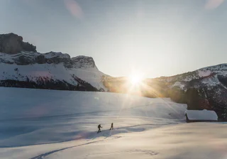
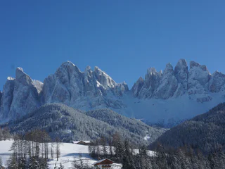
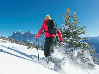
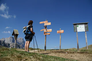
1/3
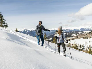
Snowshoe tour along the Adolf Munkel Trail
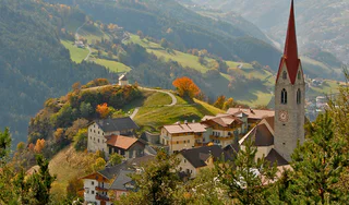
S. Maddalena/St. Magdalena - Funes/Villnöss, Villnöss/Funes, Dolomites Region Lüsen Villnöss
difficult
Moeilijkheidsgraad
765 m
Hoogteverschil
2h:46 min
Duur
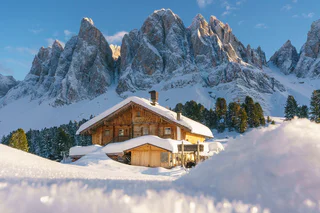
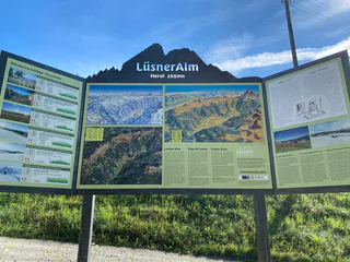
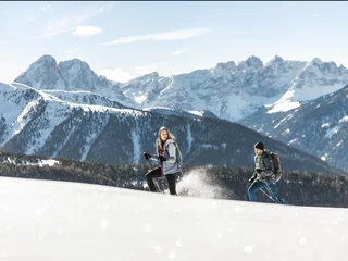
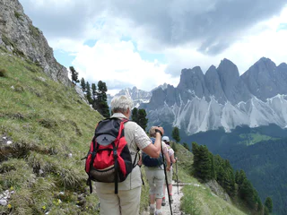
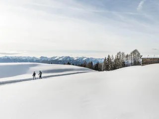
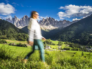
In het Valle Isarco kun je op alle hoogtes actief zijn. Wandel- en fietspaden kronkelen door de valleibodem, langs kastelen en paleizen, door wijngaarden en boomgaarden, naar zonnige alpenweiden en naar het rijk van de Dolomieten. De 33 wandelroutes voldoen aan de hoge eisen van een allround ervaring. Landbouwgrond, bloeiende alpenweiden en trotse bergtoppen vormen het decor van deze 33 wandeltips in het Eisacktal. Deze rondwandelingen, geselecteerd door de respectievelijke vakantieoorden, leiden door mediterrane landschappen en alpine gebieden. Start- en eindpunt zijn op dezelfde plaats, parcours en wandeltijd variëren. Onderweg nodigen kunst- en natuurmonumenten, culturele bezienswaardigheden, uitkijkpunten en rustieke hutten uit om even stil te staan.
1/3
S. Maddalena/St. Magdalena - Funes/Villnöss, Villnöss/Funes, Dolomites Region Lüsen Villnöss
difficult
Moeilijkheidsgraad
765 m
Hoogteverschil
2h:46 min
Duur
1/2
S. Maddalena/St. Magdalena - Funes/Villnöss, Villnöss/Funes, Dolomites Region Lüsen Villnöss
medium
Moeilijkheidsgraad
735 m
Hoogteverschil
4h:27 min
Duur
1/2
Alpe di Rodengo/Rodenecker Alm, Lüsen/Luson, Dolomites Region Lüsen Villnöss
medium
Moeilijkheidsgraad
423 m
Hoogteverschil
3h:01 min
Duur
1/2
S.Valentino/St. Valentin - Funes/Villnöss, Villnöss/Funes, Dolomites Region Lüsen Villnöss
difficult
Moeilijkheidsgraad
252 m
Hoogteverschil
0h:58 min
Duur

S. Maddalena/St. Magdalena - Funes/Villnöss, Villnöss/Funes, Dolomites Region Lüsen Villnöss
medium
Moeilijkheidsgraad
744 m
Hoogteverschil
3h:13 min
Duur
S. Maddalena/St. Magdalena - Funes/Villnöss, Villnöss/Funes, Dolomites Region Lüsen Villnöss
medium
Moeilijkheidsgraad
746 m
Hoogteverschil
3h:19 min
Duur
1/4
Luson/Lüsen, Lüsen/Luson, Dolomites Region Lüsen Villnöss
medium
Moeilijkheidsgraad
460 m
Hoogteverschil
2h:37 min
Duur
1/2
Luson/Lüsen, Lüsen/Luson, Dolomites Region Lüsen Villnöss
medium
Moeilijkheidsgraad
340 m
Hoogteverschil
2h:15 min
Duur
S. Maddalena/St. Magdalena - Funes/Villnöss, Villnöss/Funes, Dolomites Region Lüsen Villnöss
medium
Moeilijkheidsgraad
785 m
Hoogteverschil
2h:38 min
Duur
1/2
S. Maddalena/St. Magdalena - Funes/Villnöss, Villnöss/Funes, Dolomites Region Lüsen Villnöss
medium
Moeilijkheidsgraad
295 m
Hoogteverschil
1h:11 min
Duur
1/2
S. Maddalena/St. Magdalena - Funes/Villnöss, Villnöss/Funes, Dolomites Region Lüsen Villnöss
medium
Moeilijkheidsgraad
392 m
Hoogteverschil
1h:19 min
Duur
1/4
S. Pietro/St. Peter - Funes/Villnöss, Villnöss/Funes, Dolomites Region Lüsen Villnöss
easy
Moeilijkheidsgraad
322 m
Hoogteverschil
2h:01 min
Duur
1/2
Luson/Lüsen, Lüsen/Luson, Dolomites Region Lüsen Villnöss
medium
Moeilijkheidsgraad
623 m
Hoogteverschil
3h:15 min
Duur
1/3
S. Maddalena/St. Magdalena - Funes/Villnöss, Villnöss/Funes, Dolomites Region Lüsen Villnöss
medium
Moeilijkheidsgraad
799 m
Hoogteverschil
4h:00 min
Duur
1/2
Luson/Lüsen, Lüsen/Luson, Dolomites Region Lüsen Villnöss
medium
Moeilijkheidsgraad
798 m
Hoogteverschil
2h:57 min
Duur
S. Maddalena/St. Magdalena - Funes/Villnöss, Villnöss/Funes, Dolomites Region Lüsen Villnöss
medium
Moeilijkheidsgraad
753 m
Hoogteverschil
3h:19 min
Duur
1/3
Ortisei/Urtijëi/St. Ulrich/Urtijëi, Villnöss/Funes, Dolomites Region Lüsen Villnöss
difficult
Moeilijkheidsgraad
322 m
Hoogteverschil
2h:28 min
Duur
Tiso/Teis, Villnöss/Funes, Dolomites Region Lüsen Villnöss
easy
Moeilijkheidsgraad
224 m
Hoogteverschil
1h:30 min
Duur
1/2
Plose/Plose, Lüsen/Luson, Dolomites Region Lüsen Villnöss
medium
Moeilijkheidsgraad
291 m
Hoogteverschil
1h:04 min
Duur
Luson/Lüsen, Lüsen/Luson, Brixen/Bressanone and environs
easy
Moeilijkheidsgraad
329 m
Hoogteverschil
2h:07 min
Duur

1/2
Colle/Koll, Villnöss/Funes, Dolomites Region Lüsen Villnöss
easy
Moeilijkheidsgraad
799 m
Hoogteverschil
3h:28 min
Duur
S. Maddalena/St. Magdalena - Funes/Villnöss, Villnöss/Funes, Dolomites Region Lüsen Villnöss
medium
Moeilijkheidsgraad
611 m
Hoogteverschil
2h:43 min
Duur
1/2
Alpe di Rodengo/Rodenecker Alm, Lüsen/Luson, Dolomites Region Lüsen Villnöss
medium
Moeilijkheidsgraad
0 m
Hoogteverschil
5h:00 min
Duur
1/2
S. Maddalena/St. Magdalena - Funes/Villnöss, Villnöss/Funes, Dolomites Region Lüsen Villnöss
easy
Moeilijkheidsgraad
247 m
Hoogteverschil
1h:22 min
Duur
1/4
S. Maddalena/St. Magdalena - Funes/Villnöss, Villnöss/Funes, Dolomites Region Lüsen Villnöss
medium
Moeilijkheidsgraad
453 m
Hoogteverschil
2h:01 min
Duur
1/4
S. Pietro/St. Peter - Funes/Villnöss, Villnöss/Funes, Dolomites Region Lüsen Villnöss
medium
Moeilijkheidsgraad
500 m
Hoogteverschil
2h:47 min
Duur
S. Pietro/St. Peter - Funes/Villnöss, Villnöss/Funes, Dolomites Region Lüsen Villnöss
easy
Moeilijkheidsgraad
266 m
Hoogteverschil
1h:53 min
Duur
1/3
S. Pietro/St. Peter - Funes/Villnöss, Villnöss/Funes, Dolomites Region Lüsen Villnöss
easy
Moeilijkheidsgraad
515 m
Hoogteverschil
3h:01 min
Duur
1/2
S. Maddalena/St. Magdalena - Funes/Villnöss, Villnöss/Funes, Dolomites Region Lüsen Villnöss
easy
Moeilijkheidsgraad
134 m
Hoogteverschil
0h:58 min
Duur
1/2
Tiso/Teis, Villnöss/Funes, Dolomites Region Lüsen Villnöss
easy
Moeilijkheidsgraad
22 m
Hoogteverschil
0h:09 min
Duur
Bedankt voor je inschrijving!
Inschrijving al actief
Bevestig je inschrijving
Om je inschrijving te voltooien, open de e-mail die we je net hebben gestuurd en klik op de bevestigingslink.
Niet gevonden? Kijk ook even in je spammap.
Je ontvangt al onze exclusieve aanbiedingen, handige tips en speciale suggesties om volop van je vakantie te genieten.
Je hebt je al geprobeerd in te schrijven voor onze nieuwsbrief maar deze nog niet bevestigd. We hebben je de e‑mail zojuist opnieuw gestuurd. Controleer je inbox en je spammap en bevestig nu.


