1/4
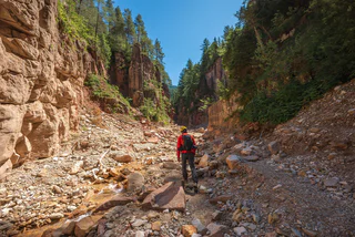
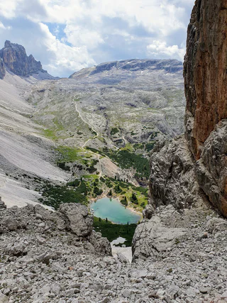
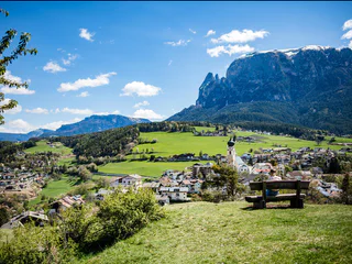
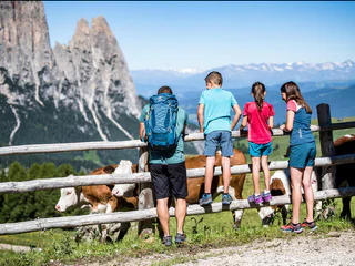
Hike through the Bletterbachschlucht Gorge
Nova Ponente Centro/Deutschnofen Dorf, Deutschnofen/Nova Ponente, Dolomites Region Eggental
medium
Moeilijkheidsgraad
588 m
Hoogteverschil
4h:00 min
Duur
Het landschap is een geschenk waar je het beste te voet van kunt genieten. In het Zuid-Tiroolse voorjaar beleef je het ontwaken van de natuur in het dal en op de bloeiende alpenweiden, terwijl je in de midzomer wordt verleid door luchtige bergtoppen, aanbevolen berghutten en bergwandelingen op grote hoogte. Beleef herfstwandelingen met prachtige uitzichten en schitterende kleuren.
1/4
Nova Ponente Centro/Deutschnofen Dorf, Deutschnofen/Nova Ponente, Dolomites Region Eggental
medium
Moeilijkheidsgraad
588 m
Hoogteverschil
4h:00 min
Duur
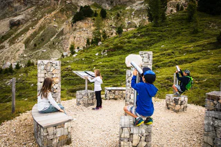
1/2
Monguelfo/Welsberg, Olang/Valdaora, Dolomites Region Kronplatz/Plan de Corones
difficult
Moeilijkheidsgraad
754 m
Hoogteverschil
2h:25 min
Duur
1/10
Chienes/Kiens, Kiens/Chienes, Dolomites Region Kronplatz/Plan de Corones
medium
Moeilijkheidsgraad
418 m
Hoogteverschil
2h:43 min
Duur

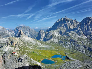
Sesto/Sexten, Sexten/Sesto, Dolomites Region 3 Zinnen
medium
Moeilijkheidsgraad
71 m
Hoogteverschil
2h:04 min
Duur
1/4
Tires/Tiers, Tiers am Rosengarten/Tires al Catinaccio, Dolomites Region Seiser Alm
medium
Moeilijkheidsgraad
448 m
Hoogteverschil
2h:30 min
Duur
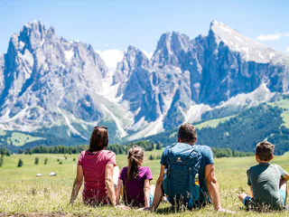
1/3
Alpe di Siusi/Seiseralm, Kastelruth/Castelrotto, Dolomites Region Seiser Alm
medium
Moeilijkheidsgraad
8730 m
Hoogteverschil
54h:00 min
Duur

1/2
San Cassiano/San Cassiano, Badia, Dolomites Region Alta Badia
medium
Moeilijkheidsgraad
306 m
Hoogteverschil
0h:54 min
Duur
1/2
Tires/Tiers, Völs am Schlern/Fiè allo Sciliar, Dolomites Region Seiser Alm
difficult
Moeilijkheidsgraad
1038 m
Hoogteverschil
4h:22 min
Duur
S.Cristina Gherdëina/S.Cristina Val Gardena/S.Cristina Gherdëina/St.Christina in Gröden, Sëlva/Selva di Val Gardena, Dolomites Region Val Gardena
easy
Moeilijkheidsgraad
0 m
Hoogteverschil
0h:16 min
Duur
Sesto/Sexten, Sexten/Sesto, Dolomites Region 3 Zinnen
medium
Moeilijkheidsgraad
256 m
Hoogteverschil
1h:00 min
Duur
Braies di Fuori/Ausserprags, Prags/Braies, Dolomites Region 3 Zinnen
difficult
Moeilijkheidsgraad
0 m
Hoogteverschil
3h:30 min
Duur
1/2
Obereggen/Obereggen, Deutschnofen/Nova Ponente, Dolomites Region Eggental
medium
Moeilijkheidsgraad
442 m
Hoogteverschil
3h:15 min
Duur
S. Candido/Innichen, Toblach/Dobbiaco, Dolomites Region 3 Zinnen
easy
Moeilijkheidsgraad
13 m
Hoogteverschil
1h:00 min
Duur
1/5
Siusi/Seis, Kastelruth/Castelrotto, Dolomites Region Seiser Alm
easy
Moeilijkheidsgraad
280 m
Hoogteverschil
2h:00 min
Duur
1/2
San Cassiano/San Cassiano, Badia, Dolomites Region Alta Badia
medium
Moeilijkheidsgraad
822 m
Hoogteverschil
5h:45 min
Duur
1/2
Gandelle-Franadega-Fienili/Kandellen-Frondeigen-Stadlern, Toblach/Dobbiaco, Dolomites Region 3 Zinnen
difficult
Moeilijkheidsgraad
1033 m
Hoogteverschil
3h:00 min
Duur
1/2
Obereggen/Obereggen, Deutschnofen/Nova Ponente, Dolomites Region Eggental
easy
Moeilijkheidsgraad
183 m
Hoogteverschil
1h:25 min
Duur
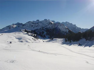
1/2
Antholz-Obertal/Anterselva di Sopra, Rasen-Antholz/Rasun Anterselva, Dolomites Region Kronplatz/Plan de Corones
easy
Moeilijkheidsgraad
0 m
Hoogteverschil
0h:30 min
Duur
1/4
Fiè/Völs, Völs am Schlern/Fiè allo Sciliar, Dolomites Region Seiser Alm
easy
Moeilijkheidsgraad
130 m
Hoogteverschil
1h:10 min
Duur
1/2
Obereggen/Obereggen, Deutschnofen/Nova Ponente, Dolomites Region Eggental
easy
Moeilijkheidsgraad
177 m
Hoogteverschil
2h:00 min
Duur
Corvara/Corvara, Tiers am Rosengarten/Tires al Catinaccio, Dolomites Region Seiser Alm
difficult
Moeilijkheidsgraad
11447 m
Hoogteverschil
17h:15 min
Duur
Villabassa/Niederdorf, Toblach/Dobbiaco, Dolomites Region 3 Zinnen
medium
Moeilijkheidsgraad
477 m
Hoogteverschil
4h:00 min
Duur
Anterselva di Sotto/Antholz-Niedertal, Rasen-Antholz/Rasun Anterselva, Dolomites Region Kronplatz/Plan de Corones
difficult
Moeilijkheidsgraad
904 m
Hoogteverschil
2h:45 min
Duur
1/4
Alpe di Siusi/Seiseralm, Kastelruth/Castelrotto, Dolomites Region Seiser Alm
medium
Moeilijkheidsgraad
167 m
Hoogteverschil
2h:07 min
Duur
1/2
Dobbiaco Vecchia/Alttoblach, Prags/Braies, Dolomites Region 3 Zinnen
medium
Moeilijkheidsgraad
556 m
Hoogteverschil
2h:30 min
Duur

1/2
Badia/Badia, Badia, Dolomites Region Alta Badia
easy
Moeilijkheidsgraad
640 m
Hoogteverschil
4h:30 min
Duur

1/2
Longiarù/Campill, San Martin /San Martino, Dolomites Region Kronplatz/Plan de Corones
medium
Moeilijkheidsgraad
943 m
Hoogteverschil
3h:10 min
Duur
San Vigilio, Al Plan/San Vigilio, Dolomites Region Kronplatz/Plan de Corones
easy
Moeilijkheidsgraad
96 m
Hoogteverschil
0h:55 min
Duur
1/3
Alpe di Siusi/Seiseralm, Kastelruth/Castelrotto, Dolomites Region Seiser Alm
medium
Moeilijkheidsgraad
431 m
Hoogteverschil
2h:47 min
Duur
1/2
Corvara/Corvara, Corvara, Dolomites Region Alta Badia
easy
Moeilijkheidsgraad
341 m
Hoogteverschil
2h:25 min
Duur
Bedankt voor je inschrijving!
Inschrijving al actief
Bevestig je inschrijving
Om je inschrijving te voltooien, open de e-mail die we je net hebben gestuurd en klik op de bevestigingslink.
Niet gevonden? Kijk ook even in je spammap.
Je ontvangt al onze exclusieve aanbiedingen, handige tips en speciale suggesties om volop van je vakantie te genieten.
Je hebt je al geprobeerd in te schrijven voor onze nieuwsbrief maar deze nog niet bevestigd. We hebben je de e‑mail zojuist opnieuw gestuurd. Controleer je inbox en je spammap en bevestig nu.


