Skip to content
added to favourites
removed from favourites
Oops! Something went wrong. Try again
Your account is being created
Your account has been successfully created and you are now logged in
You are logged out.
Filter
Selected filters
    Level of difficulty
    Duration
    Distance in KM

    Themed Hikes across South Tyrol

    Located throughout South Tyrol’s holiday regions, sign-posted themed hikes are special journeys of discovery for young and old alike. In South Tyrol’s Unterland region, for example, visitors in autumn can experience how grapes go from the vine to the barrel. In San Valentino in Campo/Gummer you can explore the universe and our solar system. and in Terlano/Terlan in spring asparagus farmers demonstrate how the precious shoots are removed from the earth. In total more then 150 sign-posted and informative themed hikes await visitors to South Tyrol.

    Results
    Hiking
    Tramin to the Rastenbach gorge
    Tramin an der Weinstraße/Termeno sulla Strada del Vino, The South Tyrolean Wine Road

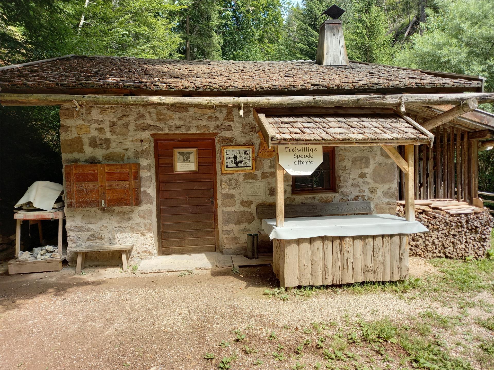
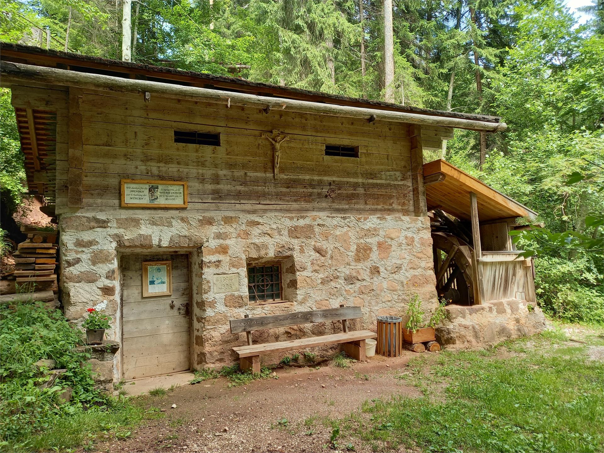
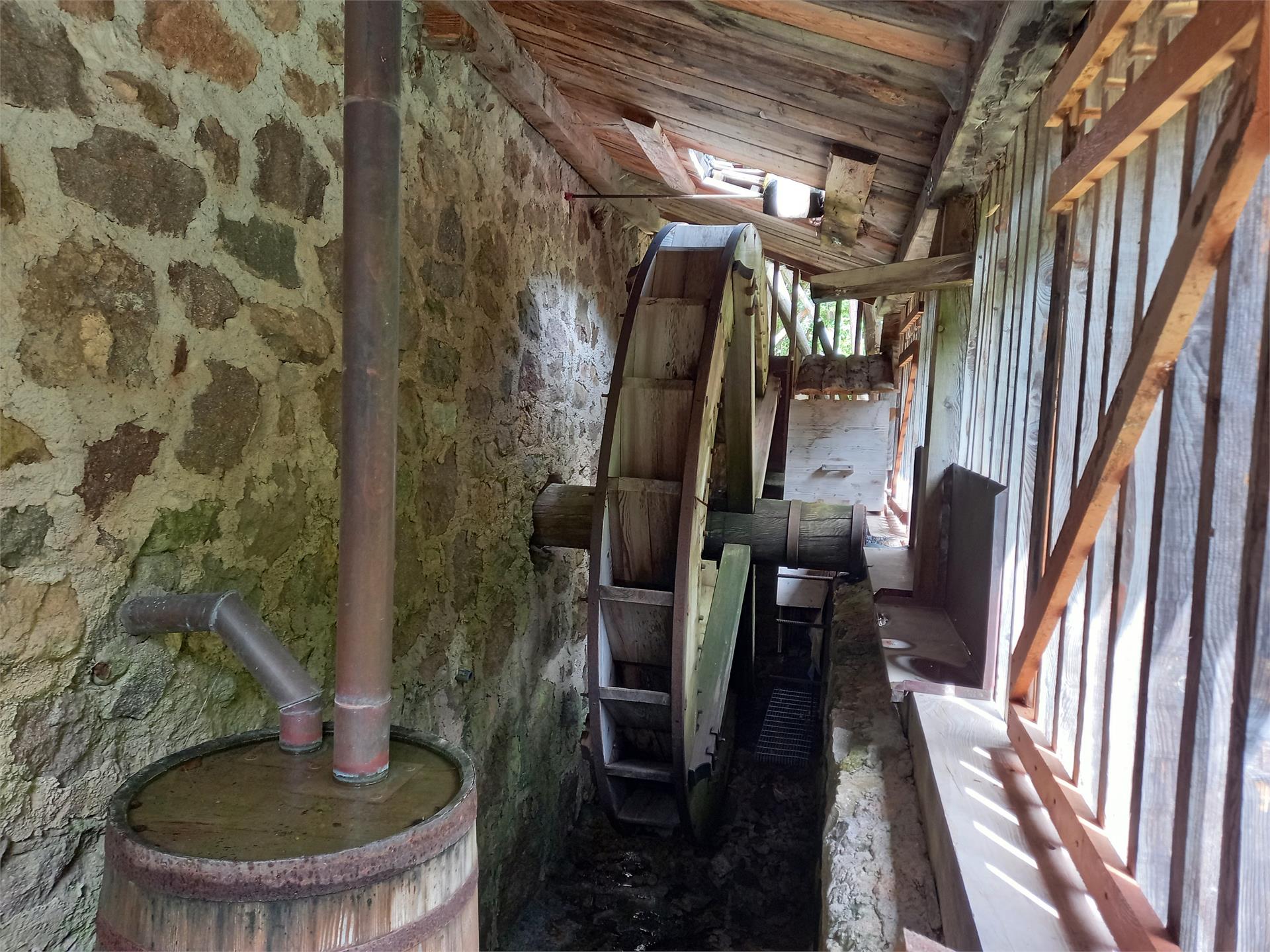
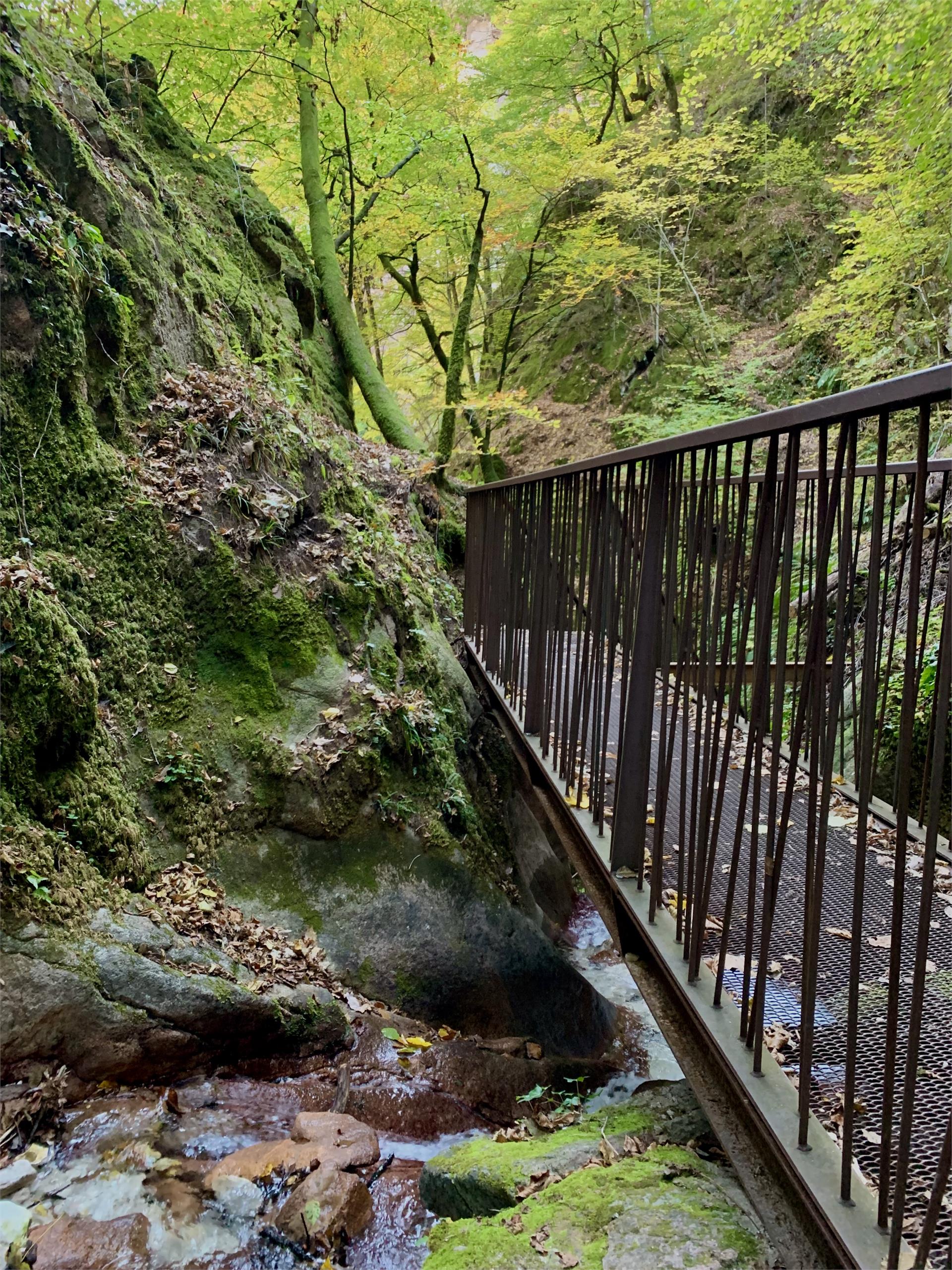
    From the town hall square to the fairground, Söllerstraße, after the Hotel Winzerhof turn right into a vineyard path and follow the nature trail (11+11 A) to Lake Kaltern. Turn left at the Hotel Seeleitenhof and follow the signs for "Rastenbachklamm". This is followed by a varied hike over paths, steps, platforms, bridges and past waterfalls and a stream, through the wild and romantic gorge up to Altenburg. Also worth seeing along the way are the ruins of St. Peter, just before Altenburg. Return via Altenburg, Panoramaweg and Römerweg (11) to the Söll fire station and at Hotel Plattenhof back down the nature trail to Tramin.

    Duration: 4.5 - 5 h

    Difference in altitude: 350 m (circular route)

    Difficulty: medium
    776 altitude up
    4h:40 min duration
    Hiking
    MountainAdventure Ratschings/Racines
    Ratschings/Racines, Sterzing/Vipiteno and environs

    The tour “Mountain Adventure World” starts directly at the mountain station of the cable car Ratschings-Jaufen on a good, suitable for buggies, path. This tour can easily be covered at an altitude difference of 50 meters in about 45 minutes and is therefore ideal especially for families with children. The adventurous hiking trail surprises with numerous attractions, like the ant words, the marmot world, the petting zoo, funny water games, the penguin giant, surprising climbing scaffolds, viewing bridges and rest points in the mountain pastures. At many locations there are educational signposts, that inform about the local flora and fauna and satisfy the thirst of knowledge of nature lovers.

    Difficulty: easy
    48 altitude up
    0h:45 min duration
    Hiking
    Entry segment | Buchholz – Gfril
    The South Tyrolean Wine Road

    From the small village of Buchholz, you will then continue on to Gfrill. Right after Buchholz, the Truden Faultline becomes especially noticeable. This boundary is visible not only on the basis of the different geological strata (dolomites and porphyry), but also due to the change in vegetation. The trail is steadily uphill until you come to the ruins of the walls of an old cableway. You continue along the old cableway trail, steadily uphill, until arriving in Gfrill, an alpine village surrounded by plenty of natural beauty.

    Difficulty: medium
    933 altitude up
    3h:04 min duration
    Hiking
    Castle trail "Castelronda" Bolzano-San Genesio-Terlano
    Bolzano/Bozen, Bolzano/Bozen and environs

    The Castle trail „Castelronda“ is about 20 km long and connects the castles and ruins of Bolzano, San Genesio and Terlano: Castle Roncolo/Runkelstein, Castle Rafenstein, Castle Grifo/Greifenstein (vulg. also called Castello del Porco, which means „Pork Castle“), Ruin Helfenberg and Castle Neuhaus (also called Maultasch). The efforts of hikers will be fully satisfied with magnificent views over the most beautiful castles and ruins of the region, in the middle of the nature.

     Trilingual information pillars near the castles and ruins will inform your whole family of interesting history facts and entertaining tips.  

    The hikes on the „Castelronda/Burgenweg“ trail are especialliy recommended in spring, autumn and winter.

    Difficulty: difficult
    1113 altitude up
    5h:55 min duration
    Hiking
    Tru di pra certified path
    La Val, Dolomites Region Alta Badia

    This trail has been certified by 'Europäisches Wandergütesiegel'.

    Once you have left the village centre, you will understand why La Val is called the village of Alpine meadows: green, well-kept meadows will constantly surround you during this hike. The man-made landscape between 1300 and 2000 metres above sea level developed through the hard work of our farming ancestors, which today is facilitated by the use of agricultural machinery. 

    As the altitude increases, so does the consistency of the meadows: from meagre meadows to the pingui meadows and larch meadows of Armentara. Along the route you will find wonderful viewpoints, a sulphurous water spring at Al Bagn and several refreshment points where you can refresh yourself with some of the delicious Ladin specialities that can satisfy every palate: try the typical canederli (dumplings) or snack on a well-earned slice of strudel.

    Every year in July, the non-competitive half-marathon 'Tru di pra' takes place on this route... are you ready for it? Sign up now, we are waiting for you!

    Difficulty: medium
    1713 altitude up
    8h:37 min duration
    Hiking
    Mill walk
    Aldein/Aldino, Bolzano/Bozen and environs
    Hike through lush meadows and mixed forest to the Möserbiotop and the Aldein mills
    Difficulty: easy
    110 altitude up
    1h:00 min duration
    Hiking
    Path of Reflection St. Zeno/Terenten
    Terenten/Terento, Brixen/Bressanone and environs

    Reflection Path of the 7 Sorrows of Mary
    Since ancient years many cultures have realised pilgrimage trails to places where the Divine can be experienced in a very special way. The oldest church of Terenten, St. Zeno in Pein, is such a divine place. The chapel was constructed in the area of a prehistoric settlement from the 12th century with the aim of building a Christian church on top of a pagan worship. The path is not only a walking trail for locals and tourists; it is a path of reflection dedicated to the suffering of Jesus and the sorrows of Mary.
    1st Sorrow: The prophecy of Simeon; 2nd Sorrow: Flight into Egypt; 3rd Sorrow: The Loss of Jesus in the Temple of Jerusalem; 4th Sorrow: Mary meets Jesus on the way to the cross; 5th Sorrow: Jesus Dies on the Cross; 6th sorrow Mary receives the dead body of her son; 7th Sorrow: Jesus is laid in the tomb.

    Difficulty: easy
    11 altitude up
    0h:19 min duration
    Hiking
    Mountain lakes trail in Pfunders
    Vintl/Vandoies, Brixen/Bressanone and environs
    The lonely green slopes of Pfunders hide two real gems: the Grindlberg lake and the Weitenberg lake. This beautiful tour, far removed from the most-trodden paths, begins at the spacious car park in the tranquil hamlet of Dun.
    Difficulty: difficult
    1080 altitude up
    7h:00 min duration
    Hiking
    Traditional farm crawl
    S.Crestina Gherdëina/Santa Cristina Val Gardana, Dolomites Region Val Gardena

    During this excursion you may well just see modern farmsteads, but handy information boards showing pictures from the time reveal what the buildings really looked like in the past.

    Difficulty: medium
    450 altitude up
    2h:25 min duration
    Hiking
    Pfunders Alpine huts trail
    Vintl/Vandoies, Brixen/Bressanone and environs

    The Fundres/Pfunders Alpine Hut Circuit (Almhüttenrundweg) begins in the hamlet of Dun. Go up a short distance along trail no. 17 and then turn right onto trail no. 13A. After a short while turn left onto trail no. 13 and then no. 18 as far as the Egger-Bodenalm Alpine farm and cheese dairy. After the farm go a little further and then turn off to the right, crossing the hillside to reach trail no. 13. Continue along here to the junction with the Fundres Alpine Ridgeway. Turn right again for a short distance towards Kuhscharte and follow the newly-made forest road. This brings you to the Gampiel Alm Alpine farm with its panoramic views over the Pfunderer Tal valley and the Rodenecker Alm Alpine pasture, as far as the Peitler Kofel peak. The farm is particularly family-friendly, with a petting zoo for children. The descent takes you first along the forest road down to the Egger Höfe farms. From here you return to Dun, first on trail no. 13 and then to the left on the “Alter Weg" back to the car park.

    Difficulty: medium
    720 altitude up
    4h:30 min duration
    Hiking
    The path across the cols: The smugglers’ path
    Gsies/Valle di Casies

    The history: The mountains of Defreggen Tal Valley form a big border between Val Casies Valley (I) and Villgratental Valley (A). It has always been crossed by the residents of the two valleys to trade. During the years from 1810–1814 and after the 2nd world war different goods have been smuggled across the border. Because of this the three “The path across the cols” developed. Some informative signs were arranged along the paths to tell about the history and life in earlier times.

    Difficulty: medium
    870 altitude up
    4h:30 min duration
    Hiking
    Castle path
    Kastelbell-Tschars/Castelbello-Ciardes, Vinschgau/Val Venosta

    The Castle path - An experience for the family on the Monte Sole at Castelbello

    Difficulty: medium
    233 altitude up
    2h:00 min duration
    Hiking
    The path across the cols: The cultivating path
    Gsies/Valle di Casies

    The history: The mountains of Defreggen Tal Valley form a big border between Val Casies Valley (I) and Villgratental Valley (A). It has always been crossed by the residents of the two valleys to trade. During the years from 1810–1814 and after the 2nd world war different goods have been smuggled across the border. Because of this the three “The path across the cols” developed. Some informative signs were arranged along the paths to tell about the history and life in earlier times.

    Difficulty: difficult
    870 altitude up
    6h:00 min duration
    Hiking
    Barefoot path
    Ratschings/Racines, Sterzing/Vipiteno and environs

    “Feel nature” – is literally the aim of the ca. 400m long barefoot path at Ratschings/Racines. Barefoot through nature, feeling fully aware different materials, like grass, sand, pebbles, marble of Ratschings, wood in all types and the natural forest soil and its quality. Try out the difference between rough and pleasant materials, the equilibration by balancing and enjoy a natural foot reflexology at the Kneipp-route at the river Ratschingerbach with hot stones and cold water. Walk barefoot is a sensual pleasure for old and young and provides significant health benefits, stimulates the organism and our immune system.

    Difficulty: easy
    0 altitude up
    0h:30 min duration
    Hiking
    Badlweg Trail S. Pancrazio
    St.Pankraz/San Pancrazio, Meran/Merano and environs

    A challenging path, partially paved, partially steep, runs in the footsteps of historic bathhouses. Located 200 m above the Lotterbad oasis is a water intake with mineral-rich spring water.

    Difficulty: easy
    0 altitude up
    0h:30 min duration
    Hiking
    Sissi's Path
    Meran/Merano, Meran/Merano and environs

    This scenic route, known as the Sentiero di Sissi in Italian and the Sissiweg in German, leads to the areas of town most beloved by Empress Elisabeth of Austria, better known as Sissi. The charming Habsburg sovereign stayed in Merano several times in the second half of the nineteenth century, and was enchanted by its charm. This path dedicated to her connects the Gardens of Trauttmansdorff Castle with the city centre; it passes through eleven stages along the way, each with a story to tell. From the castle that majestically dominates the botanical gardens, Sissi’s Path winds its way past Pienzenau and Rubein Castles, the Reichenbach Residence, Piazza Fontana (Brunnenplatz), Rottenstein Castle, and the Bavaria Hotel; it then continues down to the river, crosses the Roman Bridge, skirts the Wandelhalle and finally pays homage to the empress in the park dedicated to her. The park is on the edge of the Summer Promenade and there is a statue erected in Sissi’s honour. Obviously, the trail can be followed in either direction.

    Difficulty: easy
    109 altitude up
    0h:55 min duration
    Hiking
    Mölten circular path
    Mölten/Meltina, Bolzano/Bozen and environs

    The circular trail is an experience for the whole family through forests and meadows. There is also a small playground and a small water wheel, which especially invites children to stay.

    Difficulty: easy
    390 altitude up
    2h:52 min duration
    Hiking
    To the Lech Dlá Lé lake
    Badia, Dolomites Region Alta Badia

    The pleasant and family-friendly hike in Badia, leads along the trail Tru di tiers following the traces of the wild animals.

    Along the whole itinerary sculptures of wild animals are placed, for example: an eagle, an owl, or a bear. The sculptures were carved from larch and pine wood with a chainsaw by a local artist.

    Difficulty: easy
    0 altitude up
    0h:10 min duration
    Hiking
    Waterfall of Barbian/Barbiano
    Barbian/Barbiano, Brixen/Bressanone and environs

    From the village place near the church we have to go to the end of the village, in direction to Saubach/St. Ingenuino. At the last house of the village (Haus Urban), on the right side, beginns the "Wasserfallweg". We contnue this trail until we cross a street. We go on this street until the next curve and branch off to the left and there is another trail, which pass on the lower waterfall (Duration ca. 1 hour). From the lower one we hike to the upper waterfall. For this trail good foodwear is necessery. At he way back we take the hike way nr. 6 and 6 A to the saw mill and hear we can go back from the "Wasserfallweg" to Barbian/Barbiano.

    Difficulty: medium
    411 altitude up
    2h:40 min duration
    Hiking
    Castelronda, the castles trail
    Bolzano/Bozen, Bolzano/Bozen and environs
    The ‘Castelronda’ path connects Bolzano, San Genesio and Terlano: it’s a beautiful scenic trail boasting castles and ruins, winding its way across the hilly slopes surrounding the South Tyrolean capital. The trail is a good 20 km long and is embellished by the historical–cultural heritage represented by Roncolo Castle, Rafenstein Castle, Greifenstein and Helfenberg ruins as well as Neuhaus Castle. The ‘Castelronda’ excursion is ideal for a spring and autumn walk, as these seasons allow tourists to revel in the truly beautiful colours of nature.
    The entirety of the path features directions and signposts: indeed, plenty of information can be found from the starting points of the tour in Bolzano, Settequerce, Terlano and San Genesio. Moreover, trilingual boards containing practical tips and interesting information about the castles also abound. You don’t have to walk the full 20 km; some stretches are ideal for families with children, while others need a steady footing and are recommended for trained excursionists.
    Difficulty: medium
    1063 altitude up
    5h:35 min duration
    Hiking
    Castle trail San Genesio variation C
    Bolzano/Bozen, Bolzano/Bozen and environs

    Arrival by own car at the public parking space of Cologna. Subsequently on the path n. 9 and n. 11 to the restaurant Noafer and then to the castle ruin Grifo/Greifenstein. (enter at your own risk!)

    After visiting the castle ruin Grifo/Greifenstein, turn back to the path n. 9 and walk up to the farm Moar in Rumsein. 

    Between the restaurant Noafer and the farm Moar in Rumsein, exists a particular route (walking duration 1 hour), which is very suitable for buggies!

    From the farm Moar in Rumsein, continue to the Restaurant Plattner, the high point of this hike.

    From the restaurant Plattner, you can enjoy the incredible view overlooking the whole city of Bolzano and the beautiful Etsch/Adige Valley!  

    After this climax of hiking, you can turn back to the Car Parking space Cologna on the path n. 5. 

    Approx. walking duration: 3.30 hour


    Difficulty: medium
    512 altitude up
    3h:17 min duration
    Hiking
    Beerennaschweg trail
    Schluderns/Sluderno, Vinschgau/Val Venosta

    The berry bear trail with wooden sculptures and information boards for children and adults on the Schludernser Berg mountain.

    Difficulty: easy
    297 altitude up
    1h:00 min duration
    Hiking
    Altfasstal valley
    Mühlbach/Rio di Pusteria, Brixen/Bressanone and environs
    This itinerary takes you through a fabulous natural landscape featuring sunny terraces, children’s playgrounds and the Almenkneippweg, a path that passes four different stations.

    Tip: you can rent mountain bikes for the way back.
    Difficulty: easy
    253 altitude up
    1h:40 min duration
    Hiking
    Marble Circuit Trail
    Vinschgau/Val Venosta

    This multi-day hike at high altitude is through the tree linein the Stelvio National Park.Twisting its way around the imposing Laas/Lasa mountains,the breath-takingMarble Circuit Trailhas a total length of 80 km. Part of the formidable Ortler Alps, this spectacular mountain range is internationally renowned for its unusual pure-white Laas/Lasa marble. With stops along the way the circuit trail can be hiked in one go or split into six single-day stages.

    Lining the Marble Circuit Trailare several panels delineating the rich natural diversity found along the trail. Each of these 30 info panels is centred on a specific theme. A further 10 orientation placards offering descriptions of the start and end of the trail are positioned at strategic points along the trail.

    Difficulty: difficult
    4164 altitude up
    36h:00 min duration
    Hiking
    Mills trail & earth pyramids
    Terenten/Terento, Brixen/Bressanone and environs
    From the car park in the village centre you hike in a north-westerly direction for 100 m along the Strada del Sole Road until you reach the Ternerbach River. This is the start of the educational mills path. Follow the sign-posts. At half way you reach  the pyramids. After approximately 10 min. you will get to the 5 main mills. At Hansleitner Mill you can cross the bridge leading to the other side of the river. You hike past an old farm and reach the ski lift. From here you take the field path back to the village centre. You will get to Hotel Wiedenhofer and back to the Strada del Sole Road. Duration: 1,5 h
    Difficulty: easy
    235 altitude up
    1h:30 min duration
    Hiking
    Castle trail "Castelronda" San Genesio variation B
    Terlan/Terlano, Bolzano/Bozen and environs

    The Castle trail „Castelronda“ is about 20 km long and connects the castles and ruins of Bolzano, San Genesio and Terlano: Castle Roncolo/Runkelstein, Castle Rafenstein, Castle Grifo/Greifenstein (vulg. also called Castello del Porco, which means „Pork Castle“), Ruin Helfenberg and Castle Neuhaus (also called Maultasch). The efforts of hikers will be fully satisfied with magnificent views over the most beautiful castles and ruins of the region, in the middle of the nature.

    The trail starts at the Castle Roncolo/Runkelstein in Bolzano/Bozen and leads to the Castle Runkelstein passing the San Genesio cable car valley station. Then you continue to Restaurant Noafer in Cologna/Glaning (a hamlet in the municipality of San Genesio), situated above the Castle ruin Grifo/Greifenstein. Next, you reach the Helfenberg castle ruin and at the same time you can enjoy the marvellous panorama of the surrounding area. The descent towards Terlano/Terlan leads you to the final castle ruin Neuhaus/Maultasch and here ends the trail „Castelronda“. 

    You can choose to start in Bolzano, San Genesio or in Terlano and you can also hike partial sections at your discretion.

    The hikes on the „Castelronda/Burgenweg“ trail are especialliy recommended in spring, autumn and winter.

    Difficulty: medium
    760 altitude up
    4h:52 min duration
    Hiking
    Bunker Trail
    St.Lorenzen/San Lorenzo di Sebato, Dolomites Region Kronplatz/Plan de Corones

    Following the annexation of Austria into Nazi Germany in 1938, the Saalen-Montal bunker was hastly designed to form part of the Vallo Alpino Littorio system of fortifications. It was constructed between 1939 an 1941.

    Difficulty: easy
    252 altitude up
    1h:30 min duration
    Hiking
    S. Pancrazio Mühlenweg Trail
    St.Pankraz/San Pancrazio, Meran/Merano and environs

    Diverse, shady forest path into Kirchbachtal Valley by the remnants of old mills (Stegmühle mill, Aichermühle mill, millstones at Linserhof farm) from distant times.

    Difficulty: easy
    392 altitude up
    1h:15 min duration
    Hiking
    Entry segment | Gfrill – Buchholz
    Neumarkt/Egna, The South Tyrolean Wine Road

    When you take this extra segment, you will begin from Gfrill, which is located at approx. 1,300 meters above sea-level, and continue to Buchholz at 560 meters above sea-level. At first, you'll have a pleasant, relaxing stroll downhill until you come to Unterstein. You can then continue along the old aerial lift trail until you reach the vestiges of an old cableway. The trail then goes downhill until you come to the brook where the Truden Faultline is especially noticeable. This boundary is distinctly visible not only on the basis of the different geological strata (dolomites and porphyry), but also due to the abrupt change in vegetation. You can then continue to the small village of Buchholz.

    Difficulty: medium
    159 altitude up
    1h:45 min duration
    Hiking
    Gilf Promenade
    Meran/Merano, Meran/Merano and environs

    This trail runs along both banks from the Gilf Gorge down to the point where the river enters the city. On the right bank, it connects directly with the path that leads to the Powder Tower and the Tappeiner Promenade; on the left, it joins with the Summer Promenade. Gilf Promenade is particularly intriguing for its subtropical vegetation. Its Walk of Poets also makes it the most romantic of Merano’s promenades: modern and contemporary love poetry is engraved onto a series of benches here.

    Difficulty: easy
    17 altitude up
    0h:10 min duration
    1 2 3 4 5 6 7 8 9 10 11 12 13 14 15 16 17